Vila Boa de Quires
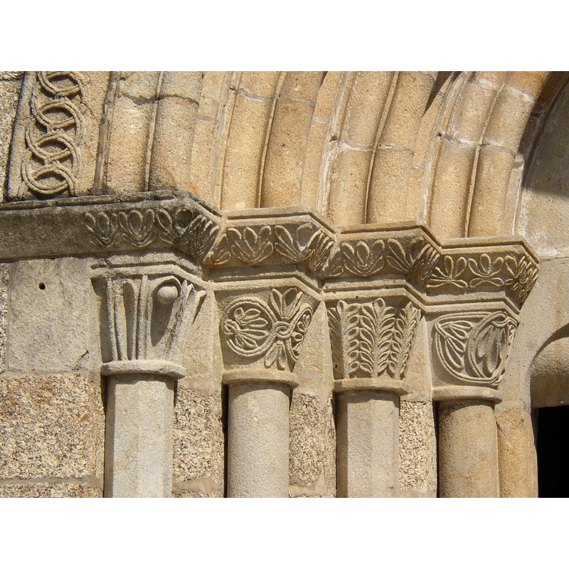
Image copyright © Alegna13, 2005
CC-BY-SA-3.0
Results: 5 records
view of church exterior - west portal - north side - detail
Copyright Statement: Image copyright © Alegna13, 2005
Image Source: digital photograph taken 4 September 2005 by Alegna13 [http://commons.wikimedia.org/wiki/File:Igreja_de_Santo_Andr%C3%A9_001.jpg] [accessed 19 February 2012]
Copyright Instructions: CC-BY-SA-3.0
view of church exterior - west portal
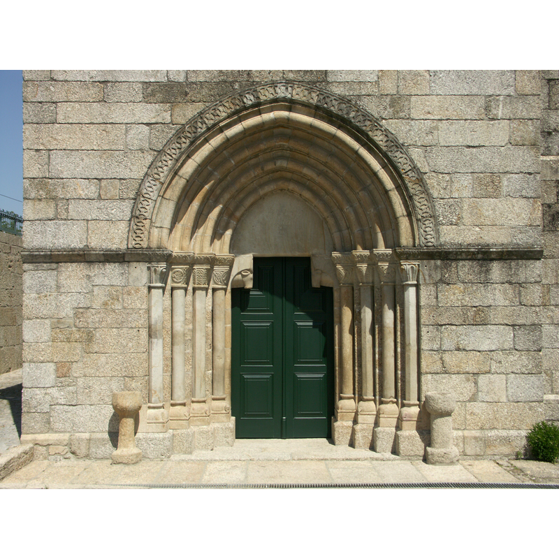
Copyright Statement: Image copyright © Joost Limburg, 2012
Image Source: digital photograph taken 28 June 2007 by Joost Limburg [www.romanicoportugal.org]
Copyright Instructions: Standing permission
view of church interior - chancel
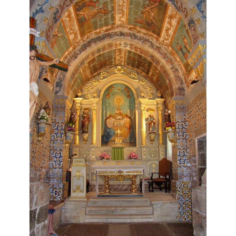
Copyright Statement: Image copyright © Alegna13, 2005
Image Source: digital photograph taken 4 September 2005 by Alegna13 [http://commons.wikimedia.org/wiki/File:Interior_da_Igreja_de_Santo_Andr%C3%A9.jpg] [accessed 19 February 2012]
Copyright Instructions: CC-BY-SA-3.0
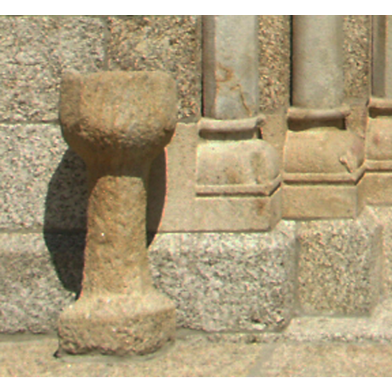
view of stoup
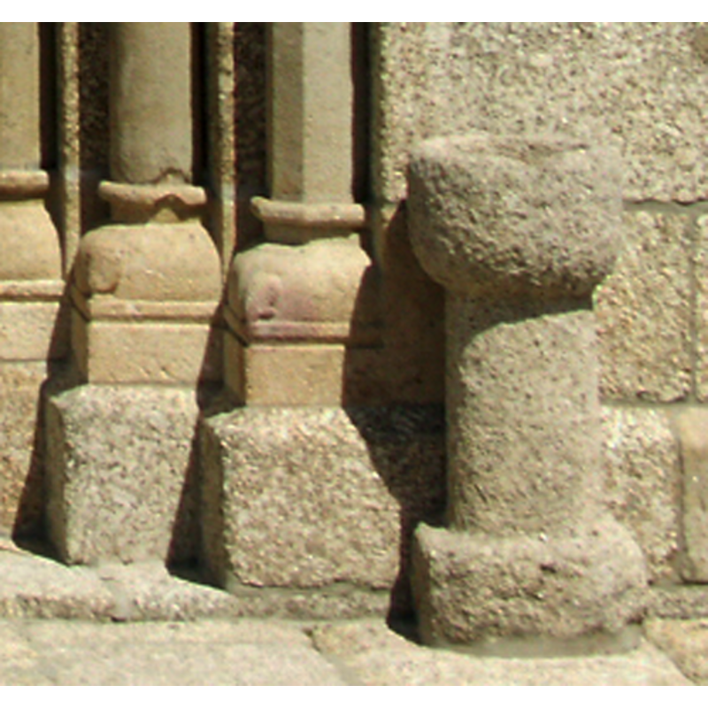
Scene Description: the stoup on the right side of the entranceway
Copyright Statement: Image copyright © Joost Limburg, 2012
Image Source: detail of a digital photograph taken 28 June 2007 by Joost Limburg [www.romanicoportugal.org]
Copyright Instructions: Standing permission
view of stoup
Scene Description: the stoup on the left side of the entranceway
Copyright Statement: Image copyright © Joost Limburg, 2012
Image Source: detail of a digital photograph taken 28 June 2007 by Joost Limburg [www.romanicoportugal.org]
Copyright Instructions: Standing permission
INFORMATION
Font ID: 17923QUI
Object Type: Stoup
Font Century and Period/Style: Late Medieval
Cognate Fonts: similar to the ones at Boelhe and Cabeça Santa
Church / Chapel Name: Igreja de Santo André
Font Location in Church: outside the church, one on each side of the W portal
Church Patron Saint(s): St. Andrew
Church Notes: the church may date back to ca. 1185; it was originally the church of a Benedictine monastery here, and became parish church in the 14th century
Church Address: 4635-709 Vila Boa de Quires, Marco de Canaveses
Site Location: Porto, Norte, Portugal, Europe
Directions to Site: Located in the municipality of Marco de Canaveses
Ecclesiastic Region: Diocese do Porto
Font Notes:
Click to view
Pair of holy-water stoups located at the entranceway to the church, one on each side; they are not identical but they are similar, monolithic and made of course granite.
Credit and Acknowledgements: We are grateful to Joost Limburg, of www.romanicoportugal.org, for the photograph of the church and stoups
COORDINATES
UTM: 29T 566977 4562168
Latitude & Longitude (Decimal): 41.20812, -8.20110
Latitude & Longitude (DMS): 41° 12′ 29.23″ N, 8° 12′ 3.97″ W
MEDIUM AND MEASUREMENTS
Material: stone, granite
Basin Interior Shape: round