Fonthill Gifford
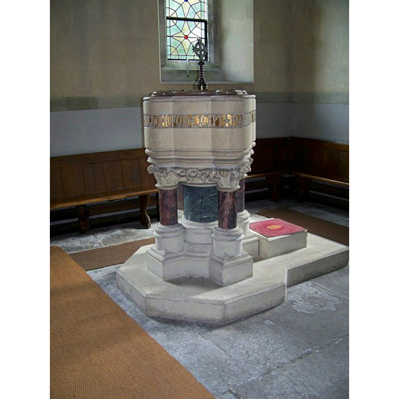
Image copyright © Trish Steel, 2008
CC-BY-SA-3.0
Results: 2 records
view of font and cover
Scene Description: the Victorian font
Copyright Statement: Image copyright © Trish Steel, 2008
Image Source: digital photograph taken 20 July 2008 by Trish Steel [www.geograph.org.uk/photo/891705] [accessed 8 February 2012]
Copyright Instructions: CC-BY-SA-3.0
view of church exterior - west tower
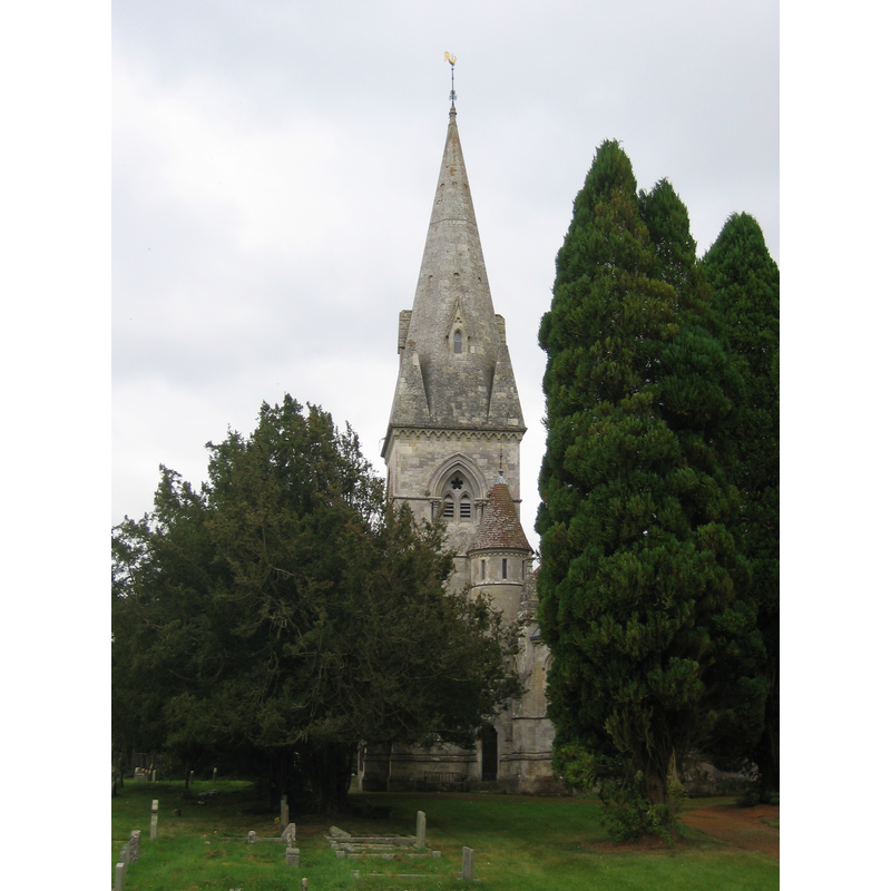
Scene Description: the Victorian church
Copyright Statement: Image copyright © [in the public domain]
Image Source: digital photograph taken 4 October 2009 by My another account [http://en.wikipedia.org/wiki/File:Fonthill_Gifford_Holy_Trinity.JPG] [accessed 8 February 2012]
Copyright Instructions: released by its author into the public domain
INFORMATION
Font ID: 17909FON
Object Type: Baptismal Font1?
Font Century and Period/Style: 13th century, Medieval
Church / Chapel Name: Parish Church of the Holy Trinity
Church Patron Saint(s): The Holy Trinity
Church Address: Fonthill Gifford, Wiltshire, SP3 6PX
Site Location: Wiltshire, South West, England, United Kingdom
Directions to Site: Located 2 km SE of Hindon, 18 km W of Salisbury
Ecclesiastic Region: Diocese of Salisbury
Historical Region: Hundred of Dunworth
Additional Comments: disappeared font? (of the medieval church here?)
Font Notes:
Click to view
The Victoria County History (Wiltshire, vol. 13, 1987) notes: "Fonthill Gifford church was standing in 1291. [...] The medieval church, said in 1566 to have been dedicated to St. Nicholas, stood near Fonthill House. [...] was said to be ruinous in 1747. Its demolition was approved then [...] and a new church, beside the Hindon—Tisbury road at the south end of the park of Fonthill House, was consecrated in 1749. [...] The church was replaced in the period 1864–6 by a church built of ashlar on the same site to designs of T. H. Wyatt and dedicated to the Holy Trinity." There is no mention of a font in the VCH entry for this parish. The present font is modern, probably from the Victorian restoration of the church. [NB: we have no information on the font from the medieval church here].
COORDINATES
UTM: 30U 562892 5659133
Latitude & Longitude (Decimal): 51.080256, -2.102161
Latitude & Longitude (DMS): 51° 4′ 48.92″ N, 2° 6′ 7.78″ W
REFERENCES
- Victoria County History [online], University of London, 1993-. URL: https://www.british-history.ac.uk.