Witherington / Widetone
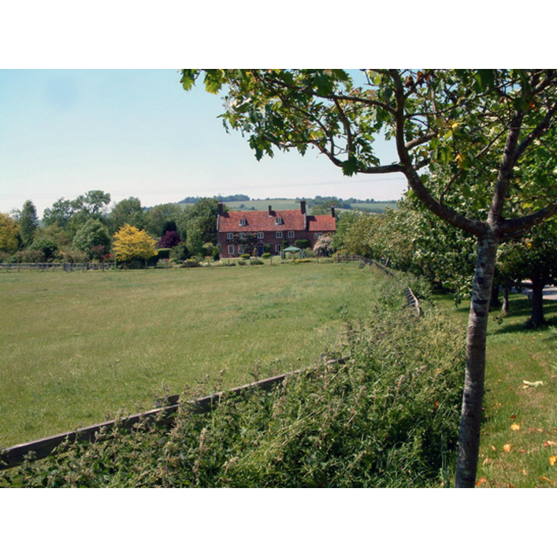
Image copyright © Stuart Buchan, 2006
CC-BY-SA-3.0
Results: 1 records
view of church exterior in context - grounds
Scene Description: the site of the disappeared church; the medieval farm at the back [cf. FontNotes]
Copyright Statement: Image copyright © Stuart Buchan, 2006
Image Source: digital photograph taken 9 June 2006 by Stuart Buchan [www.geograph.org.uk/photo/183929] [accessed 26 January 2012]
Copyright Instructions: CC-BY-SA-3.0
INFORMATION
Font ID: 17882WIT
Object Type: Baptismal Font1
Font Date: ca. 1147?
Font Century and Period/Style: 12th century (mid?), Late Norman
Church / Chapel Name: Parish Church [abandoned in the 15th century; disappeared]
Church Address: [cf. FontNotes]
Site Location: Wiltshire, South West, England, United Kingdom
Directions to Site: The village, located near Downton, has disappeared; Witherington Farm is all that remains on the site of the medieval village
Ecclesiastic Region: [Diocese of Salisbury]
Historical Region: Hundred of Downton
Additional Comments: disappeared font?
Font Notes:
Click to view
There is an entry for Witherington [variant spelling] in the Domesday survey [https://opendomesday.org/place/SU1824/witherington/] [accessed 8 November 2019] but it mentions neither cleric nor church in it. The Victoria County History (Wiltshire, vol. 11, 1980) notes: "A church at Witherington was presumably standing and dependent on Downton church in 1147 when a priest of Witherington witnessed deeds providing for services at Standlynch church. [...] the population of Witherington was much smaller in the 15th century than it had been in the 13th and 14th centuries [...] it seems likely that the church decayed and was abandoned, perhaps in the mid 15th century. [...] The village, first mentioned in 1086, [...] may have been developing at the time of the early11th-century grant. Its site cannot be precisely located but Witherington Farm, standing on a narrow strip of valley gravel, presumably marks it." There is no mention of a font in the VCH entry for this church. [NB: we have no information on its medieval font].
COORDINATES
UTM: 30U 594788 5647356
REFERENCES
- Victoria County History [online], University of London, 1993-. URL: https://www.british-history.ac.uk.