Nunton and Bodernham / Nunton-with-Bodenham
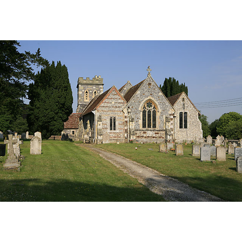
Image copyright © Peter Facey, 2006
CC-BY-SA-3.0
Results: 1 records
view of church exterior - east view
Copyright Statement: Image copyright © Peter Facey, 2006
Image Source: digital photograph taken 4 July 2006 by Peter Facey [www.geograph.org.uk/photo/196194] [accessed 26 January 2012]
Copyright Instructions: CC-BY-SA-3.0
INFORMATION
Font ID: 17880NUN
Object Type: Baptismal Font1
Font Century and Period/Style: Medieval
Church / Chapel Name: Parish Church [formerly Chapel] of St. Andrew
Church Patron Saint(s): St. Andrew
Church Notes: a chapelry of Downton until the 19th century
Church Address: Nunton, Wiltshire, SP5 4HP
Site Location: Wiltshire, South West, England, United Kingdom
Directions to Site: Located 5 km SSE of Salisbury
Ecclesiastic Region: Diocese of Salisbury
Historical Region: Hundred of Downton
Additional Comments: disappeared font?
Font Notes:
Click to view
The Victoria County History (Wiltshire, vol. 11, 1980) notes: "As parts of its masonry show a church was standing at Nunton c. 1200. It was annexed to Downton church as a chapel, probably from its foundation [...] The chancel arch is of c. 1200 and suggests that there was a small church of that date to which a south aisle and south chapel were added in the earlier 13th century [...] The registers are complete form 1672. [...] The church was restored 1854–5"; there is no mention of a font in this church in theVCH entry. [NB: we have no information on its medieval font].
COORDINATES
UTM: 30U 585550 5653869
Latitude & Longitude (Decimal): 51.03, -1.78
Latitude & Longitude (DMS): 51° 1′ 48″ N, 1° 46′ 48″ W
REFERENCES
- Victoria County History [online], University of London, 1993-. URL: https://www.british-history.ac.uk.