Thorp Arch / Torp
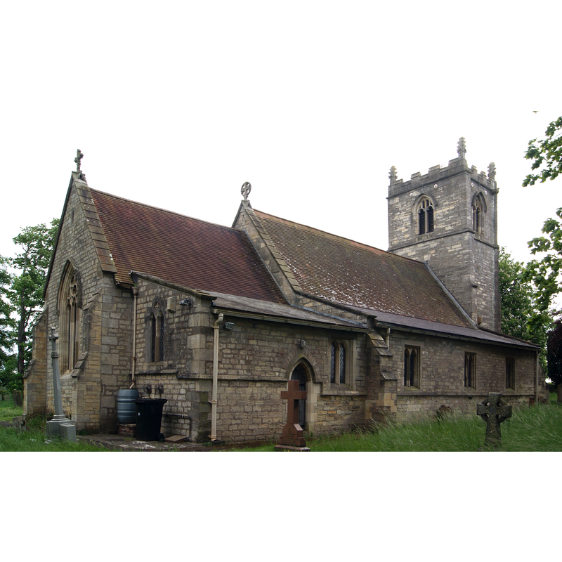
Image copyright © Mtaylor848, 2016
CC-BY-SA-4.0
Results: 4 records
view of church exterior - northeast view
Copyright Statement: Image copyright © Mtaylor848, 2016
Image Source: edited detail of a digital photograph taken 24 May 2016 by Mtaylor848 [https://commons.wikimedia.org/wiki/File:All_Saints'_Church,_Thorp_Arch_(24th_May_2016)_006.jpg] [accessed 31 October 2018]
Copyright Instructions: CC-BY-SA-4.0
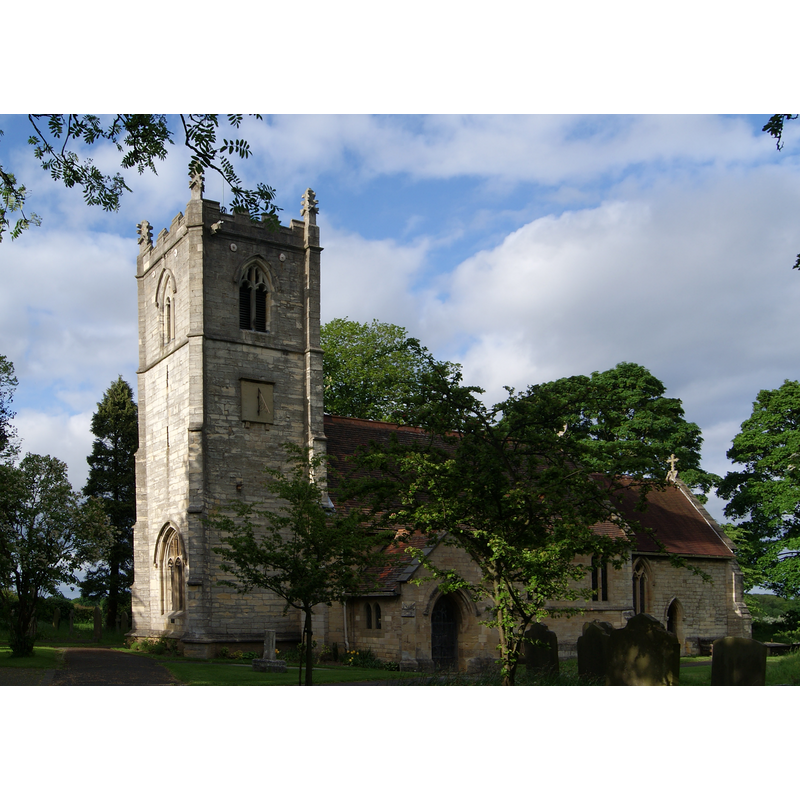
view of church exterior - southwest view
Copyright Statement: Image copyright © Mtaylor848, 2016
Image Source: edited detail of a digital photograph taken 24 May 2016 by Mtaylor848 [https://commons.wikimedia.org/wiki/File:All_Saints'_Church,_Thorp_Arch_(24th_May_2016)_012.jpg] [accessed 31 October 2018]
Copyright Instructions: CC-BY-SA-4.0
view of basin
![Source caption: "Description: 26th May 1908 View of old relics grouped together at the west end of the churchyard. On the left is an octagonal bowl of 17.5cm in depth. Next to it is an octagonal pillar. These were found buried upside down in the churchyard and are thought to be the font presented to All Saints church by the mother of Revd. Christopher Atkinson in 1756. In the centre is another old font with 13 irregular sides. It is 60cm in height and approx. 30cm deep inside. It is likely to be the font mentioned in a description of a small vestry at the north-east end of the church in an account written c. 1841. Finally, on the right, there are two old stone coffins, one dug up in 1820 on the north side of the chuch and the other discovered in 1906. They are of medieval origin." [source: www.leodis.net/display.aspx?resourceIdentifier=20041110_41245669 [accessed 23 December 2011] © Leeds Library & Information Service, 2011](/static-50478a99ec6f36a15d6234548c59f63da52304e5/others/permission_not_available.jpg)
Scene Description: Source caption: "Description: 26th May 1908 View of old relics grouped together at the west end of the churchyard. On the left is an octagonal bowl of 17.5cm in depth. Next to it is an octagonal pillar. These were found buried upside down in the churchyard and are thought to be the font presented to All Saints church by the mother of Revd. Christopher Atkinson in 1756. In the centre is another old font with 13 irregular sides. It is 60cm in height and approx. 30cm deep inside. It is likely to be the font mentioned in a description of a small vestry at the north-east end of the church in an account written c. 1841. Finally, on the right, there are two old stone coffins, one dug up in 1820 on the north side of the chuch and the other discovered in 1906. They are of medieval origin." [source: www.leodis.net/display.aspx?resourceIdentifier=20041110_41245669 [accessed 23 December 2011] © Leeds Library & Information Service, 2011
Copyright Statement: Image copyright © Leeds Library & Information Service, 2011
Image Source: B&W photograph taken 26 May 1908 in LEODIS [Subject ID:20041110_24116152] [www.leodis.net/imagesLeodis/screen/69/2020041110_24116152.jpg] [accessed 23 December 2011]
Copyright Instructions: PERMISSION NOT AVAILABLE -- IMAGE NOT FOR PUBLIC USE
view of basin
Scene Description: Source caption: "Description: 14th May 1937 View of an old font in the churchyard of All Saints Church. It has thirteen irregular sides and measures 60cm in height on the outside. The bowl is relatively shallow being just short of 30cm deep. It would appear to be included in a description of about 1841 by the Rev. Cannon W.H.Dixon. He had observed it in a small vestry laocated at the north-east end of the Church." [source: www.leodis.net/display.aspx?resourceIdentifier=20041110_41245669 [accessed 23 December 2011] © Leeds Library & Information Service, 2011
Copyright Statement: Image copyright © Leeds Library & Information Service, 2011
Image Source: B&W photograph taken 14 May 1937 in LEODIS [Subject ID: 20041110_41245669] [www.leodis.net/imagesLeodis/screen/69/20041110_41245669.jpg] [accessed 23 December 2011]
Copyright Instructions: PERMISSION NOT AVAILABLE -- IMAGE NOT FOR PUBLIC USE
INFORMATION
Font ID: 17810THO
Object Type: Baptismal Font1, basin only
Font Century and Period/Style: 12th century, Late Norman
Church / Chapel Name: Parish Church of All Saints
Font Location in Church: [cf. FontNotes]
Church Patron Saint(s): All Saints
Church Notes: The Church of England web site [www.achurchnearyou.com/thorp-arch-all-saints/] [accessed 23 December 2011] notes: All Saints Church is mentioned in the Domesday Survey of 1086 and was re-built in the Norman style in the 12th Century with further re-building in the Perpendicular style in 1485. The last major restoration of the church was in 1871/72 when it was restored in the Medieval Style, the architect being George Edmund Street".
Church Address: Church Causeway, Thorp Arch, West Yorkshire, LS23 7AH, UK
Site Location: West Yorkshire, Yorkshire and the Humber, England, United Kingdom
Directions to Site: Located off (N) the A659, E of the A1(M), 4 km ESE of Wetherby, 20 km NE of Leeds
Ecclesiastic Region: Diocese of York
Historical Region: Hundred of Ainsty -- formerly WRYrks
Additional Comments: abandoned font / disused font / buried font (outside the church, by the N side of the tower; later in the vestry) -- disappeared font? (the one from the Domesday-time church here)
Font Notes:
Click to view
There is an entry for Thorp [Arch] [variant spelling]in the Domesday survey [http://opendomesday.org/place/SE4346/thorp-arch/] [accessed 31 October 2018]; it reports a priest and a church in it. The entry for this church in Historic England [Listing NGR: SE4379646080] notes: "Church. C12 south door, C15 tower otherwise of 1871-2 by G. E. Street. The HE Listing NGR: SE4378446083, however, reports a "Disused font bowl. Early medieval; possibly C12, Magnesian limestone. Plain 13-sided bowl tapering to the base. Damaged rim" that was adjacent to the north buttress of the tower of this church. A later font, also disused, is reported in the EH Listing NGR: SE4377846088: "Disused font situated approx 2 metres to north-west of tower to Church of All Saints [...] Disused font. Probably 1759 (Speight, p.415). Magnesian limestone. Octagonal with hollow chamfered plinth, slender shaft and simple bowl with nosed rim. Speight (p.415) notes that in 1759 Rev. C. Atkinson partly rebuilt and restored the Church, at which time his mother presented the font. H. Speight, Lower Wharfedale, 1902." Two B&W photographs in the Wetherby Collection Vol 14 Y914.281 Wet/22 [Subject ID:20041110_24116152], and Wet/25 [Subject ID: 20041110_41245669] show the font in 1908 and 1937 respectively; the later photograph shows the font by itself, a much damaged polygonal basin surrounded by weeds, and footnoted with the following description: "14th May 1937 View of an old font in the churchyard of All Saints Church. It has thirteen irregular sides and measures 60cm in height on the outside. The bowl is relatively shallow being just short of 30cm deep. It would appear to be included in a description of about 1841 by the Rev. Cannon W.H.Dixon. He had observed it in a small vestry located at the north-east end of the Church." The vessel has a large drain hole on one of the sides, low down, possibly an indication that it was used for a time as a water-trough. [NB: present building is originally 12th-century, so the older basin may be the original font of the late-Norman (?) medieval church -- the 13 sides of the basin are somewhat disconcerting, however, for a font of the 12th century]. The old basin is not mentioned in the CRSBI (2018) entry for this church. Ryder (1993) reports a number of remains, some "interesting carved stones" from the early churches here, "including part of an Anglo-Saxon cross, built into the walls of the porch", but makes no mention of the old font basin.
Credit and Acknowledgements: We are grateful to Colin Hinson, of www.yorkshireCDbooks.com, for his photograph of this font
COORDINATES
UTM: 30U 609380 5974688
Latitude & Longitude (Decimal): 53.909056, -1.334889
Latitude & Longitude (DMS): 53° 54′ 32.6″ N, 1° 20′ 5.6″ W
MEDIUM AND MEASUREMENTS
Material: stone, limestone (magnesian limestone)
Number of Pieces: one
Font Shape: polygonal (thirteen sides)
Basin Interior Shape: round
Basin Exterior Shape: polygonal (thirteen sides)
Drainage System: yes [cf. FontNotes]
Drainage Notes: no lining
Basin Depth: 30 cm*
Basin Total Height: 60 cm*
Notes on Measurements: * [cf. FontNotes]
REFERENCES
- Corpus of Romanesque Sculpture in Britain and Ireland, The Corpus of Romanesque Sculpture in Britain and Ireland, The Corpus of Romanesque Sculpture in Britain and Ireland. URL: http://www.crsbi.ac.uk.
- Ryder, Peter, Medieval churches of West Yorkshire, [Leeds?]: West Yorkshire Archaeology Service, 1993, p. 175