Wallingford No. 2 / Walenge / Walengeford / Walingeford / Warenge / Warine-ford / Wealinga-ford
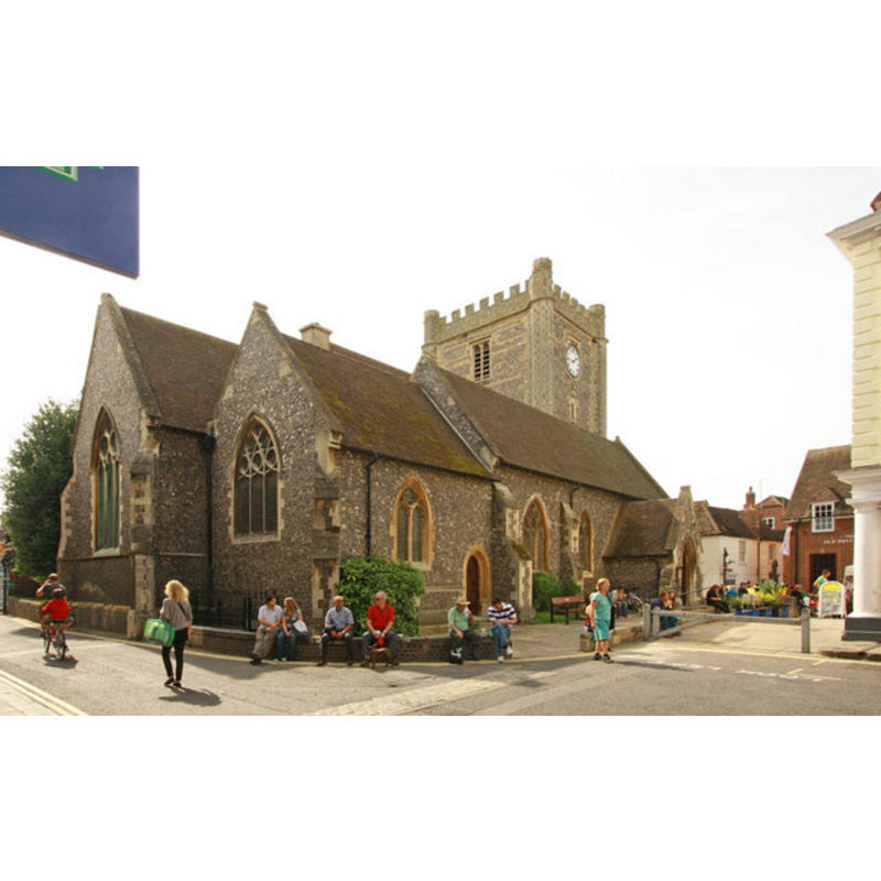
Image copyright © John Salmon, 2010
CC-BY-SA-2.0
Results: 3 records
view of church exterior - northeast view
Copyright Statement: Image copyright © John Salmon, 2010
Image Source: digital photograph taken 4 September 2010 by John Salmon [www.geograph.org.uk/photo/2060761] [accessed 5 May 2015]
Copyright Instructions: CC-BY-SA-2.0
view of church exterior - northwest view
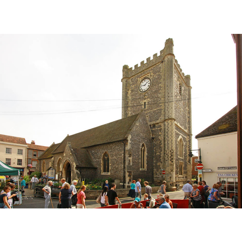
Copyright Statement: Image copyright © John Salmon, 2010
Image Source: digital photograph taken 4 September 2010 by John Salmon [www.geograph.org.uk/photo/2060764] [accessed 5 May 2015]
Copyright Instructions: CC-BY-SA-2.0
view of church interior - nave - looking east
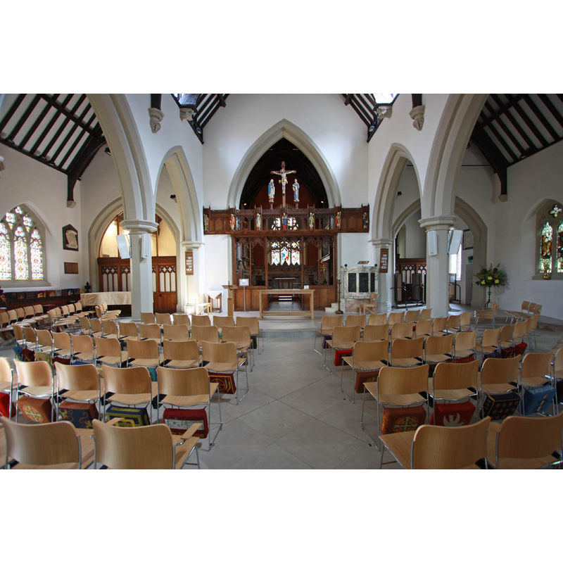
Copyright Statement: Image copyright © John Salmon, 2010
Image Source: digital photograph taken 4 September 2010 by John Salmon [www.geograph.org.uk/photo/2060748] [accessed 5 May 2015]
Copyright Instructions: CC-BY-SA-2.0
INFORMATION
Font ID: 17798WAL
Object Type: Baptismal Font1?
Font Century and Period/Style: 11th - 12th century, Medieval
Church / Chapel Name: Parish Church of St. Mary-le-More and All Hallows / St. Mary-the-More [redundant]
Church Patron Saint(s): St. Mary the Virgin & All Saints
Church Notes: St. Mary's was closed for years; it has been re-opened, and is now [December 2011] available for rent, for community activities
Church Address: St Mary's Street, Wallingford, Oxfordshire OX10 0EG -- Tel.: +44 1491 202188
Site Location: Oxfordshire, South East, England, United Kingdom
Directions to Site: Located in the centre of town, in the Market Place.Wallingford is located on the banks of the Thames, on the A4130, 20 km ESE of Oxford
Ecclesiastic Region: Diocese of Oxford
Historical Region: Hundred of Slotisford [in Domesday]
Additional Comments: disappeared font? (the one from the medieval church?)
Font Notes:
Click to view
There are eight entries for Wallingford [variant spelling] in the Domesday survey [http://opendomesday.org/place/SU6089/wallingford/] [accessed 4 May 2015], but no mention of cleric or church found in any of them. The Victoria County History (Berkshire, vol. 3, 1923) notes: "Wallingford seems at one time, perhaps in the 12th century and possibly even later in the 13th century, to have contained fourteen or fifteen churches or chapels. [...] Of these, ten or eleven were parish churches, three were chapels belonging to religious foundations and one was a bridge chapel. [...] The advowson of the church of St. Mary-the-More belonged from an early date to the abbey of St. Albans. Between 1077 and 1093 Niel Daubeney and his wife Amice gave half the church of St. Mary in Wallingford to the abbey [...] With the exception of the walls of the chancel and the west tower, the church was completely rebuilt in 1854." There is no mention of a font in this church in the VCH entry [NB: we have no information on the medieval font here].
COORDINATES
UTM: 30U 629868 5718176
Latitude & Longitude (Decimal): 51.599639, -1.124878
Latitude & Longitude (DMS): 51° 35′ 58.7″ N, 1° 7′ 29.56″ W
REFERENCES
- Victoria County History [online], University of London, 1993-. URL: https://www.british-history.ac.uk.
- Victoria County History [online], University of London, 1993-. URL: https://www.british-history.ac.uk.