Brightwell / Brightwell-cum-Sotwell / Bristowelle
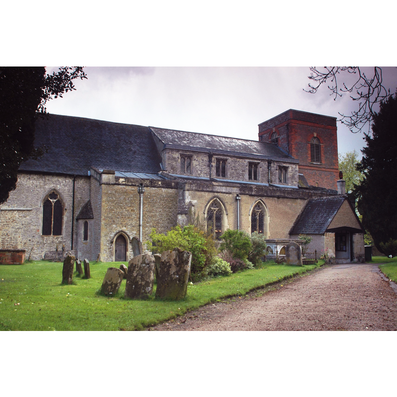
Image copyright © Motacilla, 2010
CC-BY-SA-3.0
Results: 2 records
view of church exterior - north view
Copyright Statement: Image copyright © Motacilla, 2010
Image Source: digital photograph taken 3 May 2010 by Motacilla [http://en.wikipedia.org/wiki/Brightwell-cum-Sotwell] [accessed 8 December 2011]
Copyright Instructions: CC-BY-SA-3.0
view of church interior - nave - looking east
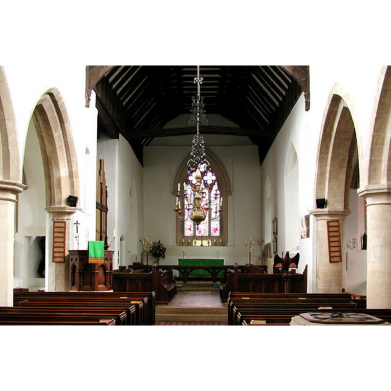
Scene Description: the top of the modern font and its cover are visible on the foreground, right (south) side
Copyright Statement: Image copyright © John Salmon, 2004
Image Source: digital photograph taken 12 June 2004 by John Salmon [www.geograph.org.uk/photo/331100] [accessed 8 December 2011]
Copyright Instructions: CC-BY-SA-3.0
INFORMATION
Font ID: 17795BRI
Object Type: Baptismal Font1?
Font Century and Period/Style: 11th century, Pre-Conquest? / Norman
Church / Chapel Name: Parish Church of St. Agatha
Church Patron Saint(s): St. Agatha [aka Agata, Agatha of Sicily, Agueda]
Church Address: Brightwell-cum-Sotwell, Wallingford, Oxfordshire, OX10 0RU
Site Location: Oxfordshire, South East, England, United Kingdom
Directions to Site: Located 3 km NW of Wallingford, E of Didcot
Ecclesiastic Region: Diocese of Oxford
Historical Region: Hundred of Slotisford [in Domesday] -- formerly in Berkshire -- Hundred of Moreton
Additional Comments: disappeared font? (the one from the Domesday-time church?)
Font Notes:
Click to view
There is an entry for Brightwell [variant spelling] in the Domesday survey [http://opendomesday.org/place/SU5790/brightwell/] [accessed 30 April 2015]; it mentions a church in it. The Victoria County History (Berkshire, vol. 3, 1923) notes: "The church of Brightwell is mentioned in the Domesday Survey. [...] The south arcade and the west wall of the nave are of the late 12th century, and a doorway of the same date remains in the south wall of the south aisle. [...] The pulpit and font are both modern." The present font, located at the west end of the nave, by the arcade that separates the nave from the south aisle, is modern, of the 19th century. [NB: we have no information on the font from the Domesday-time church here].
COORDINATES
UTM: 30U 626937 5719666
Latitude & Longitude (Decimal): 51.6137, -1.16664
Latitude & Longitude (DMS): 51° 36′ 49.32″ N, 1° 9′ 59.9″ W
REFERENCES
- Victoria County History [online], University of London, 1993-. URL: https://www.british-history.ac.uk.