Nettlebed / Nettlehed
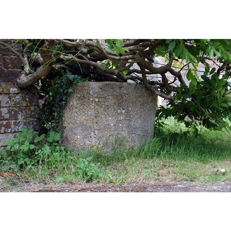
Image copyright © Sue McArdle, 2012
No known copyright restriction / Fair Dealing
Results: 9 records
view of font in context
Scene Description: described in the source as being approximately 1 m. to the south of the church
Copyright Statement: Image copyright © Sue McArdle, 2012
Image Source: digital photograph 17 June 2012 by Sue McArdle [https://britishlistedbuildings.co.uk/101047381-font-approximately-1-metre-to-south-of-church-of-st-bartholomew-nettlebed/photos/49417#.XRZIy4p7lrR] [accessed 28 June 2019]
Copyright Instructions: No known copyright restriction / Fair Dealing
view of font in context
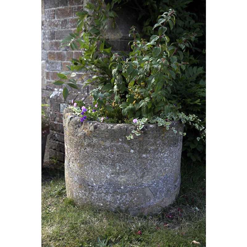
Scene Description: Source caption: "The font beside the porch at St Bartholomew Nettlebed".
Copyright Statement: Image copyright © Bill Nicholls, 2016
Image Source: digital photograph taken 14 August 2016 by Bill Nicholls [www.geograph.org.uk/photo/5188337] [accessed 28 June 2019]
Copyright Instructions: CC-BY-SA-2.0
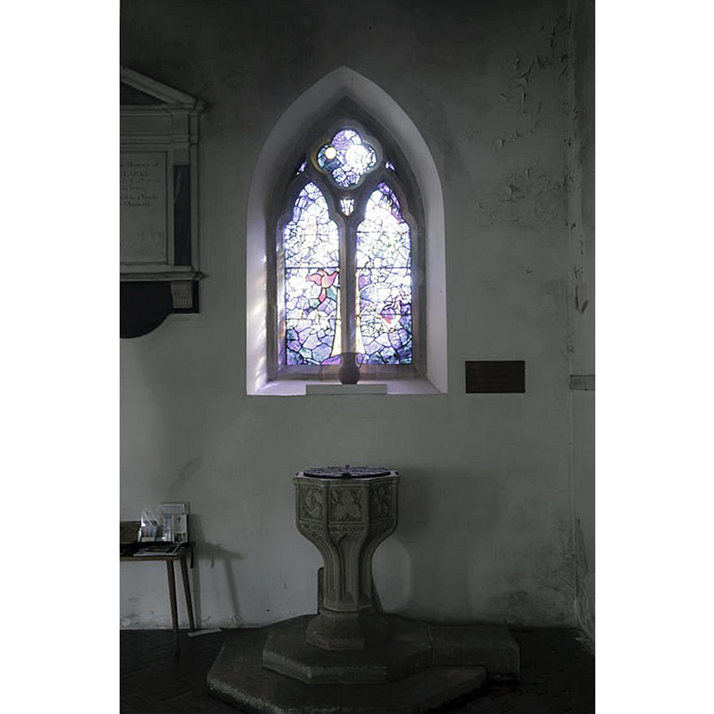
view of font and cover
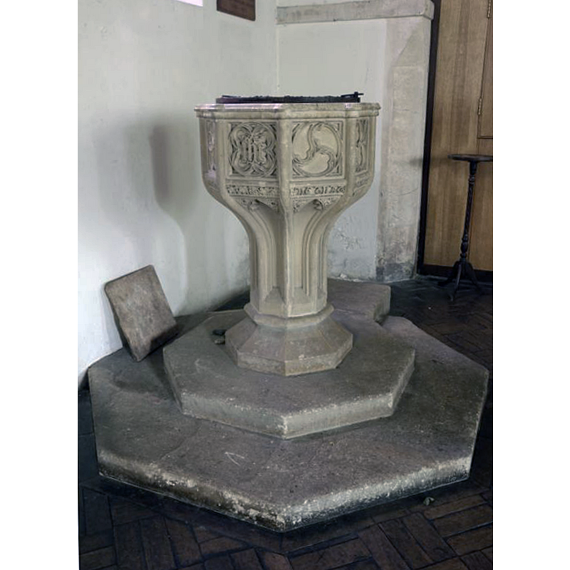
Scene Description: the modern font in use inside the church
Copyright Statement: Image copyright © Bill Nicholls, 2016
Image Source: digital photograph taken 14 August 2016 by Bill Nicholls [www.geograph.org.uk/photo/5176197] [accessed 28 June 2019]
Copyright Instructions: CC-BY-SA-2.0
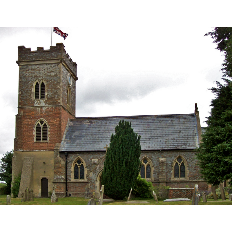
view of church exterior - northwest view
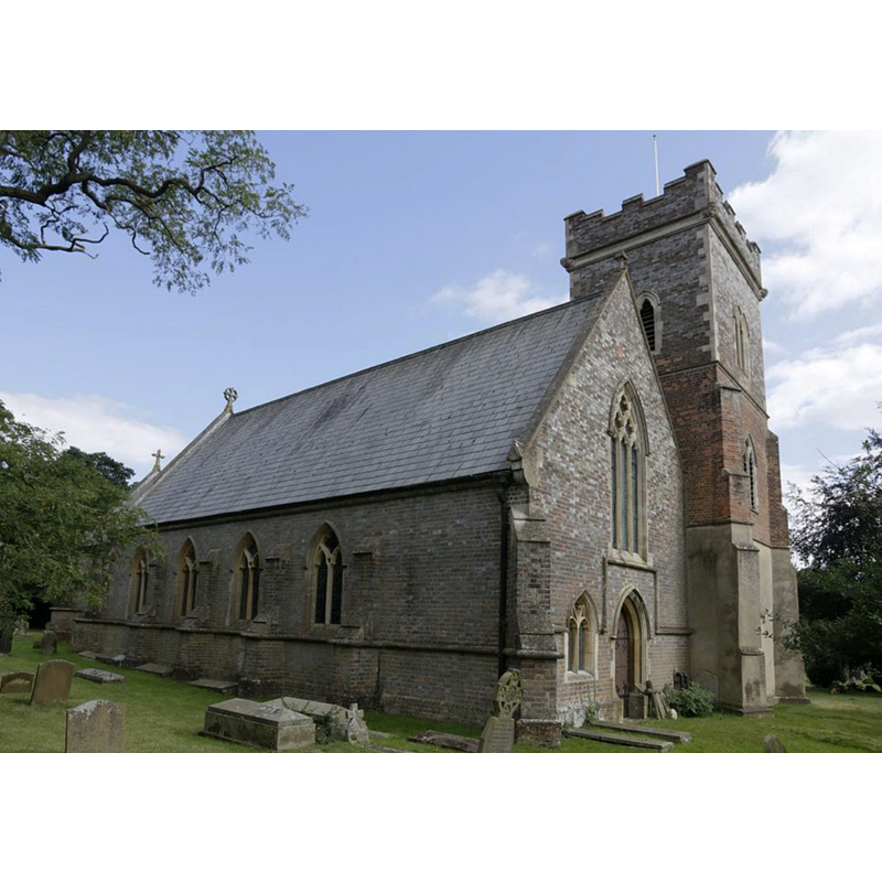
Copyright Statement: Image copyright © Bill Nicholls, 2016
Image Source: digital photograph taken 14 August 2016 by Bill Nicholls [www.geograph.org.uk/photo/5187217] [accessed 28 June 2019]
Copyright Instructions: CC-BY-SA-2.0
view of church exterior - northeast view
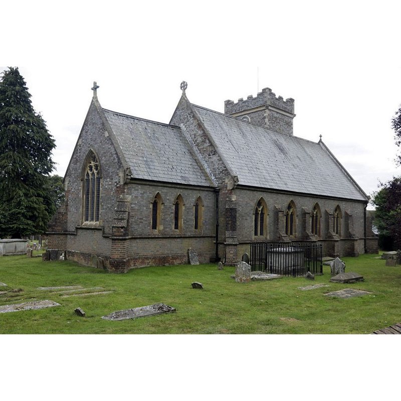
Copyright Statement: Image copyright © Bill Nicholls, 2016
Image Source: digital photograph taken 14 August 2016 by Bill Nicholls [www.geograph.org.uk/photo/5176123] [accessed 28 June 2019]
Copyright Instructions: CC-BY-SA-2.0
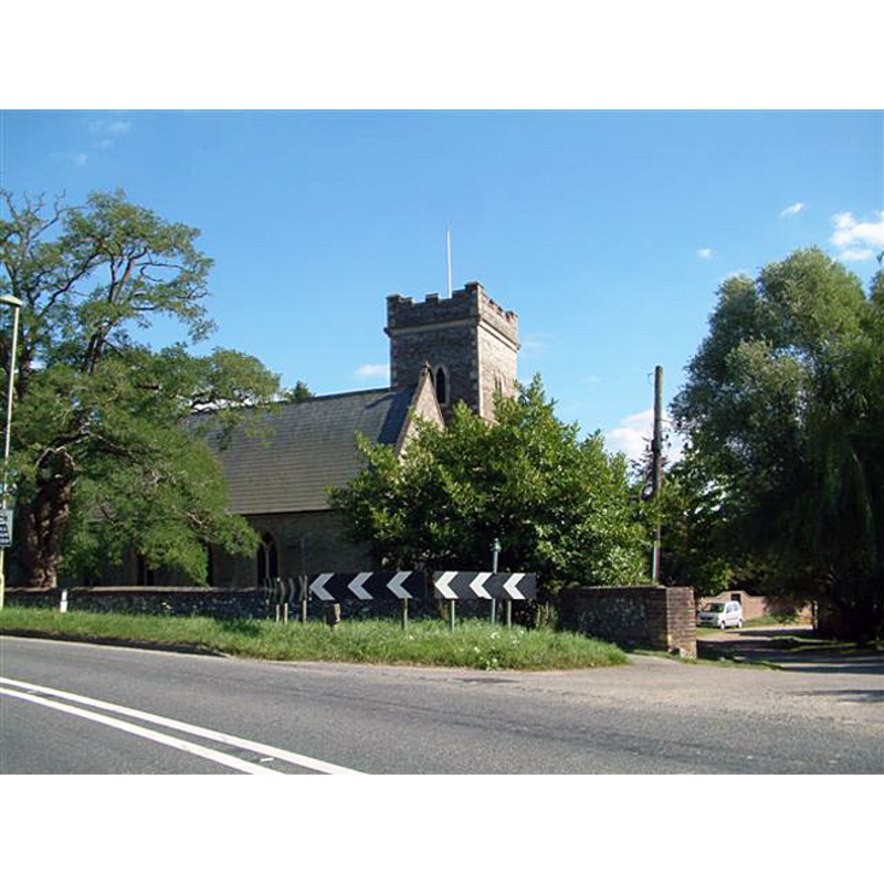
view of church exterior - south view
Copyright Statement: Image copyright © [in the public domain]
Image Source: digital photograph taken 1 August 2013 by Poliphilo [https://commons.wikimedia.org/wiki/File:St_Bartholomew,_Nettlebed.JPG] [accessed 29 June 2019]
Copyright Instructions: CC-Zero
view of church exterior - northwest view
Copyright Statement: Image copyright © Colin Bates, 2005
Image Source: digital photograph taken 8 August 2005 by Colin Bates [http://www.geograph.org.uk/photo/36349] [accessed 7 December 2011]
Copyright Instructions: CC-BY-SA-2.0
view of font and cover in context
Scene Description: the modern font and cover in use inside the church
Copyright Statement: Image copyright © Bill Nicholls, 2016
Image Source: digital photograph taken 14 August 2016 by Bill Nicholls [www.geograph.org.uk/photo/5185734] [accessed 28 June 2019]
Copyright Instructions: CC-BY-SA-2.0
view of church interior - looking east
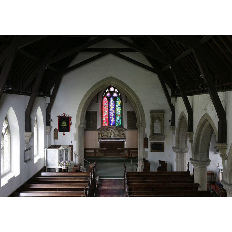
Copyright Statement: Image copyright © Bill Nicholls, 2016
Image Source: digital photograph taken 14 August 2016 by Bill Nicholls [www.geograph.org.uk/photo/5185613] [accessed 28 June 2019]
Copyright Instructions: CC-BY-SA-2.0
INFORMATION
Font ID: 17793NET
Object Type: Baptismal Font1
Font Century and Period/Style: 11th - 12th century, Norman
Church / Chapel Name: Parish Church of St. Bartholomew [formerly a chapel]
Font Location in Church: Outside the church [cf. FontNotes]
Church Patron Saint(s): St. Bartholomew
Church Address: High St, Nettlebed, Oxfordshire, RG9 5DA, UK
Site Location: Oxfordshire, South East, England, United Kingdom
Directions to Site: Located off (S) the A4130 [aka Porth Hill], 7-8 km NW of Henley-on-Thames, 10 km SE of Wallingford, 29 km SE of Oxford, in the Chiltern Hills
Ecclesiastic Region: Diocese of Oxford
Historical Region: Hundred of Ewelme -- Hundred of Benson [in Domesday]
Additional Comments: disused font? (the one reported now [2016+] outside the church)
Font Notes:
Click to view
No individual entry found for Nettlebed in the Domesday survey. A font here is described in 'Church notes...' (1887) in the context of some "notes [that] were taken between 1835 and 1840": "Font, a plain Norman cylinder". There is entry for a "Font Approximately 1 Metre to South of Church of St Bartholomew" listed in Historic England [Listing NGR: SU6983786733]: "Font. Probably Romanesque. Stone. Circular. Straight sided." The entry for this parish in the Victoria County History (Oxford, vol. 18, 2016) notes: "A church at Nettlebed probably existed by that date or very soon after: a Norman font and fragments of a 12th-century tower may survive from the medieval building, [...] which was presumably established by the Crown, by an unknown tenant or feoffee, or by Dorchester abbey. [...] Nettlebed seems to have enjoyed full parochial rights, including baptism and burial. [...] The surviving Norman font suggests that the church had baptismal rights from the outset [...] Little survives of the medieval church, which was almost entirely rebuilt in 1845–6. The base of the present tower (now rendered) may retain some 12th-century stonework, and a Norman tub font (in the churchyard) is probably original."
[NB: the village name appears historically as either Nettlehed or Nettlebed depending on the source, though modern use is Nettlebed].
[NB: the village name appears historically as either Nettlehed or Nettlebed depending on the source, though modern use is Nettlebed].
COORDINATES
UTM: 30U 638995 5715660
Latitude & Longitude (Decimal): 51.574855, -0.994183
Latitude & Longitude (DMS): 51° 34′ 29.48″ N, 0° 59′ 39.06″ W
MEDIUM AND MEASUREMENTS
Material: stone
Font Shape: cylindrical
Basin Interior Shape: round
Basin Exterior Shape: round
REFERENCES
- "Church notes, chiefly in Berks, Wilts, and Oxford, with a few in Somerset and Gloucestershire", 44, Archaeological Journal, 1887, pp. 43-50; 185-193; 291-303; 397-402; p. 299
- Victoria County History [online], University of London, 1993-. URL: https://www.british-history.ac.uk.