Sulham / Soleha / Soleham / Solham / Soulham / Suleham
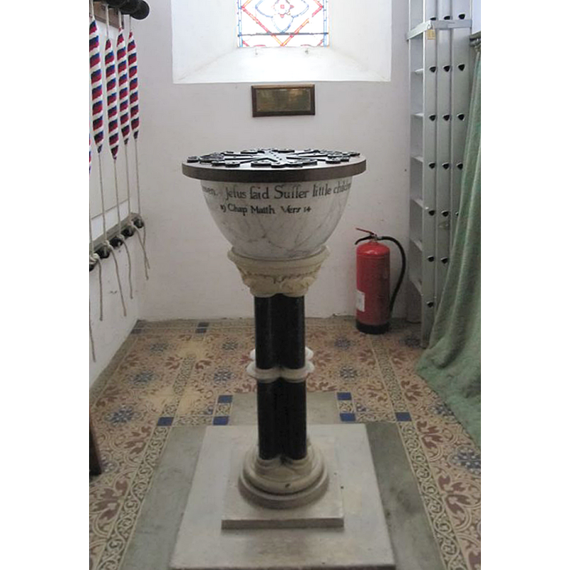
Image copyright © Bill Nicholls, 2010
CC-BY-SA-2.0
Results: 5 records
view of font and cover
Scene Description: the modern font
Copyright Statement: Image copyright © Bill Nicholls, 2010
Image Source: digital photograph taken 27 February 2010 by Bill Nicholls [www.geograph.org.uk/photo/1760968] [accessed 29 April 2015]
Copyright Instructions: CC-BY-SA-2.0
view of church exterior - west end
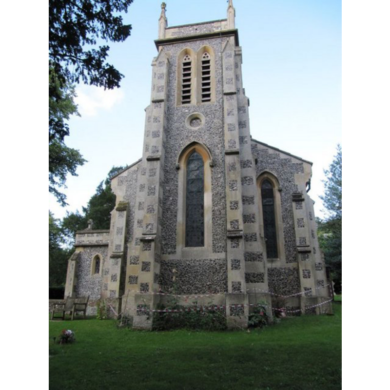
Copyright Statement: Image copyright © Bill Nicholls, 2010
Image Source: digital photograph taken 27 February 2010 by Bill Nicholls [www.geograph.org.uk/photo/14553471] [accessed 30 November 2011]
Copyright Instructions: CC-BY-SA-2.0
view of font and cover in context
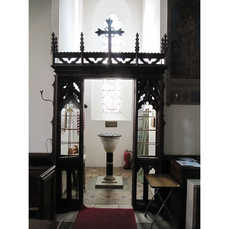
Scene Description: the modern font in the context of the tower space, behind a ornate screen
Copyright Statement: Image copyright © Bill Nicholls, 2010
Image Source: digital photograph taken 27 February 2010 by Bill Nicholls [www.geograph.org.uk/photo/1760959] [accessed 29 April 2015]
Copyright Instructions: CC-BY-SA-2.0
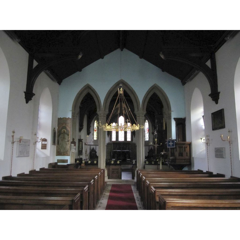
view of church interior - nave - looking west
![the modern font is visible at the far [west] end](/static-50478a99ec6f36a15d6234548c59f63da52304e5/compressed/1150501030_compressed.png)
Scene Description: the modern font is visible at the far [west] end
Copyright Statement: Image copyright © Bill Nicholls, 2010
Image Source: digital photograph taken 27 February 2010 by Bill Nicholls [www.geograph.org.uk/photo/1761008] [accessed 29 April 2015]
Copyright Instructions: CC-BY-SA-2.0
view of church interior - nave - looking east
Copyright Statement: Image copyright © Bill Nicholls, 2010
Image Source: digital photograph taken 27 February 2010 by Bill Nicholls [www.geograph.org.uk/photo/1760973] [accessed 29 April 2015]
Copyright Instructions: CC-BY-SA-2.0
INFORMATION
Font ID: 17773SUL
Object Type: Baptismal Font1?
Font Century and Period/Style: 11th century, Norman
Church / Chapel Name: Parish Church of St. Nicholas
Church Patron Saint(s): St. Nicholas of Myra
Church Notes: the date of the present font is given in the British Listed buildings entry for this church [http://www.britishlistedbuildings.co.uk/en-399801-church-of-st-nicholas-sulham] [accessed 30 Nove 2011]
Church Address: Nunhide Lane, Sulham, West Berkshire RG8 8ED
Site Location: Berkshire, South East, England, United Kingdom
Directions to Site: Located just E of Tidmarsh
Ecclesiastic Region: Diocese of Oxford
Historical Region: Hundred of Theale
Additional Comments: disappeared font?
Font Notes:
Click to view
There are three entries for Sulham [variant spelling] in the Domesday survey [http://opendomesday.org/place/SU6474/sulham/] [accessed 29 April 2015], one of which, in the tenancy of William of Cailly, mentions a church in it. The Victoria County History (Berkshire, vol. 3, 1923) notes: "There was a church attached to the large manor of Sulham in 1086 [...] The [present] church of St. Nicholas [was] rebuilt in the year 1838," The modern font consists of a round marble basin of ridiculuous dimensions dating from 1733, raised on a slender pedestal base of the 19th century; it is located at the west end of the nave. [NB: we do not have any information on the font from the Domesday-time church here].
COORDINATES
UTM: 30U 633719 5703157
Latitude & Longitude (Decimal): 51.463644, -1.072635
Latitude & Longitude (DMS): 51° 27′ 49.12″ N, 1° 4′ 21.49″ W
REFERENCES
- Victoria County History [online], University of London, 1993-. URL: https://www.british-history.ac.uk.