Reading No. 5 / Rading / Reding / Redinges / Redynges
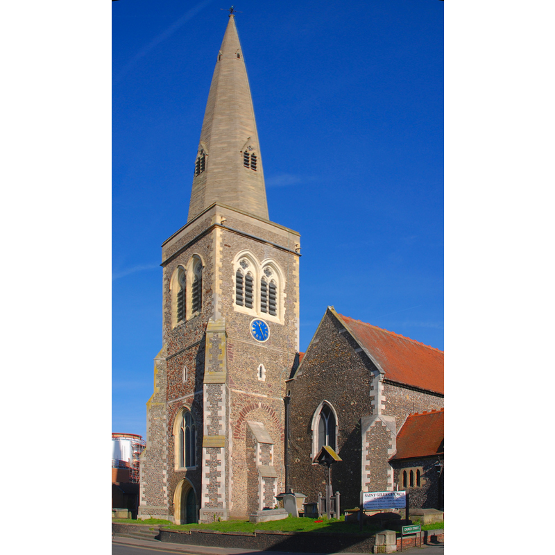
Image copyright © Uli Harder, 2008
Released by the author into the public domain
Results: 2 records
view of church exterior - southwest end
Copyright Statement: Image copyright © Uli Harder, 2008
Image Source: digital photograph taken 9 February 2008 by Uli Harder [http://www.flickr.com/photos/54037354@N00/2266638367] [accessed 29 November 2011]
Copyright Instructions: Released by the author into the public domain
view of font and cover in context

Scene Description: the modern font at the west end of the nave, north side
Copyright Statement: Image copyright © Reading St. Giles Parish, 2011
Image Source: B&W photograph in the Parish web site [www.sgilesreading.org.uk/history.html] [accessed 29 November 2011]
Copyright Instructions: PERMISSION NOT AVAILABLE -- IMAGE NOT FOR PUBLIC VIEW
INFORMATION
Font ID: 17767REA
Object Type: Baptismal Font1?
Font Century and Period/Style: 12th century, Medieval
Church / Chapel Name: Parish Church of St. Giles
Church Patron Saint(s): St. Giles [aka Aegidus, Egidus, Gilles]
Church Address: Church Street, off Southampton Street, Reading, Berkshire, RG1 2SB
Site Location: Berkshire, South East, England, United Kingdom
Directions to Site: Located at Church St. and Southampton St., Reading.
Ecclesiastic Region: Diocese of Oxford
Historical Region: Hundred of Reading [in Domesday]
Additional Comments: disappeared font? (the one from the medieval church?)
Font Notes:
Click to view
The Victoria County History (Berkshire, vol. 3, 2011) notes: "St. Giles's Church is first mentioned in a confirmatory charter given by Hubert Walter, Bishop of Salisbury (1189–93), to the Abbot and convent of Reading. [...] In 1291 it was the richest church in the town, being worth £10, (fn. 25) while St. Mary's was worth £8 and St. Lawrence's only £5. [...] From the church as it stands to-day nothing can be gathered of the early history of the building, a restoration which practically amounted to a rebuilding having taken place in 1872–3, when, with the exception of the late 13th-century south wall of the south aisle, the whole of the church east of the 15th-century tower appears to have been pulled down". There is no mention of a font in the VCH entry. The Parish web site [http://www.sgilesreading.org.uk/history.html] [accessed 29 November 2011] displays a 1875 B&W photograph of the church interior taken to years after it was "almost completely rebuilt by J. P. St Aubyn in 1873", in which a modern font is shown at the west end of the nave, north side; the font consists of a polygonal basin with carved sides, raised on a typically Victorian columnar base, and a two-step (?) plinth. The wooden font cover is a polygonal pyramid with crocketed arrises and decorated panels; also modern by all appearances.
COORDINATES
UTM: 30U 641024 5701932
Latitude & Longitude (Decimal): 51.450983, -0.970403
Latitude & Longitude (DMS): 51° 27′ 3.54″ N, 0° 58′ 13.45″ W
REFERENCES
- Victoria County History [online], University of London, 1993-. URL: https://www.british-history.ac.uk.