Shinfield / Selingefelle / Shenfeld / Shenyngfeld / Shineingfeild / Shinfeild / Shinwills / Shyningfeild [disappeared?
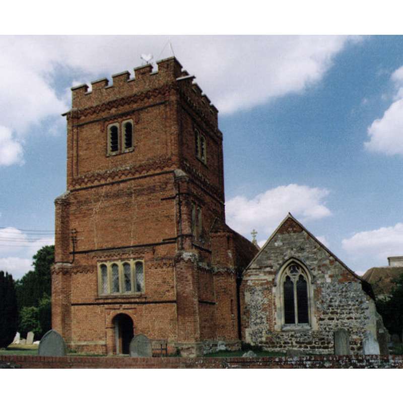
Image copyright © Michael Ford, 2002
CC-BY-SA-2.0
Results: 1 records
view of church exterior - southwest view
Scene Description: Source caption: "St Mary the Virgin, Shinfield. Grade 1 listed building erected in the 12th century."
Copyright Statement: Image copyright © Michael Ford, 2002
Image Source: photograph taken in 2002 by Michael Ford [www.geograph.org.uk/photo/1525484] [accessed 26 March 2015]
Copyright Instructions: CC-BY-SA-2.0
INFORMATION
Font ID: 17759SHI
Object Type: Baptismal Font1?
Font Century and Period/Style: 12th century (late?), Late Norman? / Transitional?
Church / Chapel Name: Parish Church of St. Mary the Virgin
Church Patron Saint(s): St. Mary the Virgin
Church Address: Church Lane, Shinfield, Berkshire, RG2 9BY
Site Location: Berkshire, South East, England, United Kingdom
Directions to Site: Located on the A327, just S of Reading and the M4
Ecclesiastic Region: Diocese of Oxford
Historical Region: Hundred of Charldon [in Domesday] -- Hundred of Carlton
Additional Comments: disappeared font (the one from the late-12th century church?)
Font Notes:
Click to view
There is an entry for Shinfield [variant spelling] in the Domesday survey [http://domesdaymap.co.uk/place/SU7268/shinfield/] [accessed 26 March 2015], but it mentions neither cleric nor church in it. The Victoria County History (Berkshire, vol. 3, 1923) notes: "The church appears to date from the last half of the 12th century, to which period the north doorway belongs" but mentions no font in this church. The Benefice of Loddon Reach web site [www.loddonreach.org.uk/shinfield2.htm] [accessed 28 November 2011] reports the move of the font in 1936, surely the modern font here: "In 1936, work to prevent the font sinking revealed a brass plate recording George and Mary Mitford, parents of Mary Russell Mitford, beneath the Victorian tiles. [...] Removal of the font revealed that it had previously been placed directly over the Mitford grave." [NB: we have no information on the original font of the 12th-century church here].
COORDINATES
UTM: 30U 642539 5697074
Latitude & Longitude (Decimal): 51.406955, -0.950568
Latitude & Longitude (DMS): 51° 24′ 25.04″ N, 0° 57′ 2.05″ W
REFERENCES
- Victoria County History [online], University of London, 1993-. URL: https://www.british-history.ac.uk.