Remenham / Rameham / Ramendham / Ramenham / Rammeham / Rammiham / Remaham / Rememham / Remnam
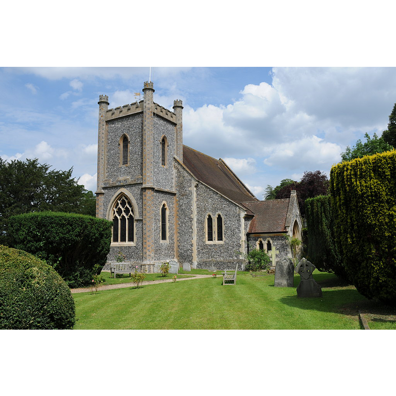
Image copyright © Philip Halling, 2011
CC-BY-SA-2.0
Results: 1 records
view of church exterior - southwest view
Copyright Statement: Image copyright © Philip Halling, 2011
Image Source: digital photograph taken 15 July 2011 by Philip Halling [www.geograph.org.uk/photo/2515758] [accesssed 19 March 2015]
Copyright Instructions: CC-BY-SA-2.0
INFORMATION
Font ID: 17751REM
Object Type: Baptismal Font1?
Font Century and Period/Style: 12th century, Late Norman
Church / Chapel Name: Parish Church of St. Nicholas
Church Patron Saint(s): St. Nicholas of Myra
Church Address: Remenham Lane, Remenham, Berkshire, RG9 3DB
Site Location: Berkshire, South East, England, United Kingdom
Directions to Site: Located 3 km NE of Henley
Ecclesiastic Region: Diocese of Oxford
Historical Region: Hundred of Charldon [in Domesday] -- Hundred of Beynhurst
Additional Comments: disappeared font? (the medieval one?)
Font Notes:
Click to view
There is an entry for Remenham [variant spelling] in the Domesday survey [http://domesdaymap.co.uk/place/SU7784/remenham/] [accessed 19 March 2015], but it mentions neither cleric nor church in it. The Victoria County History (Berkshire, vol. 3, 1923) notes: "The advowson of Remenham [...] is found in 1216 in the king's hands [...] The date of the [church] structure is uncertain, the restorations of the 19th century having removed all distinctive detail. [...] but from the plan of the nave and chancel and the position of the windows of the apse it is more likely that the building itself was erected in [...] the 12th, century [...] The font and pulpit are modern". [NB: we have no information on the medieval font here].
COORDINATES
UTM: 30U 646320 5713240
Latitude & Longitude (Decimal): 51.551252, -0.88956
Latitude & Longitude (DMS): 51° 33′ 4.51″ N, 0° 53′ 22.42″ W
REFERENCES
- Victoria County History [online], University of London, 1993-. URL: https://www.british-history.ac.uk.