Winkfield / Wenekefelde / Wenesfelle / Winckfeld / Winecanfelda / Wingfeld / Wynfeld / Wynkefeld
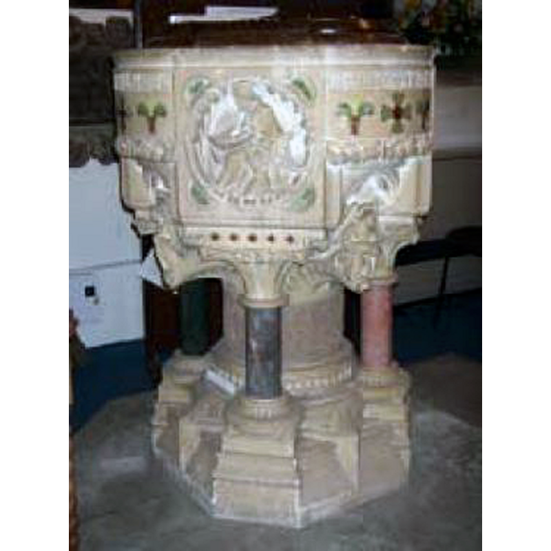
Image copyright © A Church Near You, 2015
No known copyright restriction – Fair Dealing
Results: 2 records
view of font and cover
Scene Description: the modern font [cf. FontNotes]
Copyright Statement: Image copyright © A Church Near You, 2015
Image Source: digital photograph in A Church Near You [www.achurchnearyou.com/album/6059/] [acceessed 18 March 2015]
Copyright Instructions: No known copyright restriction – Fair Dealing
view of church exterior - south view
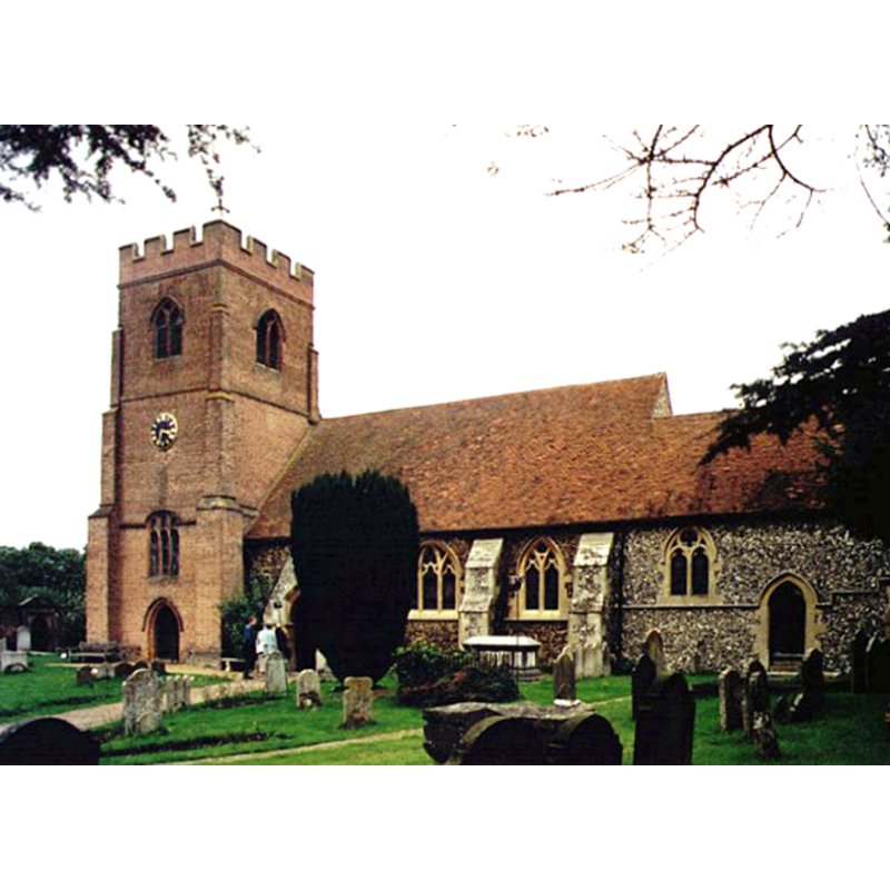
Copyright Statement: Image copyright © Michael Ford, 2002
Image Source: photograph taken in 2002 by Michael Ford [www.geograph.org.uk/photo/1527193] [accessed 18 March 2015]
Copyright Instructions: CC-BY-SA-2.0
INFORMATION
Font ID: 17745WIN
Object Type: Baptismal Font1?
Font Date: ca. 1300?
Font Century and Period/Style: 13th - 14th century, Medieval
Church / Chapel Name: Parish Church of St. Mary the Virgin
Church Patron Saint(s): St. Mary the Virgin
Church Notes: the churches of the hamlets at Winkfield -Ascot, South Ascot and Cranbourne- are all modern buildings
Church Address: Church Road A330, Winkfield, Berkshire, SL4 4SQ
Site Location: Berkshire, South East, England, United Kingdom
Directions to Site: Located off the A330, NE of Bracknell
Ecclesiastic Region: Diocese of Oxford
Historical Region: Hundred of Ripplesmere
Additional Comments: disappeared font? (the one from the ca. 1300 original church?)
Font Notes:
Click to view
There is an entry for Winkfield [variant spelling] in the Domesday survey [http://domesdaymap.co.uk/place/SU9072/winkfield/] [accessed 18 March 2015], but it mentions neither cleric nor church in it. The Victoria County History (Berkshire, vol. 3, 1923) notes: "The church of Winkfield belonged to the abbey of Abingdon, which in 1308 received a licence to alienate it to the Dean and Chapter of Salisbury Cathedral [...] The church has been much altered at various periods, and the original plan is uncertain. The north and south walls and northern half of the west wall of the present nave appear to date from c. 1300. [...] The fittings are modern." The modern font appears in the church interior plan illustrated in the VCH entry, located in the nave, by the south doorway
COORDINATES
UTM: 30U 659792 5701641
Latitude & Longitude (Decimal): 51.443387, -0.70066
Latitude & Longitude (DMS): 51° 26′ 36.19″ N, 0° 42′ 2.38″ W
REFERENCES
- Victoria County History [online], University of London, 1993-. URL: https://www.british-history.ac.uk.