Milton nr. Didcot and Abingdon / Middelton / Middeltune / Midelton / Mylton
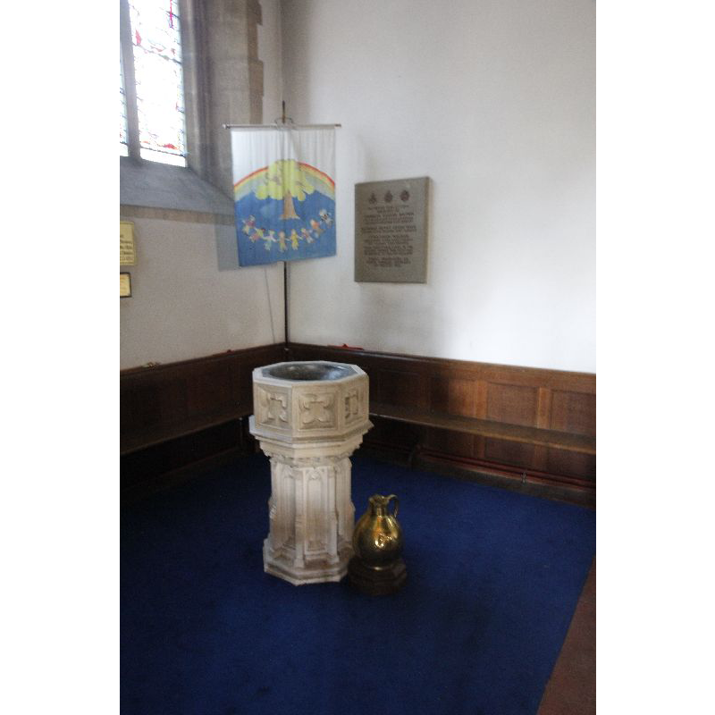
Image copyright © Bill Nicholls, 2011
CC-BY-SA-2.0
Results: 4 records
view of font
Scene Description: the 19th-century font [cf. FontNotes]
Copyright Statement: Image copyright © Bill Nicholls, 2011
Image Source: digital photograph taken 2 October 2011 by Bill Nicholls [www.geograph.org.uk/photo/2636153] [accessed 1 June 2015]
Copyright Instructions: CC-BY-SA-2.0
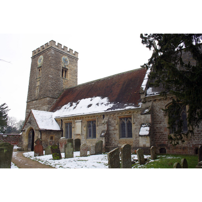
view of church exterior - southeast view
Copyright Statement: Image copyright © Roger Templeman, 2013
Image Source: digital photograph taken 24 January 2013 by Roger Templeman [www.geograph.org.uk/photo/3308550] [accessed 1 June 2015]
Copyright Instructions: CC-BY-SA-2.0
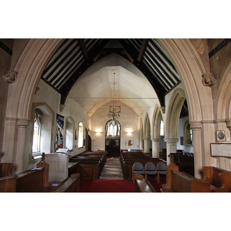
view of church interior - nave - looking west
Copyright Statement: Image copyright © Bill Nicholls, 2011
Image Source: digital photograph taken 2 October 2011 by Bill Nicholls [www.geograph.org.uk/photo/2636151] [accessed 1 June 2015]
Copyright Instructions: CC-BY-SA-2.0
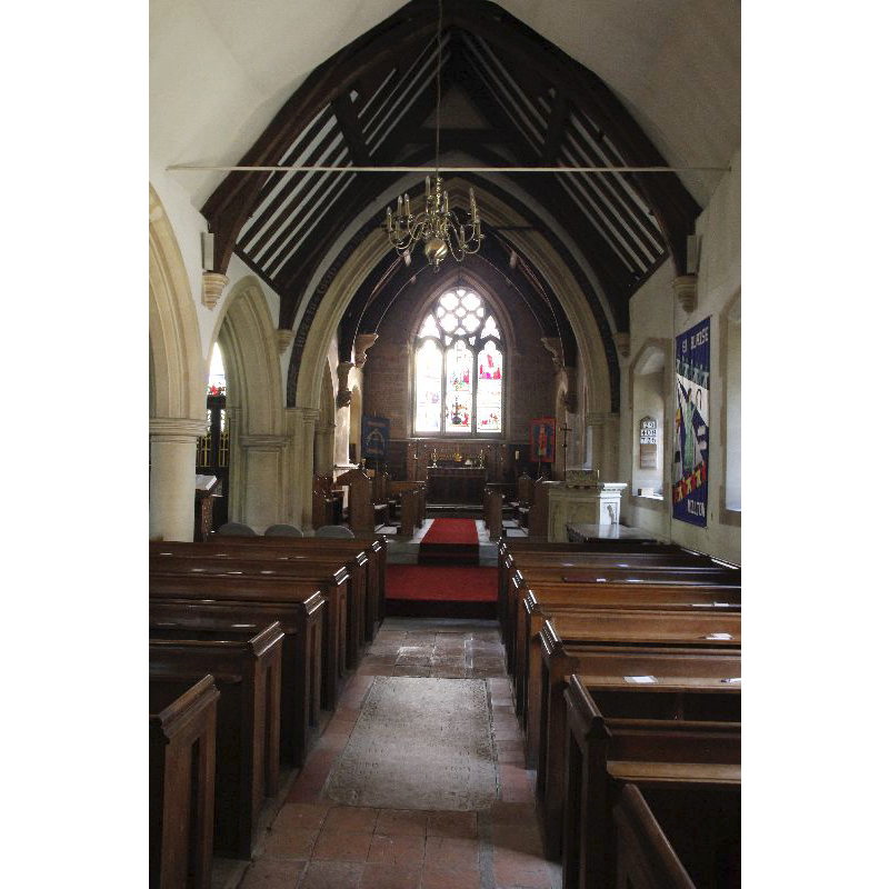
view of church interior - nave - looking east
Copyright Statement: Image copyright © Bill Nicholls, 2011
Image Source: digital photograph taken 2 October 2011 by Bill Nicholls [www.geograph.org.uk/photo/2636004] [accessed 1 June 2015]
Copyright Instructions: CC-BY-SA-2.0
INFORMATION
Font ID: 17729MIL
Object Type: Baptismal Font1?
Font Century and Period/Style: 14th century [basin only] [composite font], Medieval [composite]
Church / Chapel Name: Parish Church of St. Blaise [cf. FontNotes]
Font Location in Church: [cf. FontNotes]
Church Patron Saint(s): St. Blaise [aka Biagio, Blas, Blásios, Blasius]
Church Address: High Street, Milton, Oxfordshire OX14 4EJ
Site Location: Oxfordshire, South East, England, United Kingdom
Directions to Site: Located 5 km SSW of Abingdon, 5 km W of Didcot
Ecclesiastic Region: Diocese of Oxford
Historical Region: formerly in Berkshire -- Hundred of Ock
Additional Comments: re-cycled font: into a sundial for the rectory garden [cf. FontNotes]
Font Notes:
Click to view
There is an entry for this Milton [variant spelling] in the Domesday survey [http://opendomesday.org/place/SU4892/milton/] but it mentions neither cleric nor church in it. The Victoria County History (Berkshire, vol. 4, 1924) notes: "With the exception of the tower, south porch and the western part of the nave, the building is entirely modern. The ancient part of the nave, the porch and the lower stage of the tower are probably all of the 14th century. [...] In the garden of the rectory is the octagonal bowl and stem of a font probably of 14th-century date and now transformed into a sundial." English Heritage has two entries for Milton; the first [Listing NGR: SU4853692417] (1966), is for the church itself, with a 19th-century font moved to the north aisle in the 20th century; the second entry in English Heritage [Listing NGR: SU4855092393] (1988) has the heading "Font, Approximately 25 Metres South East of Church of St Blaise, Milton" and reports: "Font. C14 stone bowl o[n] C19 stone pillar. Octagonal pillar. Octagonal with inverted cross-gabled base."
COORDINATES
UTM: 30U 617617 5720969
Latitude & Longitude (Decimal): 51.627433, -1.300739
Latitude & Longitude (DMS): 51° 37′ 38.76″ N, 1° 18′ 2.66″ W
MEDIUM AND MEASUREMENTS
Material: stone
REFERENCES
- Victoria County History [online], University of London, 1993-. URL: https://www.british-history.ac.uk.