East Garston No. 1 / Argaston / Esegareston / Esegarestun / Esgar / Esgarston / Estgarston / Hesegerton
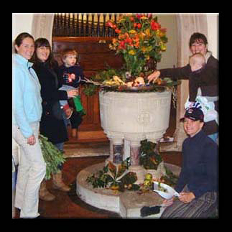
Image copyright © Martin Wright, 2008
No known copyright restriction / Fair Dealing
Results: 3 records
view of font and cover
Copyright Statement: Image copyright © Martin Wright, 2008
Image Source: digital photograph by Martin Wright, in Harvest Festival, All Saints' Church, 2008 [www.east-garston.com/site-content/archives/church-archives/church-archive-2008/harvest-festival-2008/harvest-festival.htm] [accessed 27 May 2015]
Copyright Instructions: No known copyright restriction / Fair Dealing
view of basin - detail

Copyright Statement: Image copyright © Martin Wright, 2008
Image Source: digital photograph by Martin Wright, in Harvest Festival, All Saints' Church, 2008 [www.east-garston.com/site-content/archives/church-archives/church-archive-2008/harvest-festival-2008/harvest-festival.htm] [accessed 27 May 2015]
Copyright Instructions: No known copyright restriction / Fair Dealing
view of church exterior
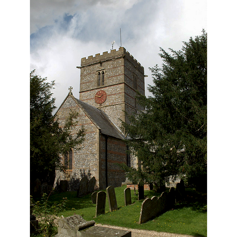
Copyright Statement: Image copyright © Andrew Smith, 2006
Image Source: digital photograph taken 28 August 2006 by Andrew Smith [www.geograph.org.uk/photo/230179] [accessed 27 May 2015]
Copyright Instructions: CC-BY-SA-2.0
INFORMATION
Font ID: 17718GAR
Object Type: Stoup
Font Century and Period/Style: 12th - 13th century, Medieval
Church / Chapel Name: Parish Church of All Saints
Font Location in Church: By the S doorway
Church Patron Saint(s): All Saints
Church Address: 8 Station Road, East Garston, Berkshire, RG17 7HH
Site Location: Berkshire, South East, England, United Kingdom
Directions to Site: Located 5 km SE of Lambourn, 9 km NE of Hungerford
Ecclesiastic Region: Diocese of Oxford
Historical Region: Hundred of Lambourn
Additional Comments: local pronounciation = Argasson -- disappeared earlier font? (ca. 1100?)
Font Notes:
Click to view
There is an entry for East Garston [variant spelling] in the Domesday survey [http://opendomesday.org/place/SU3676/east-garston/] [accessed 27 May 2015], but it mentions neither cleric nor church in it. The Victoria County History (Berkshire, vol. 4, 1924) notes: "A charter of Maurice de London [i.e., Maurice de Londres, ca. 1100?] granted the church of East Garston to the priory founded by him at Ewenny. [...] The building was modernized in 1876, when the chancel was pulled down and rebuilt and other work done. That there was a church here at the end of the 12th century is proved by the north and south doorways. [...] The font is modern; a small 17th-century font stands in the chapel." The present font is modern, probably of the date of the renovation of the church in the 19th-century [cf. supra]. The holy-water stoup could date to the period of the south doorway, the late-12th century, according to the VCH [cf. supra], or, the early-13th century, according to the CRSBI (2015) [NB: we have no information on the medieval font here].
COORDINATES
UTM: 30U 605455 5705590
Latitude & Longitude (Decimal): 51.491608, -1.480991
Latitude & Longitude (DMS): 51° 29′ 29.79″ N, 1° 28′ 51.57″ W
REFERENCES
- Victoria County History [online], University of London, 1993-. URL: https://www.british-history.ac.uk.
- Corpus of Romanesque Sculpture in Britain and Ireland, The Corpus of Romanesque Sculpture in Britain and Ireland, The Corpus of Romanesque Sculpture in Britain and Ireland. URL: http://www.crsbi.ac.uk.