West Woodhay / Wideneia / Widihay / Wydehay
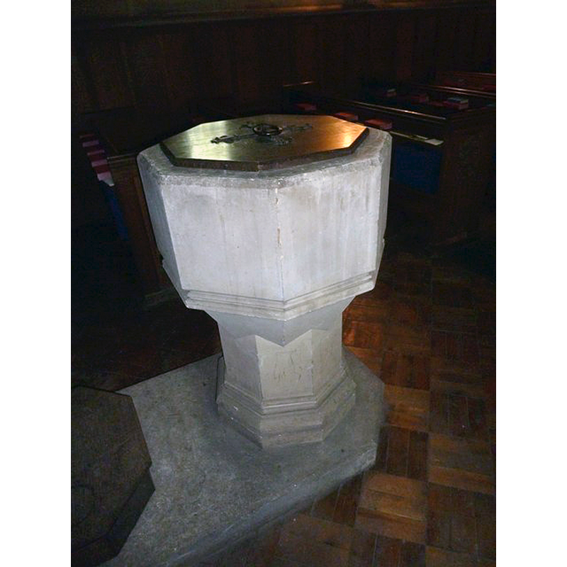
Image copyright © Basher Eyre, 2013
CC-BY-SA-2.0
Results: 3 records
view of font
Scene Description: the modern font [cf. FontNotes]
Copyright Statement: Image copyright © Basher Eyre, 2013
Image Source: digital photograph taken 14 August 2013 by Basher Eyre [www.geograph.org.uk/photo/3606231] [accessed 27 May 2015]
Copyright Instructions: CC-BY-SA-2.0
view of church exterior - east view
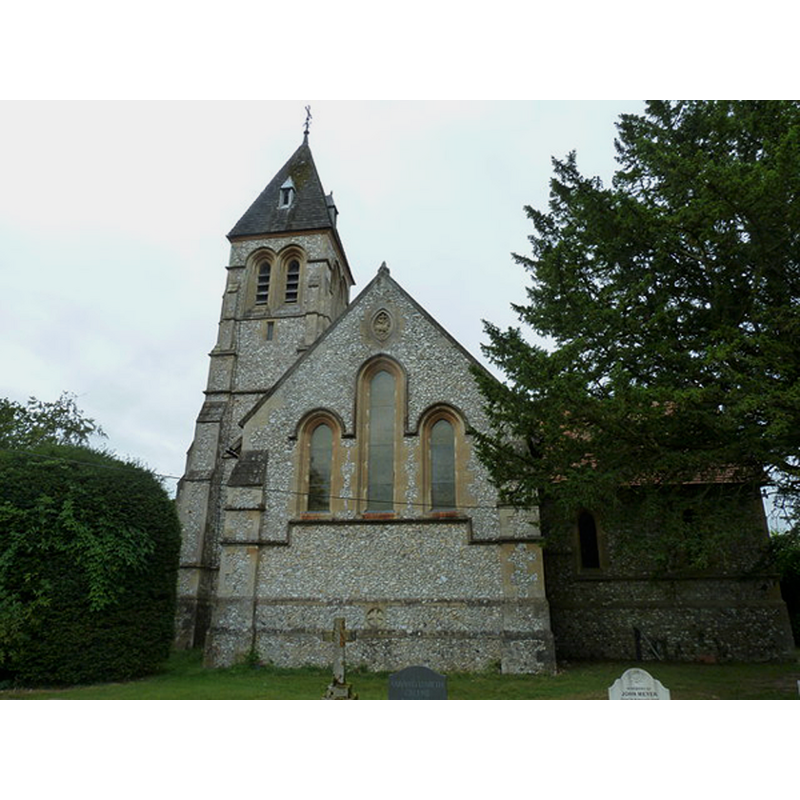
Copyright Statement: Image copyright © Basher Eyre, 2014
Image Source: digital photograph taken 14 August 2013 by Basher Eyre [www.geograph.org.uk/photo/3606248] [accessed 27 May 2015]
Copyright Instructions: CC-BY-SA-2.0
view of church exterior - north view
![EXT N digital photograph taken 9 April 2005 by Andy Malbon [www.geograph.org.uk/photo/1919] [accessed 27 May 2015]
EXT WHICH SIDE IS IT? digital photograph taken 14 August 2013 by Basher Eyre [www.geograph.org.uk/photo/3606248] [accessed 27 May 2015]
MOD FONT digital photograph taken 14 August 2013 by Basher Eyre [www.geograph.org.uk/photo/3606231] [accessed 27 May 2015]](/static-50478a99ec6f36a15d6234548c59f63da52304e5/compressed/1150621018_compressed.png)
Scene Description: EXT N digital photograph taken 9 April 2005 by Andy Malbon [www.geograph.org.uk/photo/1919] [accessed 27 May 2015]
EXT WHICH SIDE IS IT? digital photograph taken 14 August 2013 by Basher Eyre [www.geograph.org.uk/photo/3606248] [accessed 27 May 2015]
MOD FONT digital photograph taken 14 August 2013 by Basher Eyre [www.geograph.org.uk/photo/3606231] [accessed 27 May 2015]
Copyright Statement: Image copyright © Andy Malbon, 2005
Image Source: digital photograph taken 9 April 2005 by Andy Malbon [www.geograph.org.uk/photo/1919] [accessed 27 May 2015]
Copyright Instructions: CC-BY-SA-2.0
INFORMATION
Font ID: 17717WOO
Object Type: Baptismal Font1?
Font Century and Period/Style: 14th century, Medieval
Church / Chapel Name: Parish Church of St. Lawrence [aka St. Laurence's]
Church Patron Saint(s): St. Lawrence [aka Laurence]
Church Address: West Woodhay, Berkshire, RG20 0BL
Site Location: Berkshire, South East, England, United Kingdom
Directions to Site: Located 10 km SW of Newbury, near the Hampshire border [East Woodhay is in Hampshire]
Ecclesiastic Region: Diocese of Oxford
Historical Region: Hundred of Knitbury Eagle
Additional Comments: pronounced 'West Woody' -- disappeared font? (the medieval one)
Font Notes:
Click to view
No entry found for [East or West] Woodhay in the Domesday survey. The Victoria County History (Berkshire, vol. 4, 1924) notes: "The first reference to the church that has been found is in 1332 [...] The church of St. Lawrence is a modern building of flint rubble with stone dressings erected in 1882–3 [...] The original building is said to have been destroyed by fire in 1715 or 1716. The brick, church, which is stated to have been copied from a design of Inigo Jones, was erected in 1717, [...] but was pulled down in 1882. [...] The font and all the fittings are modern". [NB: we have no information on the medieval font here].
COORDINATES
UTM: 30U 609009 5692024
Latitude & Longitude (Decimal): 51.369, -1.434
Latitude & Longitude (DMS): 51° 22′ 8.4″ N, 1° 26′ 2.4″ W
REFERENCES
- Victoria County History [online], University of London, 1993-. URL: https://www.british-history.ac.uk.