Hamstead Marshall / Hamestede / Hamstead Mars Hall / Hamsted / Hamsted Marshal / Hampstead Marshall / Hampstede Mareschal
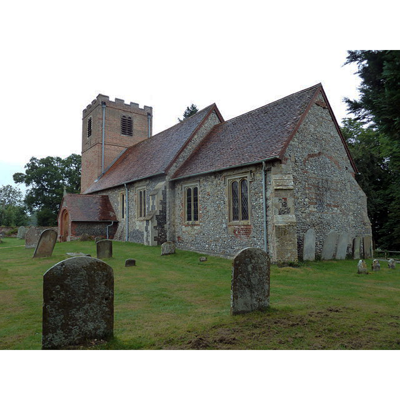
Image copyright © Basher Eyre, 2013
CC-BY-SA-2.0
Results: 3 records
view of church exterior - southeast view
Copyright Statement: Image copyright © Basher Eyre, 2013
Image Source: digital photograph taken 14 August 2013 by Basher Eyre [www.geograph.org.uk/photo/3602271] [accessed 26 May 2015]
Copyright Instructions: CC-BY-SA-2.0
view of church interior - nave - looking east
![the font partially visible in the foreground, left [north] side](/static-50478a99ec6f36a15d6234548c59f63da52304e5/compressed/1150620002_compressed.png)
Scene Description: the font partially visible in the foreground, left [north] side
Copyright Statement: Image copyright © John Vigar, 2010
Image Source: digital photograph taken 7 July 2010 by John Vigar [www.geograph.org.uk/photo/1963785] [accessed 26 May 2015]
Copyright Instructions: CC-BY-SA-2.0
view of font and cover

INFORMATION
Font ID: 17715HAM
Object Type: Baptismal Font1
Font Century and Period/Style: 17th century, Restoration
Church / Chapel Name: Parish Church lof St. Mary the Virgin
Font Location in Church: Inside the church, wowards the W end
Church Patron Saint(s): St. Mary the Virgin
Church Address: Park Lane, Hamstead Marshall, Berkshire, RG20 0JG
Site Location: Berkshire, South East, England, United Kingdom
Directions to Site: Located SW of Newbury
Ecclesiastic Region: Diocese of Oxford
Historical Region: Hundred of Kintbury [in Domesday] -- Hundred of Kintbury Ealgle
Additional Comments: painted font (the present one: white-washed) -- disappeared font? (the font from the 12thC church here)
Font Notes:
Click to view
There is an entry for Hamstead [Marshall] [variant spelling] in the Domesday survey [http://opendomesday.org/place/SU4165/hamstead-marshall/] [accessed 26 May 2015], but it mentions neither cleric nor priest in it. The Victoria County History (Berkshire, vol. 4, 19124) notes: "In 1179 the king, in granting the abbey of Amesbury to the nuns of Fontevrault, granted also the tithes of Hampstead Marshall with all parochial rights which belonged to the mother church of Kintbury. This grant was confirmed by King John in 1199 and by King Henry III in 1270. [...] The oldest part of the building is the south doorway, which is of 12th-century date [...] The font has an octagonal whitewashed bowl and appears to be of cement, probably of 17th-century date, and has a good Jacobean cover." [NB: we have no information on the medieval font here].
COORDINATES
UTM: 30U 611446 5695320
Latitude & Longitude (Decimal): 51.398147, -1.39796
Latitude & Longitude (DMS): 51° 23′ 53.33″ N, 1° 23′ 52.66″ W
MEDIUM AND MEASUREMENTS
Material: stone
Font Shape: octagonal, mounted
Basin Interior Shape: round
Basin Exterior Shape: octagonal
LID INFORMATION
Date: 17th century? / Jacobean?
Material: wood, oak
Apparatus: no
Notes: flat octagonal platform with eight vertical scroll ribs around a pivot
REFERENCES
- Victoria County History [online], University of London, 1993-. URL: https://www.british-history.ac.uk.