Speen / Speinis / Spene / Spenes / Speyne / Spienes / Spinae / Spines / Spone
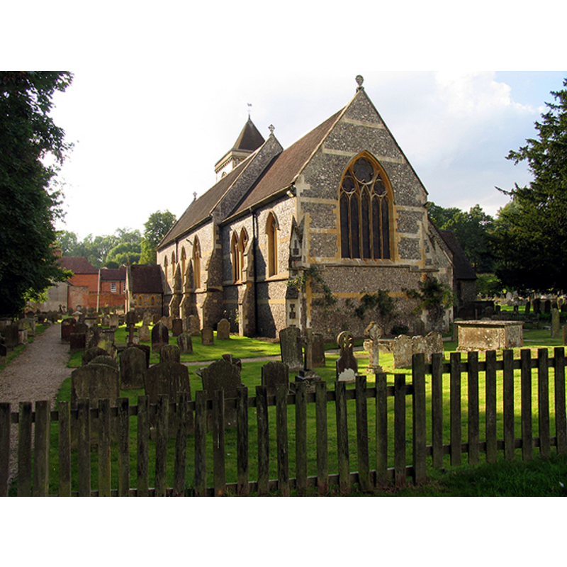
Image copyright © Pam Brophy, 2005
CC-BY-SA-3.0
Results: 1 records
view of church exterior - southeast view
Copyright Statement: Image copyright © Pam Brophy, 2005
Image Source: digital photograph taken 6 September 2005 by Pam Brophy [www.geograph.org.uk/photo/50314] [accessed 1 November 2011]
Copyright Instructions: CC-BY-SA-3.0
INFORMATION
Font ID: 17711SPE
Object Type: Baptismal Font1?
Font Century and Period/Style: 11th century, Pre-Conquest? / Norman
Church / Chapel Name: Parish Church of St. Mary the Virgin
Church Patron Saint(s): St. Mary the Virgin
Church Address: Church Lane, Speen, Berkshire, RG14 1SA
Site Location: Berkshire, South West, England, United Kingdom
Directions to Site: Located off (W) the A339, 3 km NW of Newbury
Ecclesiastic Region: Diocese of Oxford
Historical Region: Hundred of Thatcham [in Domesday] -- Hundred of Faircross
Additional Comments: disappeared font? (church existed by 1079, when it received the donation of land)
Font Notes:
Click to view
There is an entry for Speen [variant spelling] in the Domesday survey [http://opendomesday.org/place/SU4667/speen/]; it mentions a church and half-a-hide of church lands in it. The Victoria County History (Berkshire, vol. 4, 1924) notes: "There has been a church on the site from the 11th century. [...] In 1079 Bernard son of Geoffrey de Neufmarché gave to the church of St. Mary, Aufay, the church of Speen [...] with half a hide of land. [...] In 1860 it was almost wholly rebuilt [...] There are four books of registers before 1812, the first a paper volume containing baptisms 1630"; there is no mention of a font in theVCH entry for this church. [NB: we have no information on the font of the pre-Domesday-time church here]. [NB: the nearby churches of Speenhamland St. Mary's and Stockcross St. John's are both modern]. The churches in the [former?] hamlets of Stckcross and Speemhandland are modern.
COORDINATES
UTM: 30U 614956 5696128
Latitude & Longitude (Decimal): 51.40471, -1.347269
Latitude & Longitude (DMS): 51° 24′ 16.96″ N, 1° 20′ 50.17″ W
REFERENCES
- Victoria County History [online], University of London, 1993-. URL: https://www.british-history.ac.uk.