Brimpton / Brimton / Brinton / Brintone / Brinniggetun / Brumpton / Brumton / Bryningtune
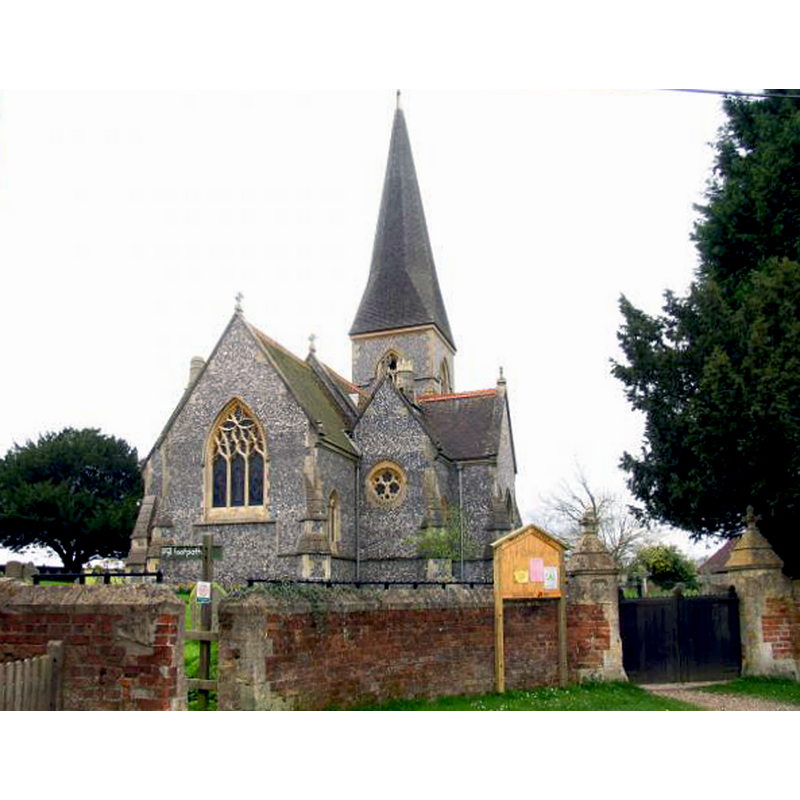
Image copyright © Pam Brophy, 2005
CC-BY-SA-2.0
Results: 5 records
view of church exterior - northeast view
Copyright Statement: Image copyright © Pam Brophy, 2005
Image Source: digital photograph taken 5 April 2005 by Pam Brophy [www.geograph.org.uk/photo/1417] [accessed 12 May 2015]
Copyright Instructions: CC-BY-SA-2.0
view of church exterior - southeast view
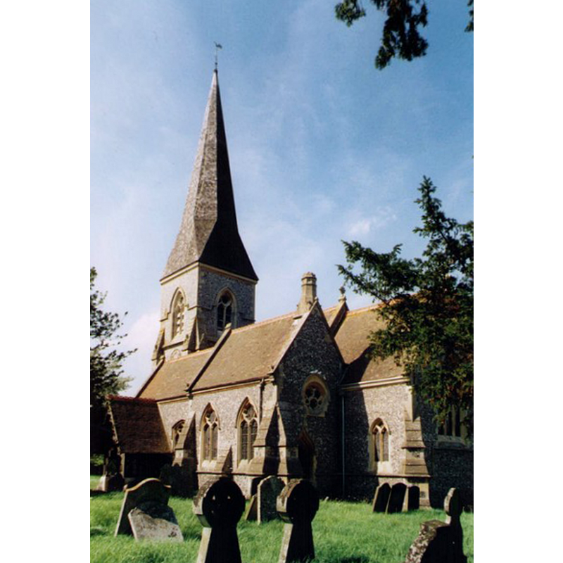
Copyright Statement: Image copyright © Michael Ford, 2003
Image Source: photograph taken in 2003 by Michael Ford [www.geograph.org.uk/photo/1538112] [accessed 12 May 2015]
Copyright Instructions: CC-BY-SA-2.0
view of font and cover
![the modern font [cf. FontNotes]](/static-50478a99ec6f36a15d6234548c59f63da52304e5/others/permission_not_available.jpg)
Scene Description: the modern font [cf. FontNotes]
Copyright Statement: Image copyright © ChurchCrawler (Phil Draper), 2005
Image Source: digital photograph taken 17 May 2005 by ChurchCrawler (Phil Draper) [www.flickr.com/photos/churchcrawler/3357435523/in/photostream/] [accessed 12 May 2015]
Copyright Instructions: PERMISSION NOT AVAILABLE -- IMAGE NOT FOR PUBLIC USE
view of church interior - nave - looking west
Copyright Statement: Image copyright © ChurchCrawler (Phil Draper), 2005
Image Source: digital photograph taken 17 May 2005 by ChurchCrawler (Phil Draper) [www.flickr.com/photos/churchcrawler/3357435293/in/photostream/] [accessed 12 May 2015]
Copyright Instructions: PERMISSION NOT AVAILABLE -- IMAGE NOT FOR PUBLIC USE
view of church interior - nave - looking east
Copyright Statement: Image copyright © ChurchCrawler (Phil Draper), 2005
Image Source: digital photograph taken 17 May 2005 by ChurchCrawler (Phil Draper) [www.flickr.com/photos/churchcrawler/3358251006/in/photostream/] [accessed 12 May 2015]
Copyright Instructions: PERMISSION NOT AVAILABLE -- IMAGE NOT FOR PUBLIC USE
INFORMATION
Font ID: 17706BRI
Object Type: Baptismal Font1
Font Century and Period/Style: 11th - 12th century, Norman
Church / Chapel Name: Parish Church of St. Peter
Church Patron Saint(s): St. Peter
Church Address: Church Lane, Brimpton, Berkshire, RG7 4TJ
Site Location: Berkshire, South East, England, United Kingdom
Directions to Site: Located between Newbury and Silchester, 8 km E of the former, near the Hants. border
Ecclesiastic Region: Diocese of Oxford [formerly in the Diocese of Salisbury]
Historical Region: Hundred of Thatcham [in Domesday] -- Hundred of Faircross
Additional Comments: disappeared font? Last report found is from a BAA visit in 1859 [cf. FontNotes] - present whereabouts unknown -- were there also two earlier fonts in the Domesday-time churches here?
Font Notes:
Click to view
There are two entries of Brimpton [variant spelling] in te Domesday survey [http://opendomesday.org/place/SU5564/brimpton/] [accessed 12 May 2015], each of which mentions a church in it. The report of a visit of the British Archaeological Association to Brimpton on 14 September1859 notes: "the font, is Norman, [...] lined with heavy lead and bears every appearance of being the original lining". The Victoria County History (Berkshire, vol. 4, 1924) notes: "The Domesday Survey mentions a church on Ralph de Mortimer's [...] manor of Brimpton. [...] The second church [...] which according to the Domesday Survey lay in Brimpton is represented by the desecrated chapel of St. Leonard. [...] The church of St. Peter was erected in 1869 on an old site [...] The font [...] of the old church is said to have been a plain Norman one without ornament." The British Listed buildings database entry for this church www.british-history.ac.uk/report.aspx?compid=62681] [accessed 1 November 2011] reports a "Square stone font with quatrefoil panels on 4 marble columns', obviously the replacement font of the 1869 re-building of the church. [NB: we have no information on the whereabouts of the old Norman font at St. Peter's, nor on whether or not a font existed in the medieval chapel/church of St. Leonard's; the building of St. Leonard's still stands, near the Brimpton Manor Farm, and is dated as far back as the 12th century].
COORDINATES
UTM: 30U 625234 5693487
Latitude & Longitude (Decimal): 51.378804, -1.200505
Latitude & Longitude (DMS): 51° 22′ 43.69″ N, 1° 12′ 1.82″ W
MEDIUM AND MEASUREMENTS
Drainage Notes: lead-lined
REFERENCES
- Victoria County History [online], University of London, 1993-. URL: https://www.british-history.ac.uk.
- British Archaeological Association (Annual Meeting, 16th, Newbury, 1859), "Proceedings of the Congress (BAA Annual Meeting, 16th, Newbury, 1859)", XVI, March 1860, Journal of the British Archaeological Association, 1860, pp. 74-100; p. 89