Potsgrove / Potesgrava / Potesgrave / Pottesgrove
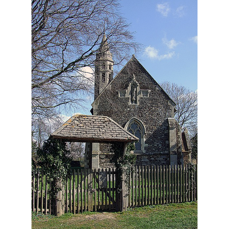
Image copyright © Rob Farrow, 2007
CC-BY-SA-2.0
Results: 2 records
view of church exterior - west view
Copyright Statement: Image copyright © Rob Farrow, 2007
Image Source: digital photograph taken 14 March 2007 by Rob Farrow [www.geograph.org.uk/photo/370576] [accessed 23 September 2015]
Copyright Instructions: CC-BY-SA-2.0
view of church exterior - south view
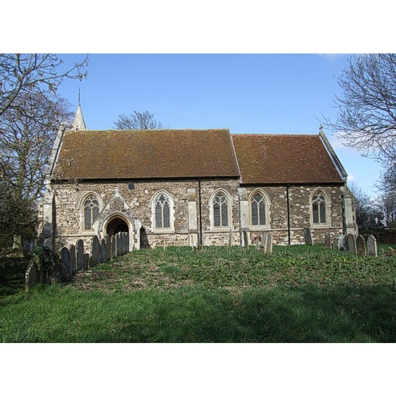
Copyright Statement: Image copyright © Rob Farrow, 2007
Image Source: digital photograph taken 14 March 2007 by Rob Farrow [www.geograph.org.uk/photo/370570] [accessed 26 October 2011]
Copyright Instructions: CC-BY-SA-2.0
INFORMATION
Font ID: 17697POT
Object Type: Baptismal Font1?
Font Century and Period/Style: 12th century, Late Norman
Church / Chapel Name: Parish Church of St. Mary the Virgin [redundant]
Church Patron Saint(s): St. Mary the Virgin
Church Notes: Building now [October 2011] under the care of the Churches Conservation Trust
Church Address: Potsgrove, Central Bedfordshire MK17 9HG
Site Location: Bedfordshire, East, England, United Kingdom
Directions to Site: Located off (N) the A5, 5 km SE of Woburn, 8 km NE of Leighton Buzzard, near the Bucks. county border
Ecclesiastic Region: Diocese of St. Albans [formerly in the Diocese of Ely; and Lincoln?]
Historical Region: Hundred of Manshead
Additional Comments: disappeared font? (the one from the 12thC church here)
Font Notes:
Click to view
There are four entries for Potsgrove [variant spelling] in the Domesday survey [http://opendomesday.org/place/SP9529/potsgrove/] [accessed 23 September 2015], but none mentions cleric or church in it, except one of the parts had as lord in 1066 "Morcar the priest of Luton", who no longer held the place in 1086. The Victoria County History (Bedfordshire, vol. 3, 1912) notes: "The church of Potsgrove was granted by Henry II [1154-1189] to the monastery of St. Albans [...] The church of St. Mary was 'entirely restored' in 1881 [...] Inside, however, the old plastering and the stonework of the jambs and heads of some of the windows show that a good deal of the mediaeval church remains. [...] The whole belongs to c. 1320–40, though a few 12th and 13th-century stones built into the north wall of the nave show that an earlier church existed. [...] The font, of Purbeck marble, is modern". [NB: we have no information on its medieval font].
COORDINATES
UTM: 30U 663753 5759161
Latitude & Longitude (Decimal): 51.959, -0.6167
Latitude & Longitude (DMS): 51° 57′ 32.4″ N, 0° 37′ 0.12″ W
REFERENCES
- Victoria County History [online], University of London, 1993-. URL: https://www.british-history.ac.uk.