Millbrook nr. Bedford / Melebroc
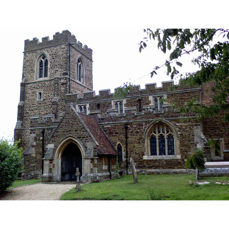
Image copyright © Jose Baptista de Sousa, 2009
CC-BY-SA-2.0
Results: 2 records
view of church exterior - south view
Copyright Statement: Image copyright © Jose Baptista de Sousa, 2009
Image Source: digital photograph taken 26 July 2009 by Jose Baptista de Sousa [www.geograph.org.uk/photo/1461429] [accessed 18 September 2015]
Copyright Instructions: CC-BY-SA-2.0
view of font and cover

Scene Description: the modern font
Copyright Statement: Image copyright © Brentorboxer, 2010
Image Source: digital photograph taken January 2010 by Brentorboxer [http://img.groundspeak.com/waymarking/large/b5e5b8c2-4507-485e-96b6-3107855357c6.JPG] [accessed 24 October 2011]
Copyright Instructions: PERMISSION NOT AVAILABLE -- IMAGE NOT FOR PUBLIC USE
INFORMATION
Font ID: 17691MIL
Object Type: Baptismal Font1?
Font Century and Period/Style: 12th century, Late Norman
Church / Chapel Name: Parish Church of St. Michael and All Angels
Church Patron Saint(s): St. Michael & All Angels
Church Address: Sandhill Close, Millbrook, Central Bedfordshire MK45 2JB
Site Location: Bedfordshire, East, England, United Kingdom
Directions to Site: Located 3 km W of Ampthill, 11 km W of Bedford
Ecclesiastic Region: Diocese of St. Albans
Historical Region: Hundred of Redbornestoke
Additional Comments: disappeared font? (the one from the 12thC church here)
Font Notes:
Click to view
There is an entry for this Millbrook [variant spelling] in the Domesday survey [http://opendomesday.org/place/TL0138/millbrook/] [accessed 18 September 2015], but it mentions neither cleric nor church in it. The Victoria County History (Bedford, vol. 3, 1912) notes: "The earliest mention of the church at Millbrook is in the foundation charter of the priory of Beaulieu [i.e., ca. 1160] In 1291 Millbrook Church was assessed at £4 6s. 8d., [...] and at the Dissolution the rectory was worth £9 17s. 2d. [...] A blocked 13th-century lancet in the south wall of the south aisle is the oldest feature visible [of the present church], the south arcade being circa 1340"; the VCH entry does not mention a font. The present font is modern, consisting of a round basin with carved foliage bands at the upper end and on the underbowl, raised on clustered columns on a round lower base and a rectangular plinth. The wooden cover is round and flat, also modern. [NB: we have no information on the medieval font here].
COORDINATES
UTM: 30U 669865 5767968
Latitude & Longitude (Decimal): 52.036276, -0.523466
Latitude & Longitude (DMS): 52° 2′ 10.6″ N, 0° 31′ 24.48″ W
REFERENCES
- Victoria County History [online], University of London, 1993-. URL: https://www.british-history.ac.uk.