St. Helens / Saint Helens
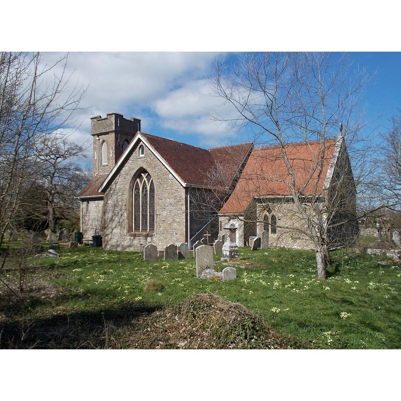
Image copyright © Mypix, 2018
CC-BY-SA-4.0
Results: 2 records
view of church exterior - southeast view
Scene Description: the modern church of St. Helens
Copyright Statement: Image copyright © Mypix, 2018
Image Source: digital photograph taken 5 April 2018 by Mypix [https://commons.wikimedia.org/wiki/File:St_Helens_New_Church,_Isle_of_Wight,_UK_(2).jpg] [accessed 14 February 2020]
Copyright Instructions: CC-BY-SA-4.0
view of church exterior - tower
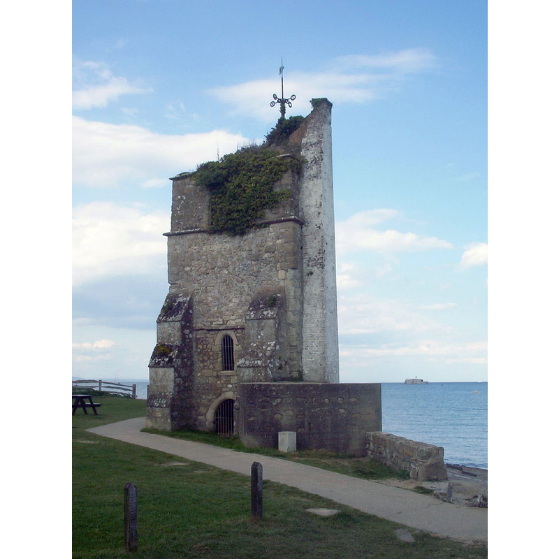
Scene Description: the old church tower now a seamark
Copyright Statement: Image copyright © Naturenet, 2002
Image Source: digital photograph taken 27 January 2002 by Naturenet [http://commons.wikimedia.org/wiki/File:St_helens_old_church1.jpg] [accessed 7 September 2011]
Copyright Instructions: CC-BY-SA-3.0
INFORMATION
Font ID: 17660HEL
Object Type: Baptismal Font1?
Font Century and Period/Style: 11th century, Pre-Conquest? / Norman
Church / Chapel Name: Parish Church of St. Helen
Church Patron Saint(s): St. Helena
Church Notes: original church pre-Conquest; re-built with dual purpose as priory and parochial church; reported in bad state 16thC; ruinous by 18thC; nedw church built in 1717 on new site farther inland
Church Address: Duver Rd, St Helens, Ryde PO33 1XZ, UK
Site Location: Isle of Wight, South East, England, United Kingdom
Directions to Site: Located 5 km from Ryde, on the E side of the island
Ecclesiastic Region: Diocese of Portsmouth
Historical Region: Hundred of East Medine -- formerly Hampshire
Additional Comments: disappeared font?
Font Notes:
Click to view
No individual entry found for St. Helens in the Domesday survey. The Victoria County History (Hampshire, vol. 5, 1912) notes: "The original church of St. Helens was in a bad state as far back as the 16th century, [...] By the 18th century it had become so ruinous that a new church was built in 1717 [...] about a mile inland, and the old church allowed to go to ruin, the tower, a 13th-century structure, only being left standing. The tower about the same time was supported by brickwork and formed into a seamark." There is no mention of a font in the VCH entry.
COORDINATES
UTM: 30U 634222 5618350
Latitude & Longitude (Decimal): 50.701457, -1.099273
Latitude & Longitude (DMS): 50° 42′ 5.24″ N, 1° 5′ 57.38″ W
REFERENCES
- Victoria County History [online], University of London, 1993-. URL: https://www.british-history.ac.uk.