New Milton / Medylton / Melton / Midelton / Mideltune / Midleton / Mildeltune / Miletone / Milton / Muleton / Muletune
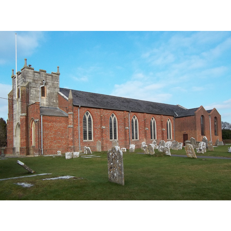
Image copyright © [in the public domain]
CC-Zero
Results: 1 records
view of church exterior - southwest view
Scene Description: Source caption: "St Mary Magdalene parish church, New Milton, Hampshire, seen from the southwest. The stone tower is 17th-century; the brick nave and buttresses were completed in 1832, and the lady chapel (right) was added in 1958."
Copyright Statement: Image copyright © [in the public domain]
Image Source: digital photograph taken 31 January 2011 by Singinglemon [https://commons.wikimedia.org/wiki/File:St_Mary_Magdalene,_New_Milton_01.jpg] [accessed 13 February 2020]
Copyright Instructions: CC-Zero
INFORMATION
Font ID: 17659MIL
Object Type: Baptismal Font1
Font Century and Period/Style: 17th century(early?)
Church / Chapel Name: Parish Church of St. Mary Magdalene
Church Patron Saint(s): St. Mary Magdalene
Church Address: Church Ln, New Milton BH25 6QN, UK -- Tel.: +44 1425 615150
Site Location: Hampshire, South East, England, United Kingdom
Directions to Site: Located off (N) the A337, between Christchurch and Lymington, 10 km W of the latter, 20 km E of Bournemouth
Ecclesiastic Region: Diocese of Winchester
Historical Region: Hundred of Christchurch / Hundred of Rowditch [in Domesday]
Additional Comments: disappeared font?
Font Notes:
Click to view
There is an entry for this Milton [variant spelling] in the Domesday survey [https://opendomesday.org/place/SZ2394/milton/] [accessed 13 February 2020] but it mentions neither cleric nor church in it. The Victoria County History (Hampshire, vol. 5, 2011) notes that the church "was rebuilt in 1832 except the tower, which is of early 17th-century date." No font mentioned in the VCH entry. [NB: we have no information on the whereabouts of the early-17th century font].
COORDINATES
UTM: 30U 594202 5622663
Latitude & Longitude (Decimal): 50.7481, -1.6647
Latitude & Longitude (DMS): 50° 44′ 53.16″ N, 1° 39′ 52.92″ W
REFERENCES
- Victoria County History [online], University of London, 1993-. URL: https://www.british-history.ac.uk.