Winchester No. 8 / Venta Belgarum / Wintanceaster / Yenta Belgaruan
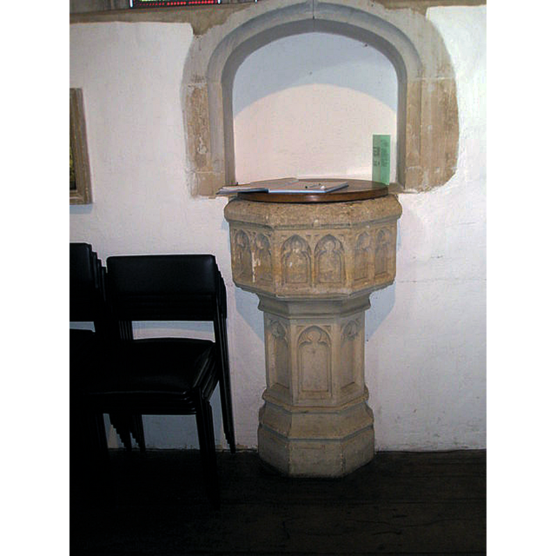
Image copyright © Basher Eyre, 2009
CC-BY-SA-2.0
Results: 3 records
view of font and cover in context
Scene Description: "The baptismal font, of roughly Perpendicular type and design is built into the west wall of the nave; it appears Victorian." [VCH, cf. FontNotes]
Copyright Statement: Image copyright © Basher Eyre, 2009
Image Source: digital photograph taken 14 February 2009 by Basher Eyre [www.geograph.org.uk/photo/1162183] [accessed 4 February 2020]
Copyright Instructions: CC-BY-SA-2.0
view of church exterior in context
![Source caption: "14th Century gateway (one of the 2 city gates remaining) with a 16th Century Church built over the top"
INT E digital photograph taken 5 May 2011 by Tony Hisgett [www.flickr.com/photos/37804979@N00/5697635472] [accessed 4 February 2020]
MOD FONT? digital photograph taken 14 February 2009 by Basher Eyre [www.geograph.org.uk/photo/1162183] [accessed 4 February 2020]](/static-50478a99ec6f36a15d6234548c59f63da52304e5/compressed/1200204003_compressed.png)
Scene Description: Source caption: "14th Century gateway (one of the 2 city gates remaining) with a 16th Century Church built over the top"
INT E digital photograph taken 5 May 2011 by Tony Hisgett [www.flickr.com/photos/37804979@N00/5697635472] [accessed 4 February 2020]
MOD FONT? digital photograph taken 14 February 2009 by Basher Eyre [www.geograph.org.uk/photo/1162183] [accessed 4 February 2020]
Copyright Statement: Image copyright © Tony Hisgett, 2011
Image Source: digital photograph taken 5 May 2011 by Tony Hisgett [www.flickr.com/photos/hisgett/5697055133/] [accessed 4 February 2020]
Copyright Instructions: CC-BY-SA-2.0
view of church interior - looking east
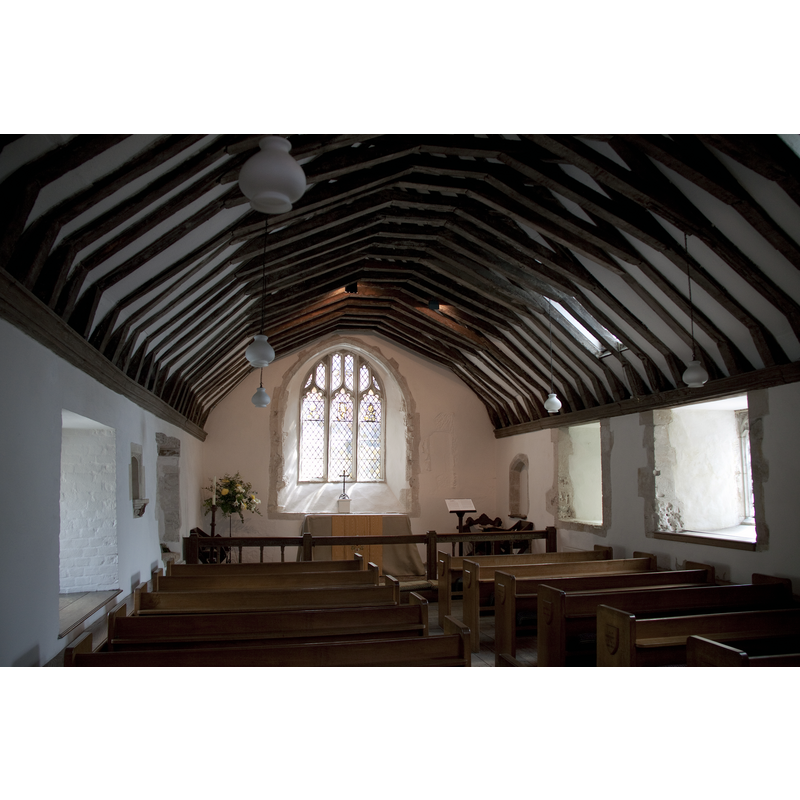
Copyright Statement: Image copyright © Tony Hisgett, 2011
Image Source: digital photograph taken 5 May 2011 by Tony Hisgett [www.flickr.com/photos/37804979@N00/5697635472] [accessed 4 February 2020]
Copyright Instructions: CC-BY-SA-2.0
INFORMATION
Font ID: 17654WIN
Object Type: Baptismal Font1?
Font Century and Period/Style: Medieval
Church / Chapel Name: Parish Church of St. Swithun over Kingsgate [aka St. Swithun upon Kingsgate]
Church Patron Saint(s): St. Swithun [aka Swithin]
Church Address: St. Swithun St, Winchester SO23 9JP, UK -- Tel.: +44 1962 849434
Site Location: Hampshire, South East, England, United Kingdom
Directions to Site: Located on St. Swithun Street, above Kingsgate, close to the cathedral
Ecclesiastic Region: Diocese of Winchester
Additional Comments: disappeared font?
Font Notes:
Click to view
The Victoria County History (Hampshire, vol. 5, 1912) mentions the Church of St. Swithun as dating from the 15th century, but reports the furnishings as modern. The baptismal font, of roughly Perpendicular type and design is built into the west wall of the nave; it appears Victorian. An earlier church said to be documented by mid-13th century was destroyed by fire. [NB: we have no inormation on the medieval font here].
COORDINATES
UTM: 30U 618121 5657756
Latitude & Longitude (Decimal): 51.059167, -1.314444
Latitude & Longitude (DMS): 51° 3′ 33″ N, 1° 18′ 52″ W
REFERENCES
- Victoria County History [online], University of London, 1993-. URL: https://www.british-history.ac.uk.