Winchester No. 6 / Venta Belgarum / Wintanceaster / Yenta Belgaruan
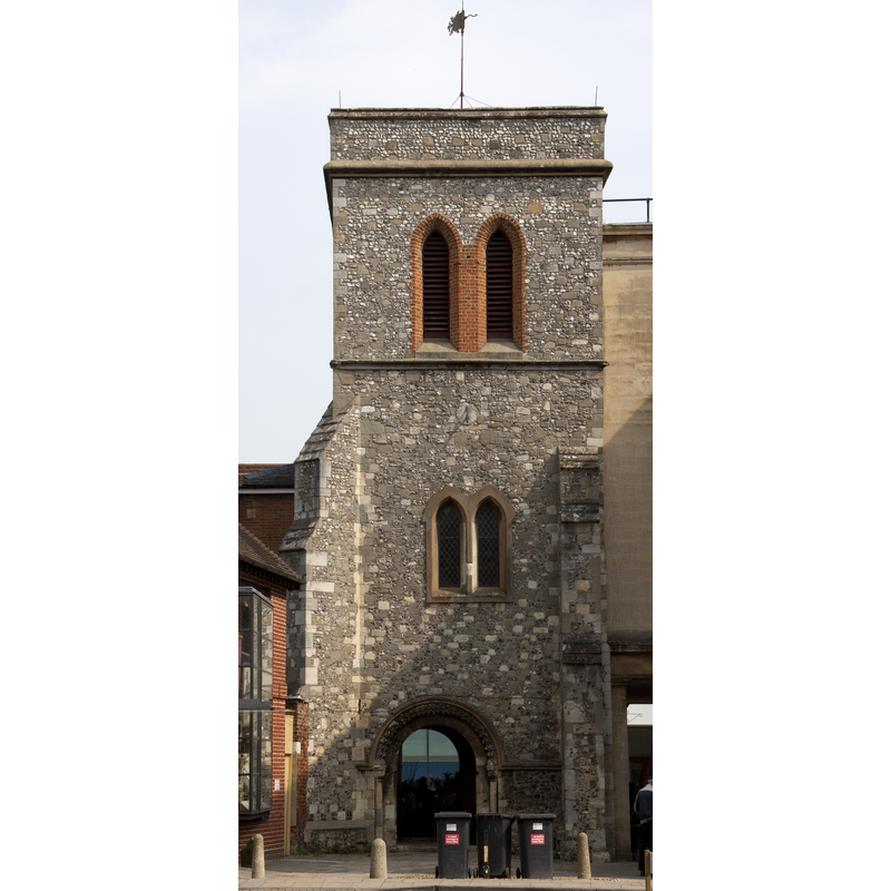
Image copyright © Tony Hispett, 2011
CC-BY-SA-2.0
Results: 2 records
view of church exterior - tower
Scene Description: the present remains of St. Maurice Church: the 12th-century tower
Copyright Statement: Image copyright © Tony Hispett, 2011
Image Source: digital photograph taken 5 May 2011 by Tony Hisgett [ahisgett] [www.flickr.com/photos/hisgett/5699657512/] [accessed 6 September 2011]
Copyright Instructions: CC-BY-SA-2.0
view of church exterior - northwest view

Scene Description: 19th-century St. Maurice
Copyright Statement: Image copyright © Winchester City Council, 2010
Image Source: 19th-century St. Maurice B&W photograph taken by Winchester photographer William Savage (1817-87) and is found in an album entitled 'Hampshire Views of Churches, Country Houses and Public Buildings' [Object number: WINCM:PWCM 4440]
Copyright Instructions: PERMISSION NOT AVAILABLE -- IMAGE NOT FOR PUBLIC USE
INFORMATION
Font ID: 17652WIN
Object Type: Baptismal Font1?
Font Century and Period/Style: 12th century, Late Norman
Church / Chapel Name: [former Parish Church of St. Maurice]
Church Patron Saint(s): St. Maurice [aka Maur, Mauritius, Moritz, Morris]
Church Notes: demolished 1840 except for the tower; re-built 1842; demolished 1950 except for the 15thC tower.
Church Address: High St, Winchester SO23 9LA, UK
Site Location: Hampshire, South East, England, United Kingdom
Directions to Site: Located on Hugh Street, S side, Winchester city centre
Ecclesiastic Region: [Diocese of Winchester]
Additional Comments: disappeared font? (the medieval one)
Font Notes:
Click to view
The Victoria County History (Hampshire, vol. 5, 1912) reports a sundial probably of Saxon times, and a "re-used 12th-century doorway" re-used in the re-building of this church in 1841. The VCH (ibid.) notes the first register of baptisms starting in 1575. The entry for this church in Historic England [Listing NGR: SU4848629368] notes: "Only C15 tower remains of the church. Flint and rubble three-stages, corner buttresed. Incorporating a Norman arch." The Winchester Museums [www.winchestermuseumcollections.org.uk] [accessed 6 September 2011] report that the 19th-century church "was demolished in the 1950s the Norman tower with its fine south doorway was spared and is still a feature of the High Street." [NB: we have no information on the medieval font of the original church].
COORDINATES
UTM: 30U 618240 5658065
Latitude & Longitude (Decimal): 51.06192, -1.31264
Latitude & Longitude (DMS): 51° 3′ 42.91″ N, 1° 18′ 45.5″ W
REFERENCES
- Victoria County History [online], University of London, 1993-. URL: https://www.british-history.ac.uk.