Southampton No. 2 / Hamwic / Hantune
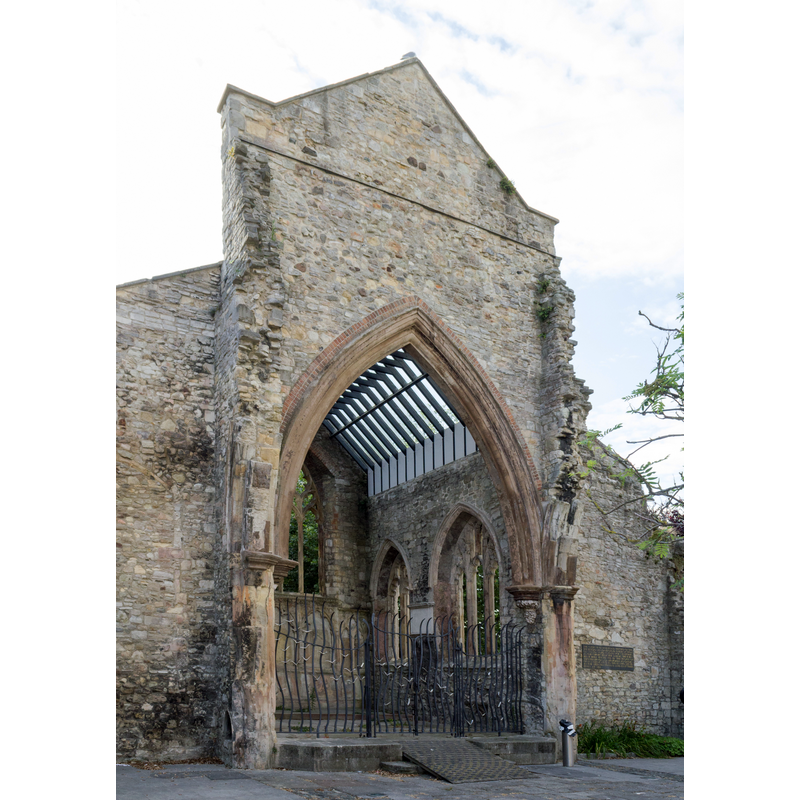
Image copyright © Richard Nevell, 2014
CC-BY-SA-2.0
Results: 3 records
view of church exterior
Scene Description: the former church, damaged in a 1940 bombing, is now a Merchant Navy memorial
Copyright Statement: Image copyright © Richard Nevell, 2014
Image Source: digital photograph taken 28 June 2014 by Richard Nevell [https://commons.wikimedia.org/wiki/File:Holy_Rood_Church,_Southampton,_June2014_(8).jpg] [accessed 30 July 2018]
Copyright Instructions: CC-BY-SA-2.0
view of church exterior in context
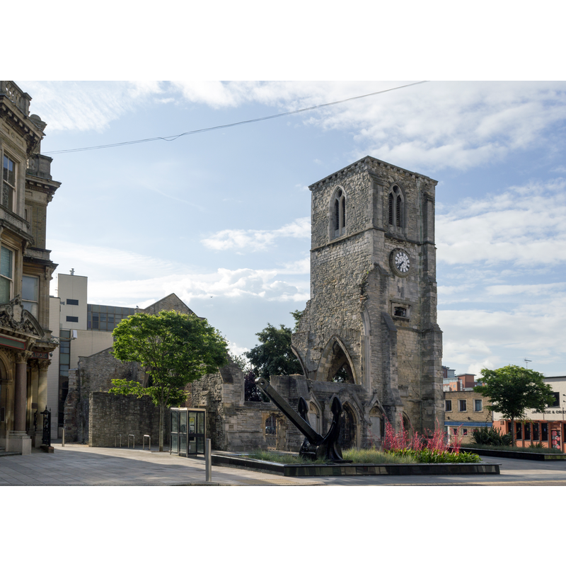
Scene Description: the former church, damaged in a 1940 bombing, is now a Merchant Navy memorial
Copyright Statement: Image copyright © Richard Nevell, 2014
Image Source: digital photograph taken 28 June 2014 by Richard Nevell [https://commons.wikimedia.org/wiki/File:Holy_Rood_Church,_Southampton,_June2014_(11).jpg] [accessed 30 July 2018]
Copyright Instructions: CC-BY-SA-2.0
angel - cherub - 8?
![[cf. FontNotes]](/static-50478a99ec6f36a15d6234548c59f63da52304e5/others/image_not_available.jpg)
Scene Description: [cf. FontNotes]
![[cf. FontNotes]](/static-50478a99ec6f36a15d6234548c59f63da52304e5/bsi-testing-site/others/image_not_available.jpg)
INFORMATION
Font ID: 17640SOU
Object Type: Baptismal Font1
Font Century and Period/Style: 15th century, Perpendicular
Church / Chapel Name: Holyrood Parish Church [aka Holy Rood, Holy Cross]
Font Location in Church: Inside the church, beneath the organ loft
Church Patron Saint(s): The Holy Cross
Church Notes: The church was originally located on English St. [later High St.]; re-built in its present location ca. 1320; mostly destroyed in a 1940 bombing
Church Address: 3-5 Bernard St, Southampton SO14 3AU, UK
Site Location: Hampshire, South East, England, United Kingdom
Directions to Site: The church was originally located on English St. [later High St.];
Ecclesiastic Region: Diocese of Winchester
Historical Region: Hundred of Mansbridge
Additional Comments: moved font? (the present one) -- disappeared font? (the medieval one)
Font Notes:
Click to view
There are four entries for Southampton [variant spelling] in the Domesday survey [http://opendomesday.org/place/SU4111/southampton/] [accessed 30 July 2019], one of which reports "3 churches. 1.0 church lands" in it. The Victoria County History (Hampshire, vol. 3, 1908) notes: "The church of this parish stood originally in the middle of the High Street in front of its present position [...] in 1320 the church was rebuilt where it now stands [...] The fifteenth-century font has an octagonal panelled bowl and stem, with angels below the bowl". The font is located now beneath the organ loft, probably not its original location. [NB: we have no information on the earlier font of this church].
COORDINATES
UTM: 30U 612262 5639881
Latitude & Longitude (Decimal): 50.89966, -1.40353
Latitude & Longitude (DMS): 50° 53′ 58.78″ N, 1° 24′ 12.71″ W
MEDIUM AND MEASUREMENTS
Material: stone
Font Shape: octagonal, mounted
Basin Interior Shape: round
Basin Exterior Shape: octagonal
REFERENCES
- Victoria County History [online], University of London, 1993-. URL: https://www.british-history.ac.uk.