Nursling / Nhustcelle / Notesselinge / Nutshalling
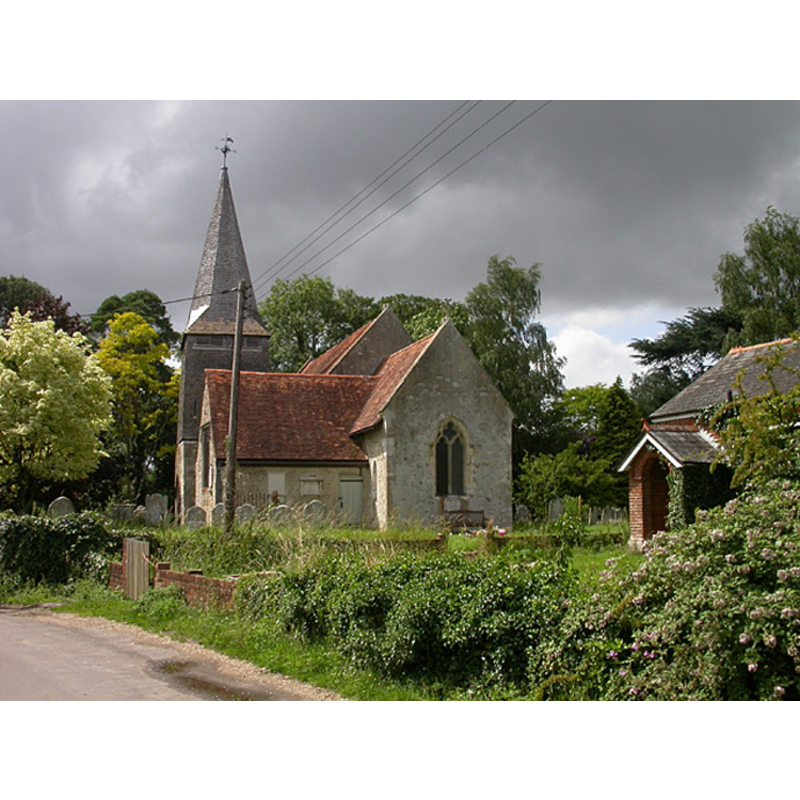
Image copyright © Alan Stewart, 2007
CC-BY-SA-2.5
Results: 1 records
view of church exterior - southeast view
Scene Description: Source caption: "Nursling Church"
Copyright Statement: Image copyright © Alan Stewart, 2007
Image Source: digital photograph 2 July 2007 by Alan Stewart [https://www.geograph.org.uk/photo/491596] [accessed 24 November 2024]
Copyright Instructions: CC-BY-SA-2.5
INFORMATION
Font ID: 17631NUR
Object Type: Baptismal Font1
Font Century and Period/Style: 11th century, Pre-Conquest? / Norman
Church / Chapel Name: Parish Church of St. Boniface
Church Patron Saint(s): St. Boniface [aka Bonifatius, Winfrith]
Church Address: Church Lane, Nursling, Southampton SO16 0YB , UK -- Tel.: 023 8073 8293
Site Location: Hampshire, South East, England, United Kingdom
Directions to Site: Located off (N) the M27, now practically a NW suburb of Southampton
Ecclesiastic Region: Diocese of Winchester
Historical Region: Hundred of Buddlesgate
Additional Comments: disappeared font? [the one from the Domesday time church]
Font Notes:
Click to view
There is an entry for Nursling [variant spelling] in the Domesday survey [http://opendomesday.org/place/SU3516/nursling/] [accessed 17 July 2018]; it reports a church in it. The Victoria County History (Hampshire, vol. 3, 1908) notes: "There was a church in Nursling at the time of the Domesday Survey. [...] The first book of the registers begins in 1617 and runs to 1735 [...] The building in its present form appears to date from the first quarter of the fourteenth century, but includes part of the thirteenth-century church. In 1881 the church was repaired by Street [i.e., Sir George Edmund Street (1824-1881), Victorian archictect] [...] To the east of the south doorway is a holy-water niche, and the font, which is modern, stands near by, having an octagonal bowl on marble shafts." The entry for this church in Historic England [Listing NGR: SU3593316473] notes: "Parish church. Of Saxon origin, mainly C14, with a C13 transept, restored by G.E Street 1881 [...] mid C19 Perpendicular octagonal font."
Credit and Acknowledgements: We are grateful to Chris Hayley, of http://southernlife.org.uk, for his photographs of church and modern font
COORDINATES
UTM: 30U 606075 5644992
Latitude & Longitude (Decimal): 50.94678, -1.49
Latitude & Longitude (DMS): 50° 56′ 48.41″ N, 1° 29′ 24″ W
REFERENCES
- Victoria County History [online], University of London, 1993-. URL: https://www.british-history.ac.uk.