Compton / Cantone / Cantune / Cumyngton / Cuntone / Cuntune
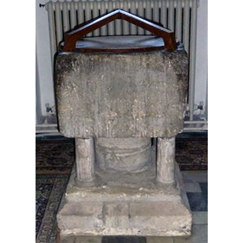
Image copyright © Basher Eyre, 2013
CC-BY-SA-2.0
Results: 4 records
view of font and cover
Scene Description: the modern cover atop
Copyright Statement: Image copyright © Basher Eyre, 2013
Image Source: detail of a digital photograph taken 20 April 2013 by Basher Eyre [www.geograph.org.uk/photo/3429855] [accessed 7 May 2015]
Copyright Instructions: CC-BY-SA-2.0
view of church exterior - northwest view
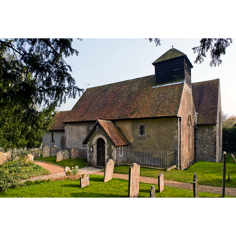
Copyright Statement: Image copyright © Peter Facey, 2009
Image Source: digital photograph taken 3 April 2009 by Peter Facey [www.geograph.org.uk/photo/1235350] [accessed 7 May 2015]
Copyright Instructions: CC-BY-SA-2.0
view of font and cover in context
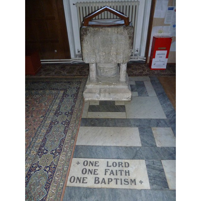
Scene Description: against the west wall of the north aisle
Copyright Statement: Image copyright © Basher Eyre, 2013
Image Source: digital photograph taken 20 April 2013 by Basher Eyre [www.geograph.org.uk/photo/3429855] [accessed 7 May 2015]
Copyright Instructions: CC-BY-SA-2.0
view of church interior - nave - northwest corner
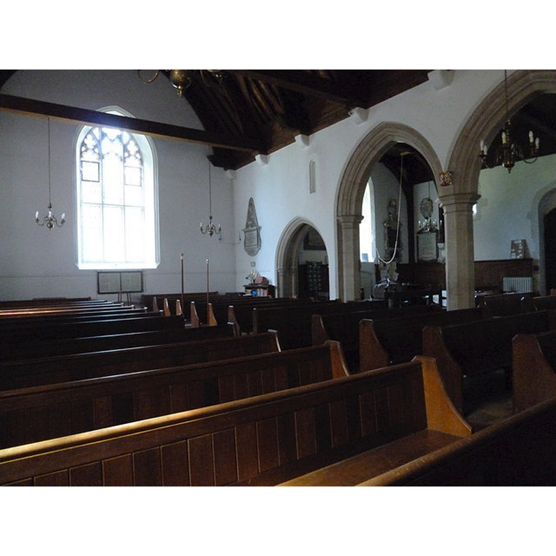
Scene Description: the top of the font can be seen through the middle arch, beneath the hanging bell rope
Copyright Statement: Image copyright © Basher Eyre, 2013
Image Source: digital photograph taken 20 April 2013 by Basher Eyre [www.geograph.org.uk/photo/3427261] [accessed 7 May 2015]
Copyright Instructions: CC-BY-SA-2.0
INFORMATION
Font ID: 17625COM
Object Type: Baptismal Font1
Font Century and Period/Style: 12th century, Late Norman
Church / Chapel Name: Parish Church of All Saints
Font Location in Church: Inside the church, in the N aisle, W end
Church Patron Saint(s): All Saints
Church Address: Carmans Lane, Compton, Hampshire SO21 2AT
Site Location: Hampshire, South East, England, United Kingdom
Directions to Site: Located W of Winchester, E of Salisbury
Ecclesiastic Region: Diocese of Winchester
Historical Region: Hundred of Buddlesgate -- Hundred of Somborne [in Domesday]
Additional Comments: [cf. FontNotes]
Font Notes:
Click to view
There are two entries for this Compton [variant spelling] in the Domesday survey [http://opendomesday.org/place/SU3429/compton/], neither of which mentions cleric or church in it. The Victoria County History (Hampshire, vol. 3, 1908) notes: "The church of All Saints is a small twelfth-century building [...] The fittings of the church are for the most part modern, [...] in the north porch is a relic of the old order of things, now happily past, in the shape of a blue china bowl which did duty at baptisms till within modern times." The British Listed Buildings database [www.britishlistedbuildings.co.uk/en-145774-all-saints-church-compton-and-shawford] [accessed 29 August 2011] entry for this church reports: "Norman font; square with rounded top on central pillar with 4 corner columns." The Southern Live web site [http://southernlife.org.uk/compchur.htm] [accessed 29 August 2011], too, confirms : "The only other survival of the Norman church in situ is the simple, sturdy twelfth-century font".
COORDINATES
UTM: 30U 616816 5654295
Latitude & Longitude (Decimal): 51.02832, -1.334172
Latitude & Longitude (DMS): 51° 1′ 41.95″ N, 1° 20′ 3.02″ W
MEDIUM AND MEASUREMENTS
Material: stone
Font Shape: square, mounted
Basin Interior Shape: round
Basin Exterior Shape: square
LID INFORMATION
Date: modern
Apparatus: no
Notes: modern shape of four straight ribs with round paltform
REFERENCES
- Victoria County History [online], University of London, 1993-. URL: https://www.british-history.ac.uk.