East Stratton / Estratton / Stratton / Strattone / Stratune / West Stratton
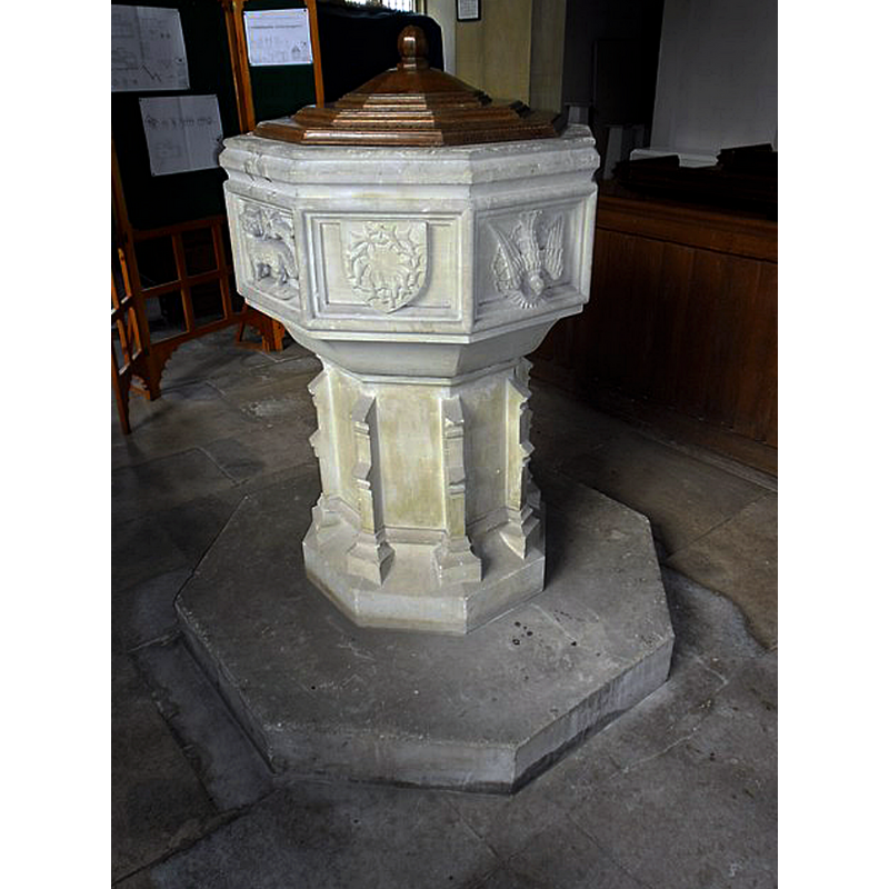
Image copyright © Basher Eyre, 2012
CC-BY-SA-2.0
Results: 6 records
view of font and cover
Scene Description: the modern font and cover in the new church
Copyright Statement: Image copyright © Basher Eyre, 2012
Image Source: digital photograph taken 30 May 2012 by Basher Eyre [www.geograph.org.uk/photo/2969201] [accessed 17 July 2018]
Copyright Instructions: CC-BY-SA-2.0
view of church exterior - southeast view
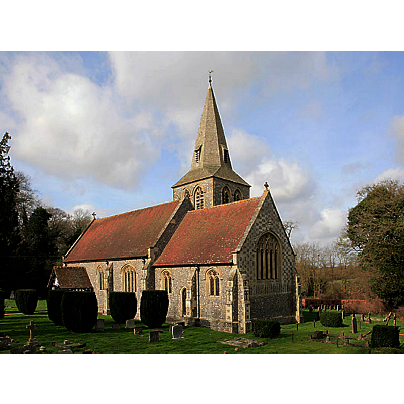
Scene Description: Source caption: "All Saint's Church, East Stratton. This church was built in 1888 by Lord Northbrook to replace the church that was demolished to make way for a new deer park."
Copyright Statement: Image copyright © Peter Facey, 2007
Image Source: digital photograph taken 5 March 2007 by Peter Facey [www.geograph.org.uk/photo/354650] [accessed 17 July 2018]
Copyright Instructions: CC-BY-SA-2.0
view of church exterior in context
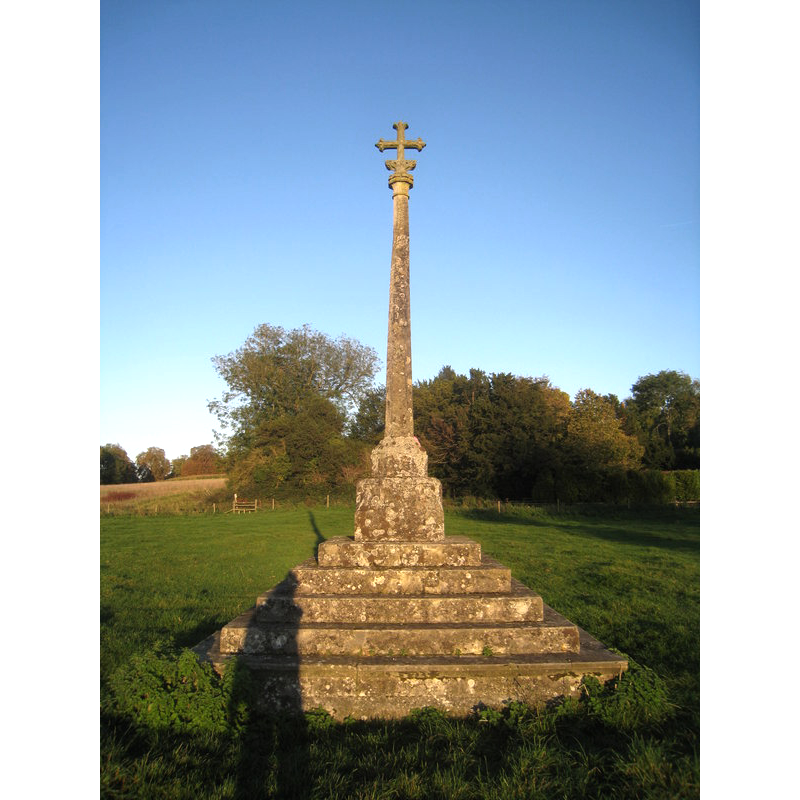
Scene Description: Source caption: "Site of the Old Church of All Saints East Stratton. In 1890 the stone cross in Stratton Park was erected with the inscription: “THIS CROSS ERECTED AD MDCCCXC MARKS THE SITE
OF THE OLD CHURCH OF ALL SAINTS EAST STRATTON” The top section of the cross was damaged during a storm in 1989. In 1998 Lady Rowena Northbrook funded the restoration of the top of the cross in memory of her husband and an inscribed stone plaque added to the steps reads: “This cross damaged by storm in 1989 was restored in 1998 to the memory of Francis John Baring 5th Baron Northbrook.” The original church which stood here was demolished in 1887."
Copyright Statement: Image copyright © Given Up, 2011
Image Source: digital photograph taken 15 October 2011 by Given Up [www.geograph.org.uk/photo/2649032] [accessed 17 July 2018]
Copyright Instructions: CC-BY-SA-2.0
view of church exterior in context
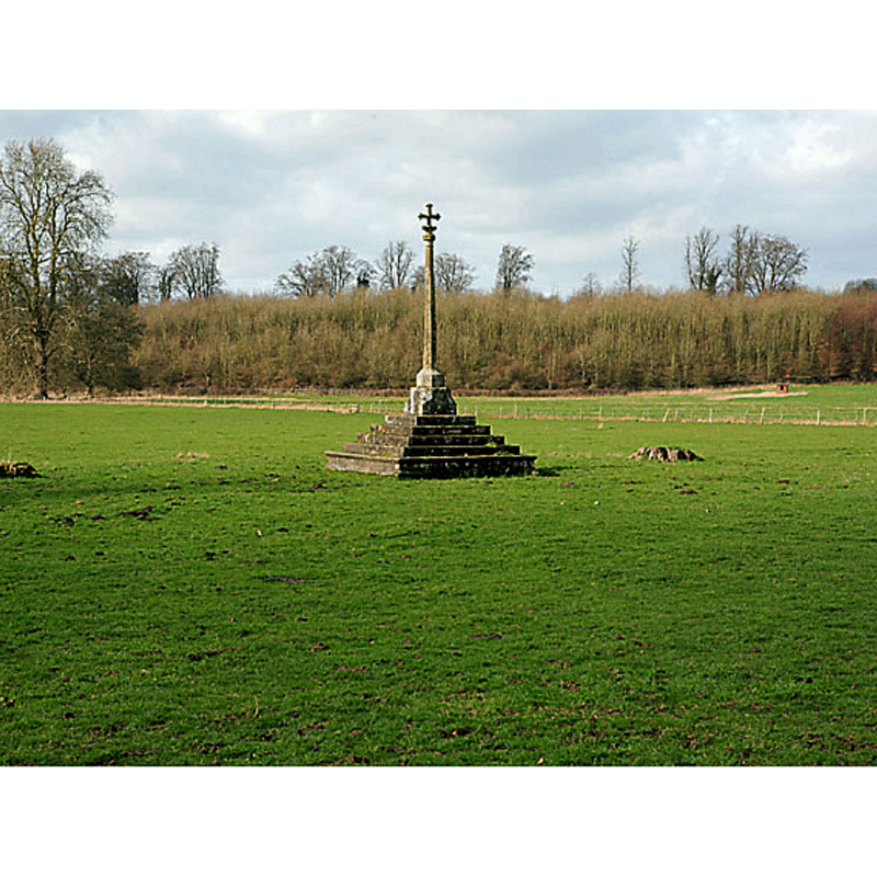
Scene Description: Source caption: "Cross in Stratton Park, East Stratton. This is all that remains of the old village of East Stratton. In the 1880s the local Lord of the Manor, Earl Russell, relocated the village further up the hill, so as to make way for his deer park."
Copyright Statement: Image copyright © Peter Facey, 2007
Image Source: digital photograph taken 5 Marxch 2007 by Peter Facey [www.geograph.org.uk/photo/354648] [accessed 17 July 2018]
Copyright Instructions: CC-BY-SA-2.0
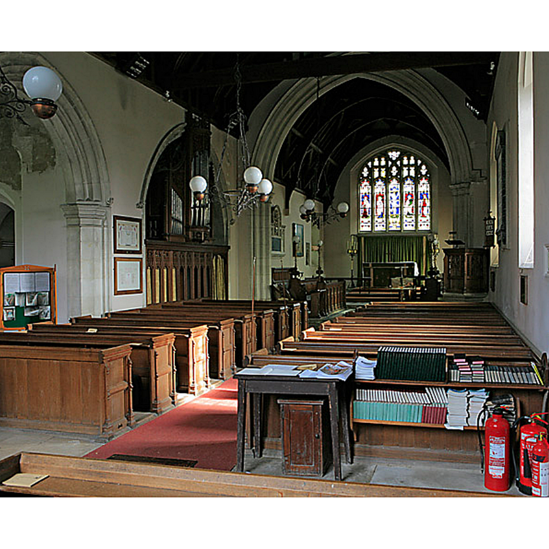
view of church interior - nave - looking west
![the interior of the new church; the top of the modern font is visible ar the far [west] enb, right [north] side](/static-50478a99ec6f36a15d6234548c59f63da52304e5/compressed/1180729024_compressed.png)
Scene Description: the interior of the new church; the top of the modern font is visible ar the far [west] enb, right [north] side
Copyright Statement: Image copyright © Richard Croft, 2014
Image Source: digital photograph taken 26 June 2014 by Richard Croft [www.geograph.org.uk/photo/4046632] [accessed 17 July 2018]
Copyright Instructions: CC-BY-SA-2.0
view of church interior - nave - looking east
Scene Description: the interioor of the new church
Copyright Statement: Image copyright © Peter Facey, 2007
Image Source: digital photograph taken 5 March 2007 by Peter Facey [www.geograph.org.uk/photo/354652] [accessed 17 July 2018]
Copyright Instructions: CC-BY-SA-2.0
INFORMATION
Font ID: 17624STR
Object Type: Baptismal Font1?
Font Century and Period/Style: Medieval
Church / Chapel Name: Old Parish Church/Chapel [disappeared]
Church Address: [cf. Directions (Geo) to site]
Site Location: Hampshire, South East, England, United Kingdom
Directions to Site: Formerly located in Stratton Park, 13 km N of Winchester
Ecclesiastic Region: Diocese of Winchester
Historical Region: Hundred of Micheldever
Additional Comments: disappeared font?
Font Notes:
Click to view
There is an entry for [East and West] Stratton [variant spelling] in the Domesday survey [http://opendomesday.org/place/XX0000/east-and-west-stratton/] [accessed 17 July 2018] but it mentions neither priest nor church in it. The Victoria County History (Hampshire, vol. 3, 1908) notes that the old church in the Park was removed, and replaced by the Church of All Saints built in 1873 in another location. The VCH (ibid.) mentions a register of baptisms for the old church for 1719-1809, while other registers "are incorporated with those of Micheldever from 1540 down to 1813". The font of the 19th-century church is modern, with an octagonal basin decorated with shields bearing emblems, and with other symbols (pelican piercing its chest to feed its young, etc.] [NB: we have no information on the font of the disappeared church].
COORDINATES
UTM: 30U 623963 5669150
Latitude & Longitude (Decimal): 51.16034, -1.2272
Latitude & Longitude (DMS): 51° 9′ 37.22″ N, 1° 13′ 37.92″ W
REFERENCES
- Victoria County History [online], University of London, 1993-. URL: https://www.british-history.ac.uk.