Twyford nr. Winchester / Tuiforde
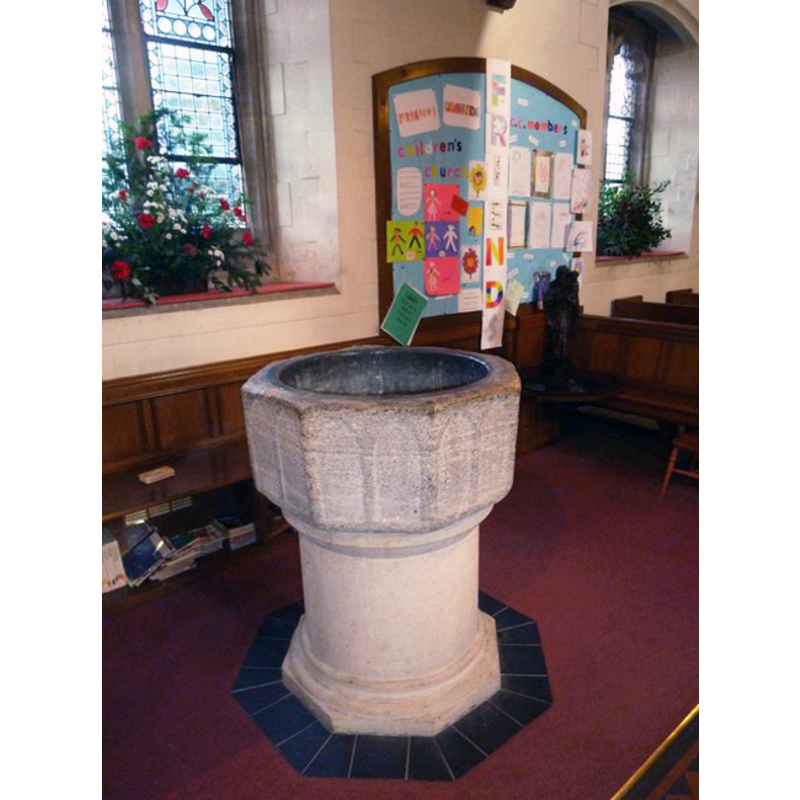
Image copyright © Basher Eyre, 2011
CC-BY-SA-2.0
Results: 3 records
view of font
Copyright Statement: Image copyright © Basher Eyre, 2011
Image Source: digital photograph taken 2 January 2011 by Basher Eyre [www.geograph.org.uk/photo/2278982] [accessed 19 August 2011]
Copyright Instructions: CC-BY-SA-2.0
design element - architectural - arcade - blind - pointed arches - 16
Copyright Statement: Image copyright © Basher Eyre, 2011
Image Source: digital photograph taken 2 January 2011 by Basher Eyre [www.geograph.org.uk/photo/2278982] [accessed 19 August 2011]
Copyright Instructions: CC-BY-SA-2.0
view of church exterior
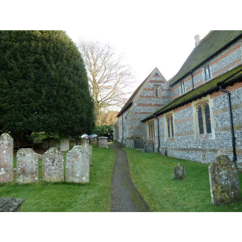
Copyright Statement: Image copyright © Basher Eyre, 2011
Image Source: Ndigital photograph taken 2 January 2011 by Basher Eyre [www.geograph.org.uk/photo/2279048] [accessed 19 August 2011]
Copyright Instructions: CC-BY-SA-2.0
INFORMATION
Font ID: 17606TWY
Object Type: Baptismal Font1?
Font Century and Period/Style: 12th century (late?) [basin only] [composite font], Transitional [altered]
Church / Chapel Name: Parish Church of Our Lady [aka St. Mary's]
Font Location in Church: Inside the church, N side of the nave
Church Patron Saint(s): St. Mary the Virgin
Church Address: Church Lane, Twyford, Hampshire SO21 1NT, UK
Site Location: Hampshire, South East, England, United Kingdom
Directions to Site: Located off (W) the B3335, W of the M3, 5 km S of Winchester
Ecclesiastic Region: Diocese of Winchester
Historical Region: Hundred of Fawley
Additional Comments: altered font: only the basin is original -- disappeared font? (the one in the Domesday-time church here)
Font Notes:
Click to view
There are two entries for this Twyford [variant spelling] in the Domesday survey [http://opendomesday.org/place/SU4824/twyford/] [accessed 9 July 2018], one of which reports a church in it. The Victoria County History (Hampshire, vol. 3, 1908) notes: "At the time of the Domesday Survey there was a church in Twyford [...] [it] was rebuilt in 1876–7, some features of the former building being re-used in the new work. [...] The first book of the registers runs from 1627 to 171". There is no mention of a font in the VCH entry. The Bristish Listed Buildings database [www.britishlistedbuildings.co.uk/en-145949-st-marys-church-twyford] [accessed 19 August 2011], however, reports: "In N aisle C12 Purbeck octagonal font with blank arcading." Only the octagonal basin of the font appears original, a pair of pointed arches on each of the eight sides; it is raised on a cylindrical pedetal and an octagonal lower base, both of modern appearance. [NB: we have no information on the 11th-century font of this church].
COORDINATES
UTM: 30U 618174 5653740
Latitude & Longitude (Decimal): 51.023056, -1.315
Latitude & Longitude (DMS): 51° 1′ 23″ N, 1° 18′ 54″ W
MEDIUM AND MEASUREMENTS
Material: stone
Font Shape: octagonal, mounted
Basin Interior Shape: round
Basin Exterior Shape: octagonal
Drainage Notes: lead-lined
REFERENCES
- Victoria County History [online], University of London, 1993-. URL: https://www.british-history.ac.uk.