Tichborne No. 1
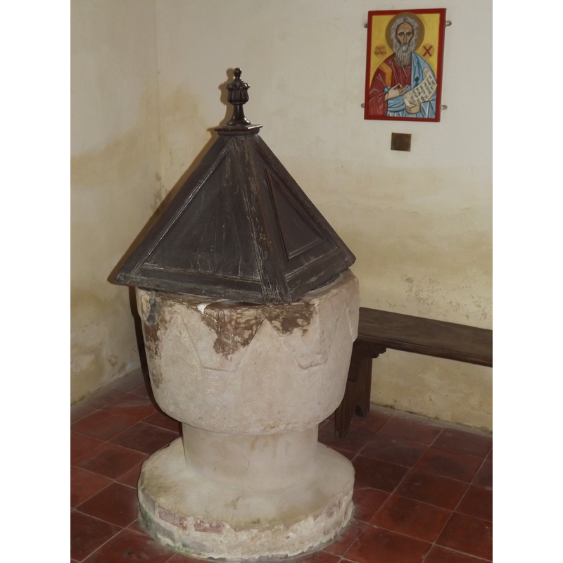
Image copyright © Colin Smith, 2012
Image and permission received (email of 25 July 2012)
Results: 5 records
view of font and cover
Copyright Statement: Image copyright © Colin Smith, 2012
Image Source: digital photograph taken 15 July 2012 by Colin Smith [www.geograph.org.uk/photo/3042639] [accessed 29 August 2012]
Copyright Instructions: Image and permission received (email of 25 July 2012)
design element - patterns - crenellated
![added after the re-cutting of the font [cf. FontNotes]](/static-50478a99ec6f36a15d6234548c59f63da52304e5/compressed/1120829031_compressed.png)
Scene Description: added after the re-cutting of the font [cf. FontNotes]
Copyright Statement: Image copyright © Colin Smith, 2012
Image Source: detail of a digital photograph taken 15 July 2012 by Colin Smith [www.geograph.org.uk/photo/3042620] [accessed 29 August 2012]
Copyright Instructions: Image and permission received (email of 25 July 2012)
view of church exterior - east view
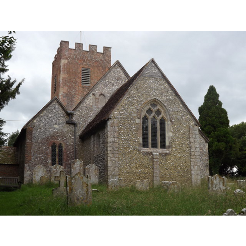
Copyright Statement: Image copyright © Colin Smith, 2012
Image Source: digital photograph taken 15 July 2012 by Colin Smith [www.geograph.org.uk/photo/3042620] [accessed 29 August 2012]
Copyright Instructions: Image and permission received (email of 25 July 2012)
view of church interior - nave - looking west
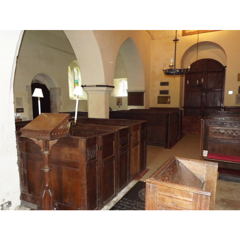
Copyright Statement: Image copyright © Colin Smith, 2012
Image Source: digital photograph taken 15 July 2012 by Colin Smith [www.geograph.org.uk/photo/3042690] [accessed 29 August 2012]
Copyright Instructions: Image and permission received (email of 25 July 2012)
view of font cover
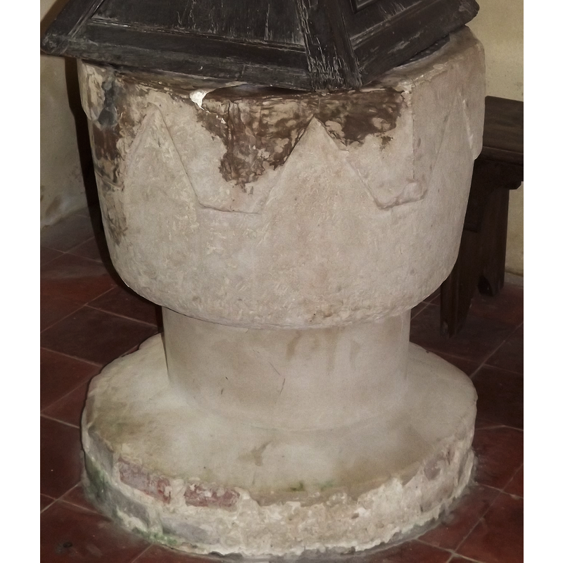
Scene Description: the 18th-century (?) cover
Copyright Statement: Image copyright © Colin Smith, 2012
Image Source: detail of a digital photograph taken 15 July 2012 by Colin Smith [www.geograph.org.uk/photo/3042620] [accessed 29 August 2012]
Copyright Instructions: Image and permission received (email of 25 July 2012)
INFORMATION
Font ID: 17604TIC
Object Type: Baptismal Font1
Font Century and Period/Style: 12th century [basin only] [re-cut], Medieval [composite]
Church / Chapel Name: Parish Church of St. Andrew
Font Location in Church: Inside the church, at the W end of the S aisle
Church Patron Saint(s): St. Andrew
Church Address: Beech Tree Cottages, Tichborne, Hampshire SO24 0NA, UK
Site Location: Hampshire, South East, England, United Kingdom
Directions to Site: Located off (W) the B3046, SE of the A31, 6-7 km E of Winchester
Ecclesiastic Region: Diocese of Winchester
Historical Region: Hundred of Fawley
Additional Comments: altered font (re-cut basin; modern base) -- disappeared font? (the one from the mid-11thC church here?)
Font Notes:
Click to view
No entry found for Tichborne in the Domesday survey. The Proceedings of the British Archaeological Association, reported in The Archaeological Journal (issue of April 1849: 80) include a note referent to this font: "Mr. F.I. Baigent [i.e., Francis Joseph Baigent] presented drawings of a font in Tichbourne church, Hants: its circumference at the top was about eight feet, and it was composed of the Isle of Wight stone. In the churchyard there is also the base of an old font of purbeck marble, which stood upon four pillars." The Victoria County History (Hampshire, vol. 3, 1908) notes: "The chancel is an interesting piece of early building, probably belonging to the middle of the eleventh century. [...] The font at the west end of the south aisle has a large bowl originally octagonal, but cut back to circular form; it is ancient but of uncertain date, and stands on a modern shaft and a plastered brick base." [NB: an octagonal font would not have probably been the original font from the mid-11th century church; we have no information on an earlier font here]. The entry for this church in Historic England [Listing NGR: SU5687230258] reports a "C12 font, round body, octagonal top. C18 cover." The Upper Titchen Benefice web site [www.upperitchen.org.uk/Tichborne CH.htm] [accessed 18 August 2011] reports: "The eighteenth cover which is square clearly comes from elsewhere. "
Credit and Acknowledgements: We are grateful to Colin Smith for his photographs of this church and font
COORDINATES
UTM: 30U 626835 5659046
Latitude & Longitude (Decimal): 51.0689, -1.1897
Latitude & Longitude (DMS): 51° 4′ 8.04″ N, 1° 11′ 22.92″ W
MEDIUM AND MEASUREMENTS
Material: stone
Font Shape: octagonal, mounted
Basin Interior Shape: round
Basin Exterior Shape: octagonal, re-cut from round
LID INFORMATION
Date: 18th-century?
Material: wood
Apparatus: no
Notes: [cf. FontNotes]
REFERENCES
- Victoria County History [online], University of London, 1993-. URL: https://www.british-history.ac.uk.