Privett / Pryvate / Pryvet
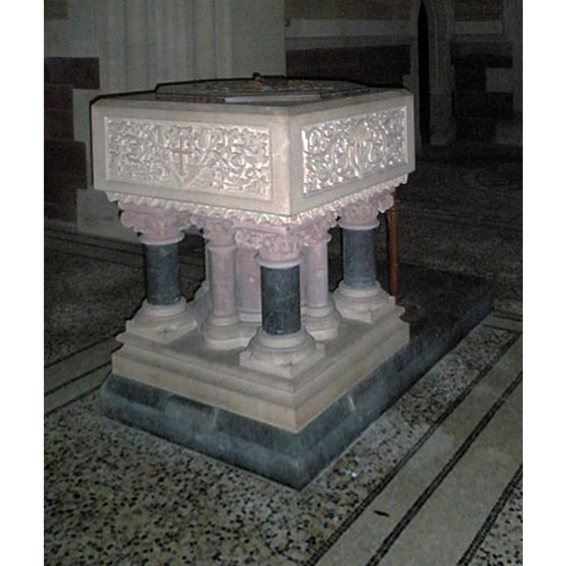
Image copyright © Basher Eyre, 2009
CC-BY-SA-2.0
Results: 2 records
view of font and cover
Scene Description: the modern font introduced in the 19thC
Copyright Statement: Image copyright © Basher Eyre, 2009
Image Source: digital photograph taken 28 February 2009 by Basher Eyre [www.geograph.org.uk/photo/1182184] [accessed 9 July 2018]
Copyright Instructions: CC-BY-SA-2.0
view of church exterior - north view
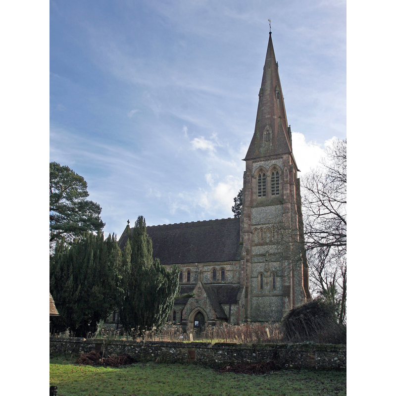
Scene Description: a 19thC re-building by Arthur Blomfield of a medieval one; it became redundant in the 1970s
Copyright Statement: Image copyright © Brendan and Ruth McCartney, 2011
Image Source: digital photograph taken 16 February 2011 by Brendan and Ruth McCartney [www.geograph.org.uk/photo/2272269] [accessed 9 July 2018]
Copyright Instructions: CC-BY-SA-2.0
INFORMATION
Font ID: 17603PRI
Object Type: Baptismal Font1?
Font Date: ca. 1391?
Font Century and Period/Style: 14th century (late?), Perpendicular
Church / Chapel Name: Parish Church of the Holy Trinity [redundant]
Church Patron Saint(s): The Holy Trinity
Church Notes: present church is 19thC re-building by Arthur Blomfield of a medieval one; became redundant in the 1970s
Church Address: Merepond Ln, Privett, Alton GU34 3PE, UK
Site Location: Hampshire, South East, England, United Kingdom
Directions to Site: Located off the A272, 8 km NW of Petersfield
Ecclesiastic Region: Diocese of Winchester
Historical Region: Hundred of Fawley
Additional Comments: disappeared font? (the one from the late-14thC church here)
Font Notes:
Click to view
No entry found for Privett in the Domesday survey. The Victoria County History (Hampshire, vol. 3, 1908) notes: "The earliest mention of a chapel in Privett is in the year 1391 [...] The first book of registers contains the baptisms 1538–1632 [...] The [present] church was built in 1876–8, from the designs of J. L. Pearson, and occupies the site of the old church, of which nothing now remains." The entry for this church in Historic England [Listing NGR: SU6791628475] reports a "square font on pillars" in it. [NB: we have no information on the medieval font of this church].
COORDINATES
UTM: 30U 637681 5655897
Latitude & Longitude (Decimal): 51.0381, -1.0362
Latitude & Longitude (DMS): 51° 2′ 17.16″ N, 1° 2′ 10.32″ W
REFERENCES
- Victoria County History [online], University of London, 1993-. URL: https://www.british-history.ac.uk.