Owslebury / Oselbury / Owlesbury
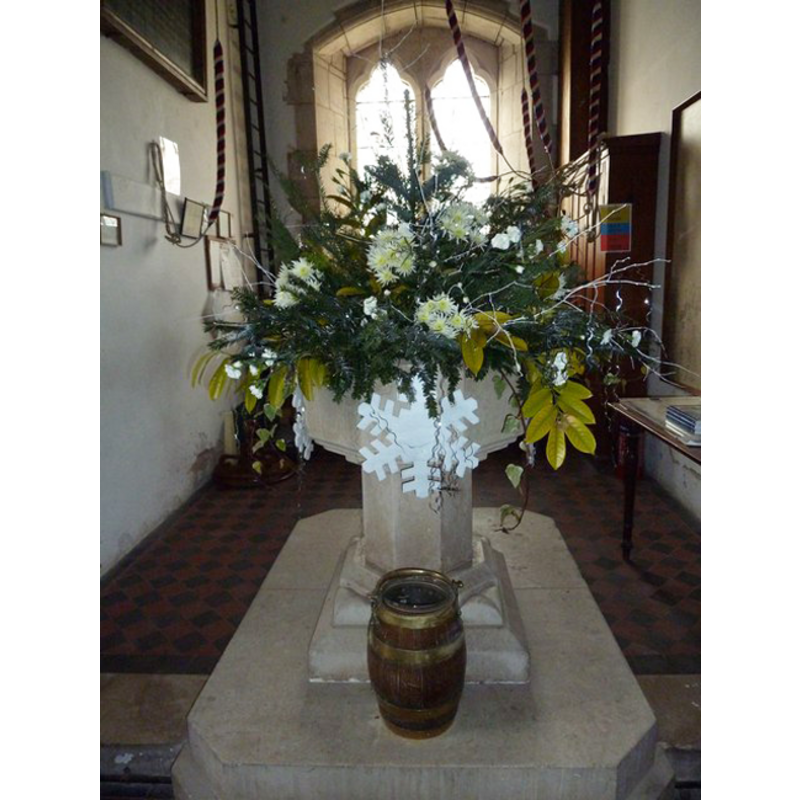
Image copyright © Basher Eyre, 2011
CC-BY-SA-3.0
Results: 2 records
view of font in context
Copyright Statement: Image copyright © Basher Eyre, 2011
Image Source: digital photograph taken 2 January 2011 by Basher Eyre [www.geograph.org.uk/photo/2273466] [accessed 18 August 2011]
Copyright Instructions: CC-BY-SA-3.0
view of church exterior - northwest end
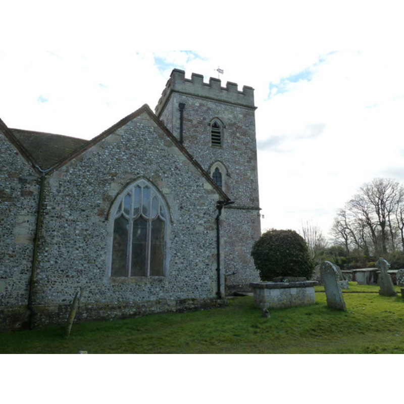
Copyright Statement: Image copyright © Basher Eyre, 2011
Image Source: digital photograph taken 2 January 2011 by Basher Eyre [www.geograph.org.uk/photo/2274248] [accessed 18 August 2011]
Copyright Instructions: CC-BY-SA-3.0
INFORMATION
Font ID: 17602OWS
Object Type: Baptismal Font1
Font Century and Period/Style: 15th century [re-tooled], Perpendicular [altered?]
Church / Chapel Name: Parish Church of St. Andrew
Font Location in Church: Inside the church, beneath the tower
Church Patron Saint(s): St. Andrew
Church Notes: present church 14thC; modified 15thC; modified and restored 19thC
Church Address: Pitcot Lane, Owslebury, Hampshire SO21 1LU
Site Location: Hampshire, South East, England, United Kingdom
Directions to Site: Located 3 km S of Morestead, 8 km SSE of Winchester
Ecclesiastic Region: Diocese of Winchester
Historical Region: Hundred of Fawley
Additional Comments: altered font (re-tooled font) -- disappeared font? (the one from the 14thC church here)
Font Notes:
Click to view
No entry found for Owslebury in the Domesday survey. The Victoria County History (Hampshire, vol. 3, 1908) notes: "The earliest mention of the present church of St. Andrew seems to be in the year 1551 [...] The chancel appears to be the earliest part of the church, dating from the first quarter of the fourteenth century [...] The font, at the west end of the nave, is octagonal with a moulded base to the bowl, and perhaps of fifteenth-century date, but much re-tooled." The entry for this church in Historic England [Listing NGR: SU5143323309] notes: "Under tower donor board 1835 and retooled C15 octagonal font on column."
COORDINATES
UTM: 30U 621610 5652099
Latitude & Longitude (Decimal): 51.00759, -1.266582
Latitude & Longitude (DMS): 51° 0′ 27.32″ N, 1° 15′ 59.69″ W
MEDIUM AND MEASUREMENTS
Material: stone
Font Shape: octagonal, mounted
Basin Interior Shape: round
Basin Exterior Shape: octagonal
REFERENCES
- Victoria County History [online], University of London, 1993-. URL: https://www.british-history.ac.uk.