Old Alresford / Alresforde
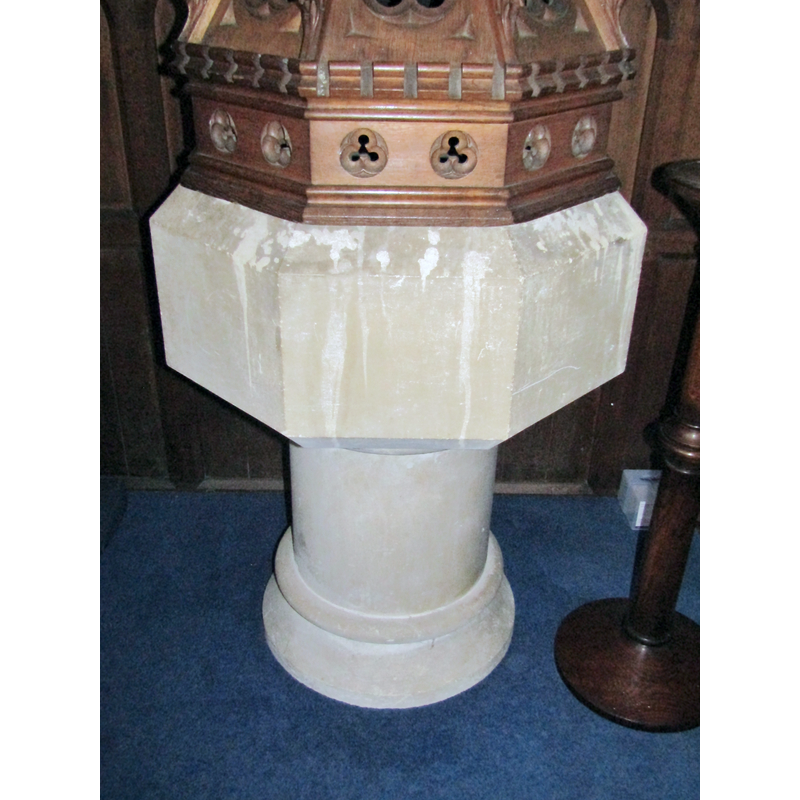
Image copyright © Colin Smith, 2018
Image and permission received from the author (e-mail of 14 February 2018)
Results: 4 records
view of font
Scene Description: the modern font
Copyright Statement: Image copyright © Colin Smith, 2018
Image Source: digital photograph taken 15 October 2017 by Colin Smith
Copyright Instructions: Image and permission received from the author (e-mail of 14 February 2018)
view of font and cover
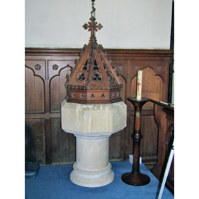
Scene Description: the modern font and cover
Copyright Statement: Image copyright © Colin Smith, 2018
Image Source: digital photograph taken 15 October 2017 by Colin Smith
Copyright Instructions: Image and permission received from the author (e-mail of 14 February 2018)
view of church exterior - southwest view
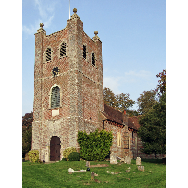
Scene Description: the mid-18thC church
Copyright Statement: Image copyright © Colin Smith, 2018
Image Source: digital photograph taken 15 October 2017 by Colin Smith
Copyright Instructions: Image and permission received from the author (e-mail of 14 February 2018)
view of font cover
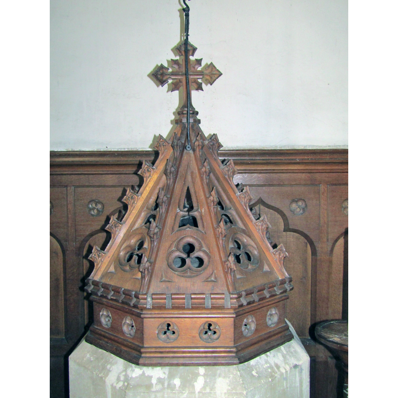
Scene Description: the modern font cover on the modern font
Copyright Statement: Image copyright © Colin Smith, 2018
Image Source: digital photograph taken 15 October 2017 by Colin Smith
Copyright Instructions: Image and permission received from the author (e-mail of 14 February 2018)
INFORMATION
Font ID: 17592ALR
Object Type: Baptismal Font1?
Font Century and Period/Style: 10th - 11th century, Pre-Conquest
Church / Chapel Name: Parish Church of St. Mary the Virgin
Church Patron Saint(s): St. Mary the Virgin
Church Address: Old Alresford, Alresford SO24 9DY, UK -- Tel.: +44 1962 737300
Site Location: Hampshire, South East, England, United Kingdom
Directions to Site: Located off the B3046, 1 km N of New Alresford, 12 km NE of Winchester
Ecclesiastic Region: Diocese of Winchester
Historical Region: Hundred of Fawley
Additional Comments: disappeared?
Font Notes:
Click to view
There is an entry for Alresford [variant spelling] in the Domesday survey [https://opendomesday.org/place/SU5833/alresford/] [accessed 15 February 2018]; it reports a very large place with 52.3 households and three churches in it. The Victoria County History (Hampshire, vol. 3, 1908) notes: "At the time of the Domesday Survey there were three churches in Alresford worth £4 [...] The church of Old Alresford with the chapel were of considerable value at an early date; for in 1291 they were valued at £26 13s. 4d., [...] The advowson of St. Mary's Church at Old Alresford has always been in the hands of the bishop of Winchester [...] The church of Our Lady was entirely rebuilt in 1753" [there is no mention of a font in the VCH entry] [NB: we have no information on the medieval font]. The entry for this church in British Listed Buildings [Listing NGR: SU5876034222] accessed 15 February 2018] does not mention a font in it. The present font is modern; it consists of an octagonal basin with chamfered top and bottom, all palin; raised on a cylindrical pedestal base with mouldings at top and bottom. [cf. Index entries for New Alresford]
Credit and Acknowledgements: We are grateful to Colin Smith for his photographs of this church and modern font
COORDINATES
UTM: 30U 628724 5662461
Latitude & Longitude (Decimal): 51.099177, -1.161537
Latitude & Longitude (DMS): 51° 5′ 57.04″ N, 1° 9′ 41.53″ W
REFERENCES
- Victoria County History [online], University of London, 1993-. URL: https://www.british-history.ac.uk.