Fawley nr. Southampton / Falegia / Falelie / Falle / Fallele
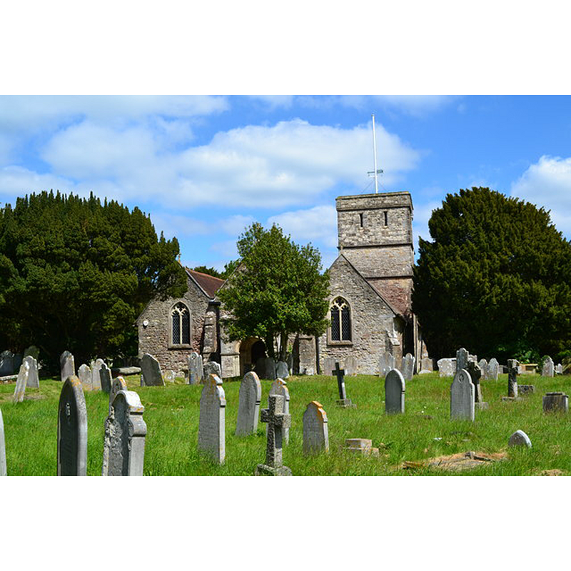
Image copyright © David Martin. 2013
CC-BY-SA-2.0
Results: 3 records
view of church exterior - east view
Copyright Statement: Image copyright © David Martin. 2013
Image Source: digital photograph taken 9 June 2013 by David Martin [www.geograph.org.uk/photo/3501741] [accessed 25 May 2015]
Copyright Instructions: CC-BY-SA-2.0
view of font and cover
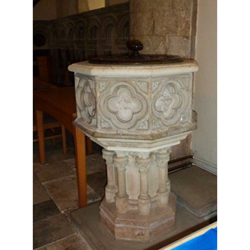
Scene Description: the modern font
Copyright Statement: Image copyright © Basher Eyre, 2010
Image Source: edited detail of a digital photograph taken 3 July 2010 by Basher Eyre [www.geograph.org.uk/photo/1977561] [accessed 25 May 2015]
Copyright Instructions: CC-BY-SA-2.0
view of church interior - nave - looking east
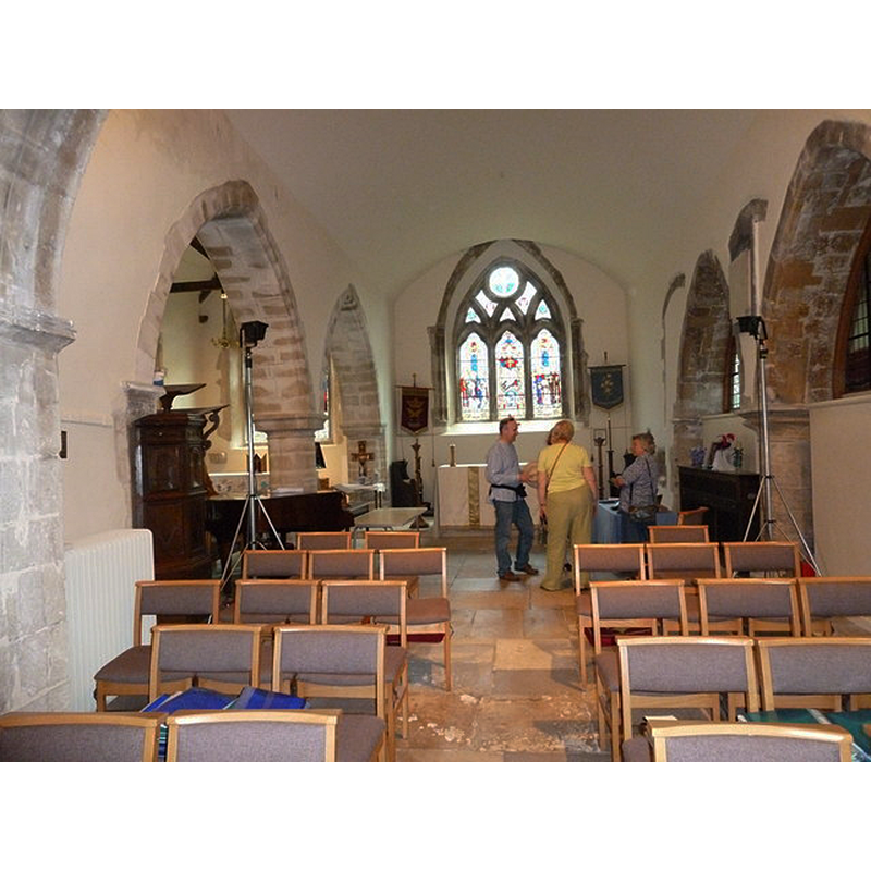
Copyright Statement: Image copyright © Basher Eyre, 2010
Image Source: digital photograph taken 3 July 2010 by Basher Eyre [www.geograph.org.uk/photo/1977580] [accessed 25 May 2015]
Copyright Instructions: CC-BY-SA-2.0
INFORMATION
Font ID: 17589FAW
Object Type: Baptismal Font1?
Font Century and Period/Style: 11th century, Pre-Conquest? / Norman
Church / Chapel Name: Parish Church of All Saints
Church Patron Saint(s): All Saints
Church Address: Marsh Lane, Fawley, Hampshire, SO45 1DL
Site Location: Hampshire, South East, England, United Kingdom
Directions to Site: Located in the New Forest, 11 km S of Southampton
Ecclesiastic Region: Diocese of Winchester
Historical Region: Hundred of Redbridge [in Domesday] -- Hundred of Waltham
Additional Comments: disappeared font? (the one from the Domesday-time church here)
Font Notes:
Click to view
There are two entries for this Fawley [variant spelling] in the Domesday survey [http://opendomesday.org/place/SU4503/fawley/] [accessed 25 May 2015], one of which mentions a church in it. The Victoria County History (Hampshire, vol. 3, 1908) notes: "As it stands to-day, without taking into account the modern details, the church seems to belong to two main periods, c. 1170–1210, and 1300–1340. [...] The font, at the west end of the south aisle, is modern, octagonal with panelled sides." [NB: we have no information on the medieval font].
COORDINATES
UTM: 30U 616065 5632190
Latitude & Longitude (Decimal): 50.829776, -1.351909
Latitude & Longitude (DMS): 50° 49′ 47.2″ N, 1° 21′ 6.87″ W
REFERENCES
- Victoria County History [online], University of London, 1993-. URL: https://www.british-history.ac.uk.