Alverstoke / Aillewardstoke / Alvardestoke / Alverstoke / Alwarestoch / Alwarestock / Halwarestoke
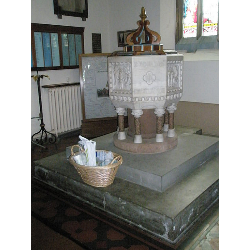
Image copyright © Basher Eyre, 2009
CC-BY-SA-2.0
Results: 2 records
view of font and cover
Scene Description: the modern font [cf. FontNotes[
Copyright Statement: Image copyright © Basher Eyre, 2009
Image Source: digital photograph taken 2 August 2009 by Basher Eyre [www.geograph.org.uk/photo/1424904] [accessed 25 June 2018]
Copyright Instructions: CC-BY-SA-2.0
view of church exterior in context - southeast view
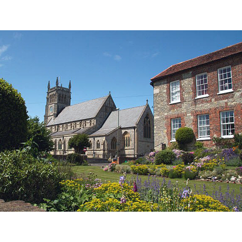
Copyright Statement: Image copyright © Margaret Auerstedt, 2012
Image Source: digital photograph taken 9 June 2012 by Margaret Auerstedt [https://en.wikipedia.org/wiki/File:Parish_Church_of_St_Mary's_Alverstoke.jpg] [accessed 25 June 2018]
Copyright Instructions: GFDL / CC-BY-SA-3.0
INFORMATION
Font ID: 17578ALV
Object Type: Baptismal Font1?
Font Century and Period/Style: 12th century (early?), Late Norman? / Transitional?
Church / Chapel Name: Parish Church of Our Lady [aka St. Mary's]
Church Patron Saint(s): St. Mary the Virgin
Church Address: Green Rd, Alverstoke, Gosport PO12 2ET, UK -- Tel.: +44 23 9258 0551
Site Location: Hampshire, South East, England, United Kingdom
Directions to Site: Alverstoke is now a suburb of Gosport, on the W side of Portsmouth harbour, across from Portsmouth
Ecclesiastic Region: Diocese of Portsmouth
Historical Region: Liberty of Alverstoke -- Hundred of Meonstoke [in Domesday]
Additional Comments: disappeared font? (the font of the original church)
Font Notes:
Click to view
There is an entry for Alverstoke [variant spelling] in the Domesday survey [http://opendomesday.org/place/SZ6098/alverstoke/] [accessed 25 June 2018], but it mentions neither priest nor church in it. The Victoria County History (Hampshire, vol. 3, 1908) notes: "No church is mentioned in the Domesday Survey. In 1122 William Giffard, then bishop of Winchester, disputed with the prior of St. Swithun the possession of nine churches attached to the manors held by the monks. [...] Among these was Alverstoke church, which the bishop restored to the monks in 1124 [...] The church [...] is now entirely modern. [...] The old church, of which a plan is preserved in the library of the Society of Antiquaries, was of the same general plan". There is no mention of a font in the VCH entry.
COORDINATES
UTM: 30U 630554 5627640
Latitude & Longitude (Decimal): 50.78579, -1.1479
Latitude & Longitude (DMS): 50° 47′ 8.84″ N, 1° 8′ 52.44″ W
REFERENCES
- Victoria County History [online], University of London, 1993-. URL: https://www.british-history.ac.uk.