Widley / Wydele / Wydelig
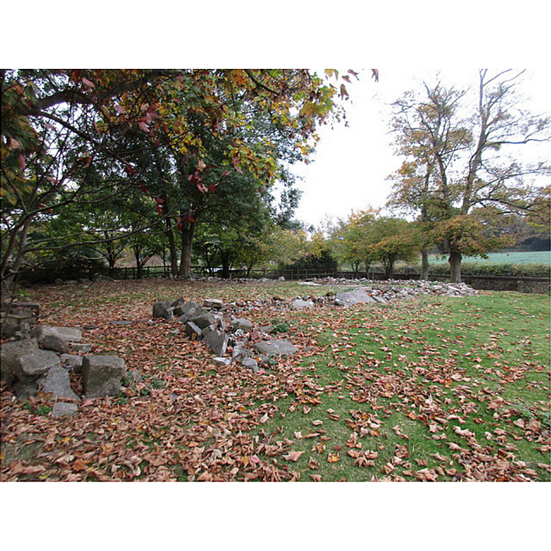
Image copyright © Jonathan Thacker, 2016
CC-BY-SA-2.0
Results: 4 records
view of church exterior in context - ruins
Scene Description: Source caption: "The site of the church of St. Mary Magdalene, Widley. The church here (which had been rebuilt in 1849) was demolished in 1953 having been effectively replaced by Christ Church, Portsdown".
Copyright Statement: Image copyright © Jonathan Thacker, 2016
Image Source: digital photograph taken 29 October 2016 by Jonathan Thacker [www.geograph.org.uk/photo/5179224] [accessed 25 June 2018]
Copyright Instructions: CC-BY-SA-2.0
inscription
![[cf. FontNotes]](/static-50478a99ec6f36a15d6234548c59f63da52304e5/others/image_not_available.jpg)
Scene Description: [cf. FontNotes]
![[cf. FontNotes]](/static-50478a99ec6f36a15d6234548c59f63da52304e5/bsi-testing-site/others/image_not_available.jpg)
design element - motifs - leaf - acanthus
design element - motifs - floral - rose - crowned rose
INFORMATION
Font ID: 17576WID
Object Type: Baptismal Font1
Font Date: 1690?
Font Century and Period/Style: 17th century(late?), Restoration
Church / Chapel Name: Parish Church of St. Mary Magdalen [demolished in 1953]
Church Patron Saint(s): St. Mary Magdalene
Church Address: London Rd, Portsmouth, Waterlooville PO6 3NB, UK -- Tel.: +44 23 9237 9992
Site Location: Hampshire, South East, England, United Kingdom
Directions to Site: Located off (N) the B2177, 8 km N of Portsmouth, now part of Greater Portsmouth
Ecclesiastic Region: Diocese of Portsmouth
Historical Region: Hundred of Portsdown
Additional Comments: disappeared font? (the one from the medieval church) -- disused font: reported serving as a credence ca. 1908 [cf. FontNotes]
Font Notes:
Click to view
No entry found for Widley in the Domesday survey. The Victoria County History (Hampshire, vol. 3, 1908) notes: "The earliest mention of a church at Widley seems to be in the year 1291, when the rectory of Widley was assessed at £4 6s. 8d. [...] The church of St. Mary Magdalen was entirely rebuilt in 1849 [...] Nothing of the old church has been preserved except a small font with a slender bowl on which is IS 1690. It is built into the north wall of the chancel to serve as a credence, three faces of the bowl being exposed, on one of which is the date already noted, and on the others an acanthus leaf and a crowned rose respectively." [NB: we have no information on the font from the medieval church, or the whereabouts of the 17th-century font after the demolition of St Mary's church in 1953].
COORDINATES
UTM: 30U 637383 5635719
Latitude & Longitude (Decimal): 50.85683, -1.04806
Latitude & Longitude (DMS): 50° 51′ 24.59″ N, 1° 2′ 53.02″ W
MEDIUM AND MEASUREMENTS
Material: stone
Font Shape: round, mounted
INSCRIPTION
Inscription Language: letters and numbers
Inscription Location: on one of the exposed sides of the basin
Inscription Text: "IS 1690"
Inscription Source: VCH entry [cf. FontNotes]
REFERENCES
- Victoria County History [online], University of London, 1993-. URL: https://www.british-history.ac.uk.