Catherington / Catrington / Katerinton / Katheringeton / Katherington / Katteryngton / Ketherington
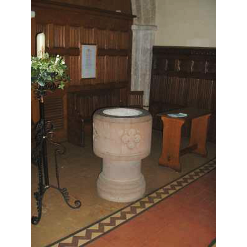
Image copyright © Chris Hayley, 2011
Standing permission
Results: 4 records
view of font
Scene Description: the modern font
Copyright Statement: Image copyright © Chris Hayley, 2011
Image Source: digital photograph taken by Chris Hayley [http://southernlife.org.uk/catherington_church.htm] [accessed 10 August 2011]
Copyright Instructions: Standing permission
view of church exterior - west view
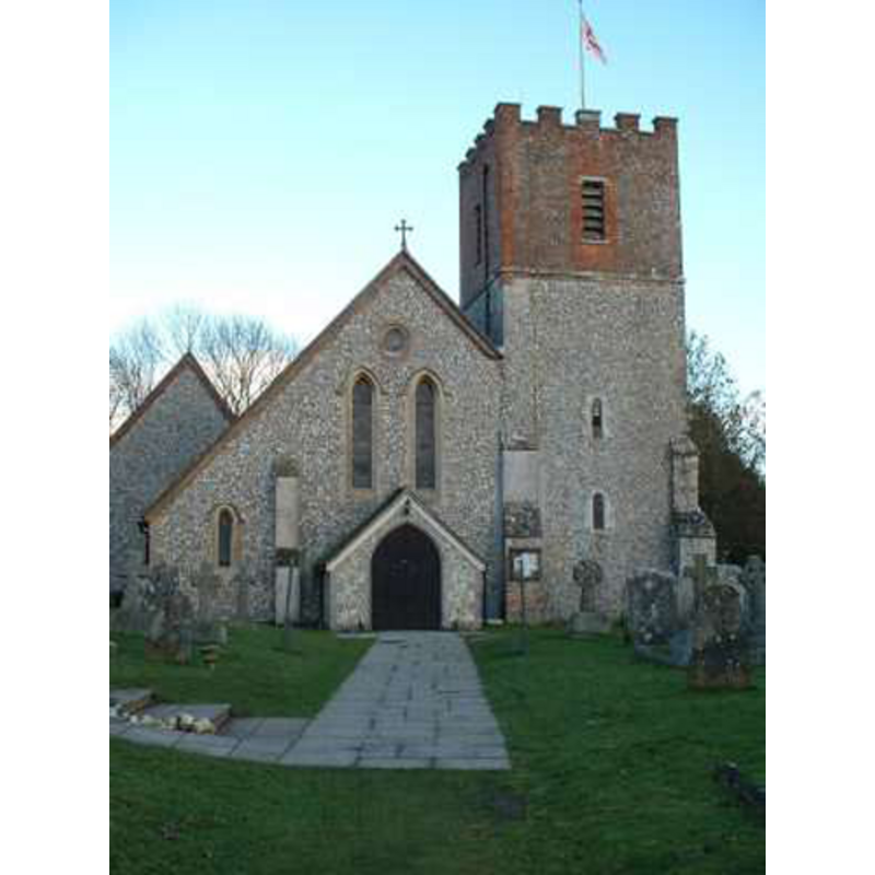
Copyright Statement: Image copyright © Chris Hayley, 2011
Image Source: digital photograph taken by Chris Hayley [http://southernlife.org.uk/catherington_church.htm] [accessed 10 August 2011]
Copyright Instructions: Standing permission
view of font and cover in context
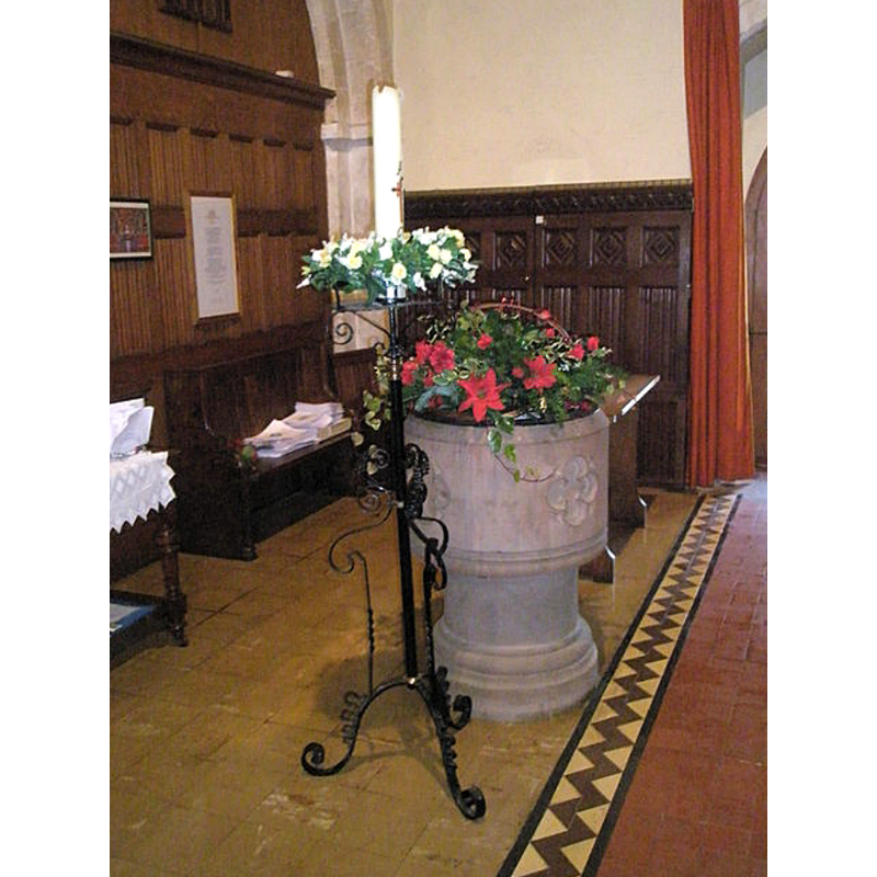
Scene Description: the modern font
Copyright Statement: Image copyright © Basher Eyre, 2008
Image Source: digital photograph taken 30 December 2008 by Basher Eyre [www.geograph.org.uk/photo/1098220] [accessed 19 June 2018]
Copyright Instructions: CC-BY-SA-2.0
view of church interior - nave - looking east
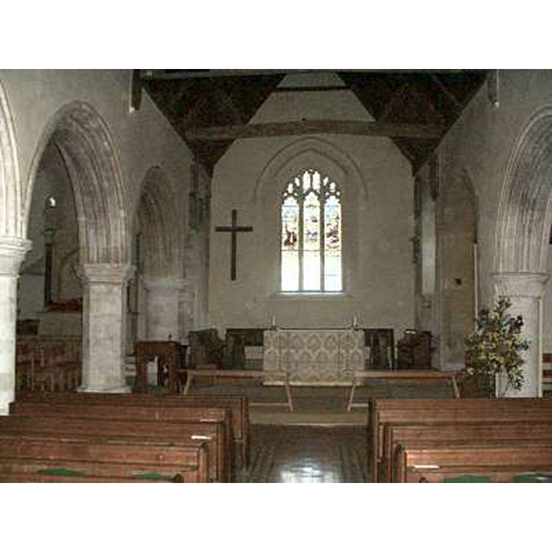
Copyright Statement: Image copyright © Chris Hayley, 2011
Image Source: digital photograph taken by Chris Hayley [http://southernlife.org.uk/catherington_church.htm] [accessed 10 August 2011]
Copyright Instructions: Standing permission
INFORMATION
Font ID: 17569CAT
Object Type: Baptismal Font1?
Font Century and Period/Style: 11th - 12th century, Medieval
Church / Chapel Name: Parish Church of St. Katherine
Church Patron Saint(s): St. Catherine of Alexandria [aka Katherine, Katharine]
Church Address: 330 Catherington Ln, Waterlooville PO8 0TD, UK -- Tel.: +44 23 9259 3139
Site Location: Hampshire, South East, England, United Kingdom
Directions to Site: Located W of the A3, 2 km NW of Horndean, 13 km S of Petersfield
Ecclesiastic Region: Diocese of Winchester
Historical Region: Hundred of Finchdean
Additional Comments: disappeared font?
Font Notes:
Click to view
No entry found for Catherington in the Domesday survey. The Victoria County History (Hampshire, vol. 3, 1908) notes: "The greater part of the building belongs to the end of the twelfth century and the beginning of the thirteenth, [...] doubtless developed from an older church [...] The first book of the registers contains baptisms, marriages, and burials from 1602 to 1640". There is no mention of a font in the VCH entry. The present font in this church is modern, a cylindrical basin decorated with quatrefoils, etc., raised on a round moulded pedestal base. [NB: we have no information on the medieval font]
Credit and Acknowledgements: We are grateful to Chris Hayley, of http://southernlife.org.uk, for his photographs of church and modern font
COORDINATES
UTM: 30U 639841 5643449
Latitude & Longitude (Decimal): 50.92571, -1.0102
Latitude & Longitude (DMS): 50° 55′ 32.56″ N, 1° 0′ 36.72″ W
REFERENCES
- Victoria County History [online], University of London, 1993-. URL: https://www.british-history.ac.uk.