Steep / La Stiepe / La Stuppe / Steepe / Stupe
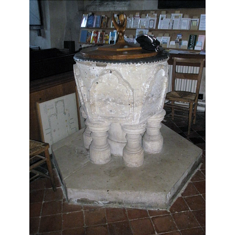
Image copyright © Basher Eyre, 2009
CC-BY-SA-2.0
Results: 4 records
view of font and cover
Scene Description: the squat colonnettes of the base look suspiciously neat
Copyright Statement: Image copyright © Basher Eyre, 2009
Image Source: digital photograph taken 7 March 2009 by Basher Eyre [www.geograph.org.uk/photo/1194872] [accessed 19 June 2018]
Copyright Instructions: CC-BY-SA-2.0
design element - architectural - arch or window - trefoiled - 6
Copyright Statement: Image copyright © Basher Eyre, 2009
Image Source: digital photograph taken 7 March 2009 by Basher Eyre [www.geograph.org.uk/photo/1194872] [accessed 19 June 2018]
Copyright Instructions: CC-BY-SA-2.0
view of church exterior - north view
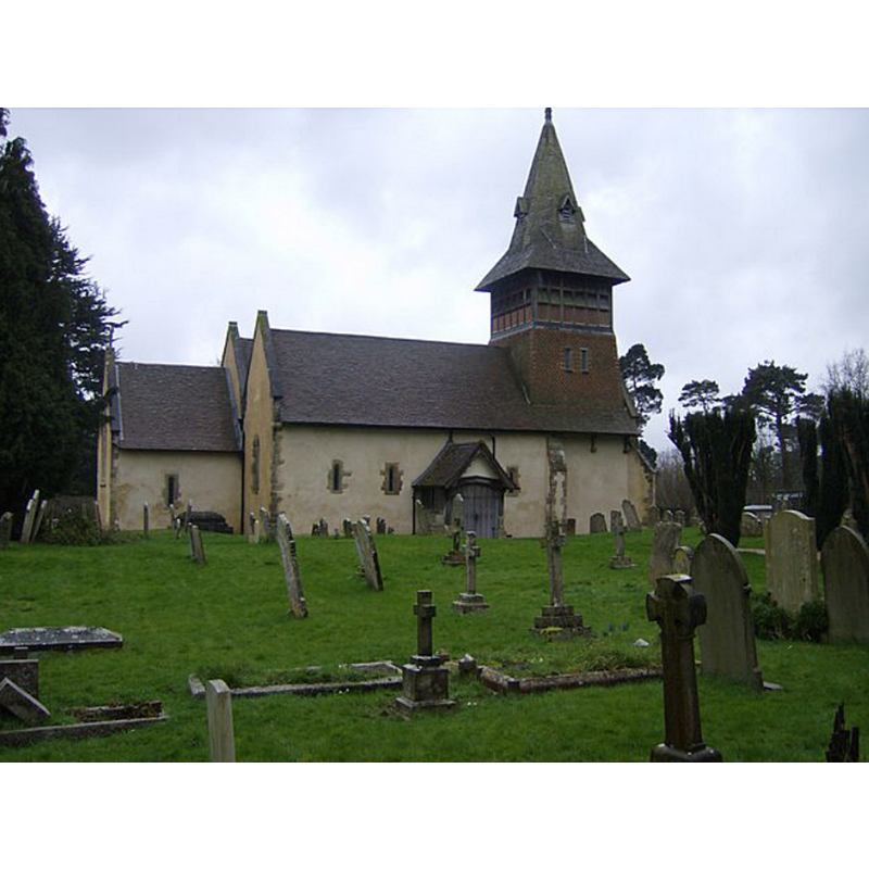
Scene Description: Source caption: "All Saints Church, Steep. An unusual church tower built in the 19th century. Parts of the church date back to the 12th century."
Copyright Statement: Image copyright © Graham Horne, 2007
Image Source: digital photograph taken 4 March 2007 by Graham Horne [www.geograph.org.uk/photo/357303] [accessed 19 June 2018]
Copyright Instructions: CC-BY-SA-2.0
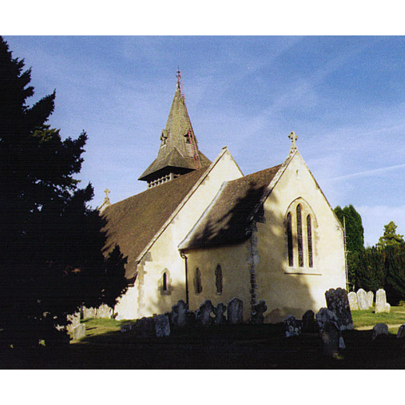
view of church exterior - southeast view
Copyright Statement: Image copyright © Michael Ford, 2005
Image Source: digital photograph taken in 2005 by Michael Ford [www.geograph.org.uk/photo/1494499] [accessed 19 June 2018]
Copyright Instructions: CC-BY-SA-2.0
INFORMATION
Font ID: 17567STE
Object Type: Baptismal Font1
Font Century and Period/Style: 14th century (early?), Decorated
Church / Chapel Name: Parish Church of All Saints
Font Location in Church: Inside the church
Church Patron Saint(s): All Saints
Church Address: 77 Church Rd, Steep, Petersfield GU32 2DF, UK -- Tel.: +44 1730 264282
Site Location: Hampshire, South East, England, United Kingdom
Directions to Site: Located off the A3, 2 km N of Petersfield. near the border with Sussex
Ecclesiastic Region: Diocese of Winchester
Historical Region: Hundred of East Meon
Additional Comments: altered font? [cf. FontNotes] -- disappeared font? (the one from the ca. 1180 church here)
Font Notes:
Click to view
No entry found for Steep in the Domesday survey. The Victoria County History (Hampshire, vol. 3, 1908) notes: "The eastern bays of the south arcade of the nave, c. 1180, are the earliest pieces of detail in the building, but it seems probable that the oldest masonry on the site belongs to a church of the Colemore and Ropley type, and probably of the first half of the twelfth century. [...] The font at the west of the nave has a tapering round bowl, becoming hexagonal, with six projecting trefoiled arches on its sides, the capitals of which are shown in profile only. It stands on six modern dwarf columns and a central shaft, and is of early fourteenth-century date." The entry for this church in English Heritage [Listing NGR: SU7464025294] reports: "The C14 font is hexagonal on six short shafts around a central shaft." [NB: we have no information on the font from the late-12th century church].
COORDINATES
UTM: 30U 644651 5654391
MEDIUM AND MEASUREMENTS
Material: stone
Font Shape: round-to-hexagonal, mounted
Basin Interior Shape: round
Basin Exterior Shape: round-to-hexagonal
REFERENCES
- Victoria County History [online], University of London, 1993-. URL: https://www.british-history.ac.uk.