Bishop's Sutton / Sottone Bishop / Sudtone / Sutton Bishops / Sutton Episcopi
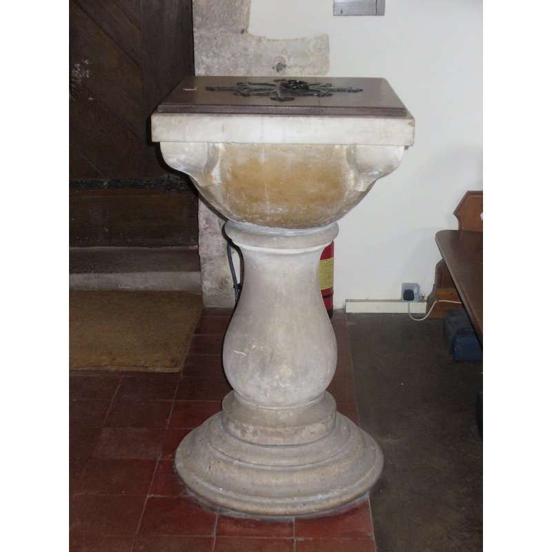
Image copyright © Colin Smith, 2011
Image and permission received (email of 11 September 2011)
Results: 6 records
view of font and cover
Scene Description: the modern font
Copyright Statement: Image copyright © Colin Smith, 2011
Image Source: digital photograph taken September 2011 by Colin Smith
Copyright Instructions: Image and permission received (email of 11 September 2011)
view of font and cover
![the modern font [cf. FontNotes]](/static-50478a99ec6f36a15d6234548c59f63da52304e5/compressed/1110810004_compressed.png)
Scene Description: the modern font [cf. FontNotes]
Copyright Statement: Image copyright © Basher Eyre, 2010
Image Source: digital photograph taken 13 November 2010 by Basher Eyre [www.geograph.org.uk/photo/2169323] [accessed 10 August 2011]
Copyright Instructions: CC-BY-SA-3.0
view of church exterior - north view
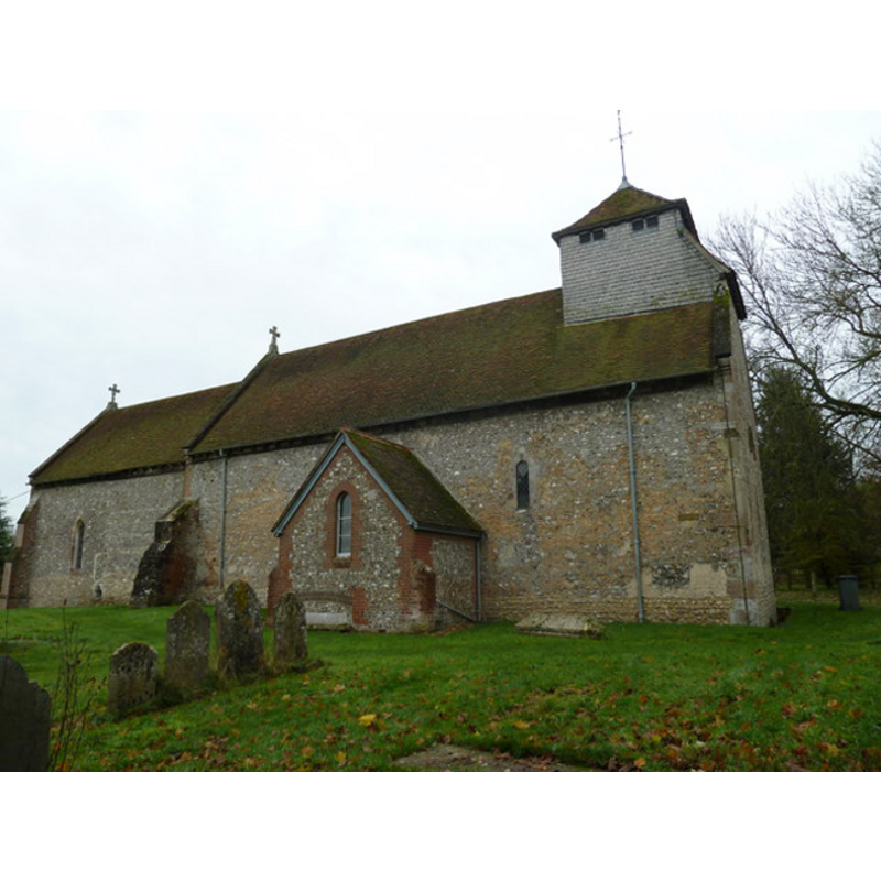
Copyright Statement: Image copyright © Basher Eyre, 2010
Image Source: digital photograph taken 13 November 2010 by Basher Eyre [www.geograph.org.uk/photo/2170915] [accessed 10 August 2011]
Copyright Instructions: CC-BY-SA-3.0
view of church exterior - southeast view
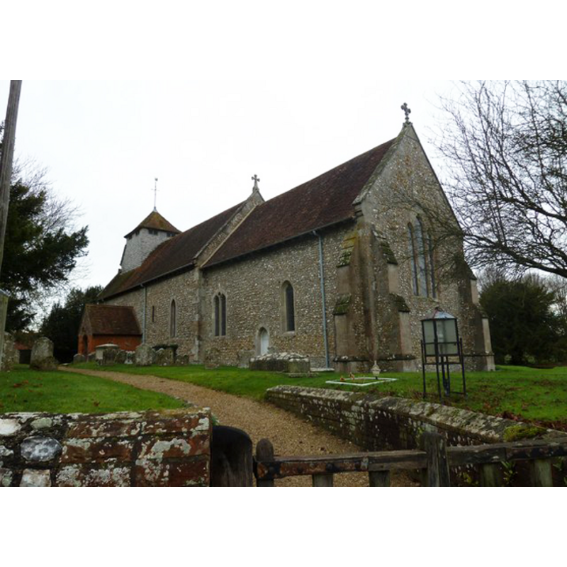
Copyright Statement: Image copyright © Basher Eyre, 2010
Image Source: digital photograph taken 13 November 2010 by Basher Eyre [www.geograph.org.uk/photo/2169322] [accessed 10 August 2011]
Copyright Instructions: CC-BY-SA-3.0
view of church interior - nave - looking west
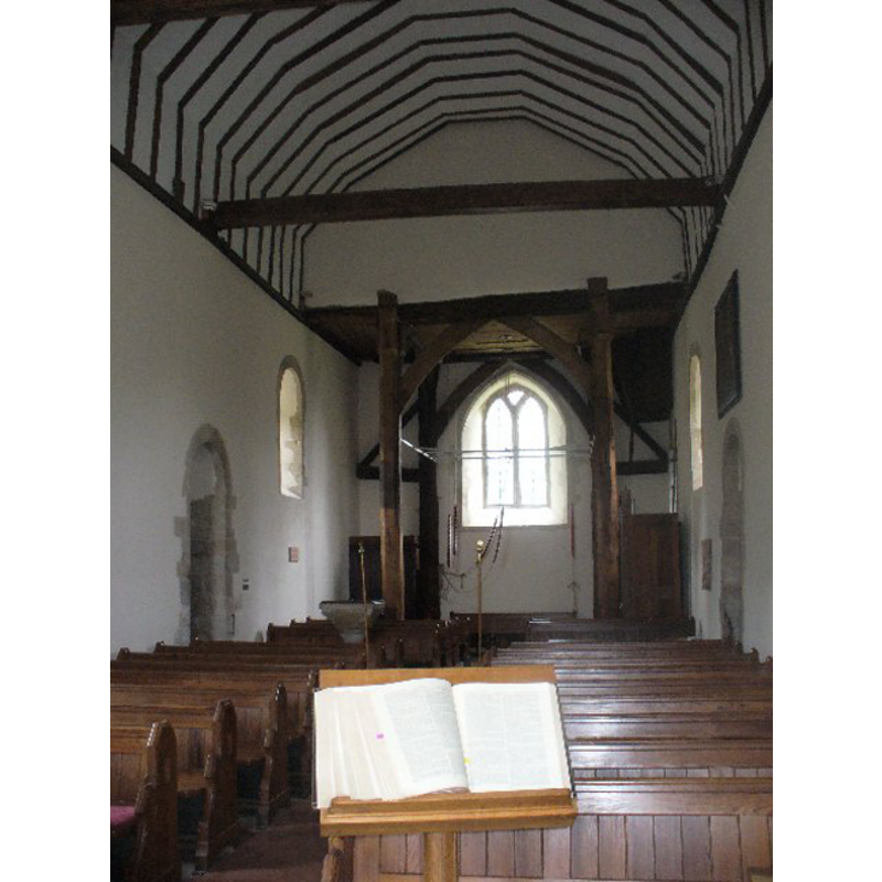
Copyright Statement: Image copyright © Colin Smith, 2011
Image Source: digital photograph taken September 2011 by Colin Smith
Copyright Instructions: Image and permission received (email of 11 September 2011)
view of church interior - nave - southwest view

Scene Description: the modern font visible at the back, just west of the south entranceway
Copyright Statement: Image copyright © Basher Eyre, 2010
Image Source: digital photograph taken 13 November 2010 by Basher Eyre [www.geograph.org.uk/photo/2170934] [accessed 10 August 2011]
Copyright Instructions: CC-BY-SA-3.0
INFORMATION
Font ID: 17565BIS
Object Type: Baptismal Font1
Font Century and Period/Style: 11th century, Pre-Conquest? / Norman
Church / Chapel Name: Parish Church of St. Nicholas
Font Location in Church: [cf. FontNotes]
Church Patron Saint(s): St. Nicholas of Myra
Church Address: Church Ln, Bishops Sutton, Alresford SO24 0AD, UK -- Tel.: +44 1962 773075
Site Location: Hampshire, South East, England, United Kingdom
Directions to Site: Located off (N) the B3047, 2 km ESE of Alresford, 14 km SW of Alton
Ecclesiastic Region: Diocese of Winchester
Historical Region: Hundred of Bishop's Sutton -- Hundred of Ashley [aka Esselei] [in Domesday]
Additional Comments: disappeared font? (the one from the Domesday-time church here)
Font Notes:
Click to view
There is an entry for [Bishop's] Sutton [variant spelling] in the Domesday survey [http://opendomesday.org/place/SU6031/bishops-sutton/] [accessed 19 June 2018]; it mentions "1 church. 1.0 church lands" in it. The Victoria County History (Hampshire, vol. 3, 1908) notes: "The nave has been but little altered in its main features since its building about 1150 [...] The font stands by the south door of the nave, large and baluster-shaped, with a moulded base, and inconveniently high. It is of eighteenth-century date." [NB: we have no information on the font from the Domesday-time church here]
Credit and Acknowledgements: We are grateful to Colin Smith for his photographs of church and modern font
COORDINATES
UTM: 30U 630538 5660848
Latitude & Longitude (Decimal): 51.084263, -1.13623
Latitude & Longitude (DMS): 51° 5′ 3.35″ N, 1° 8′ 10.43″ W
REFERENCES
- Victoria County History [online], University of London, 1993-. URL: https://www.british-history.ac.uk.