East Tisted / Estistede / Esttystede / Ostede / Thistede
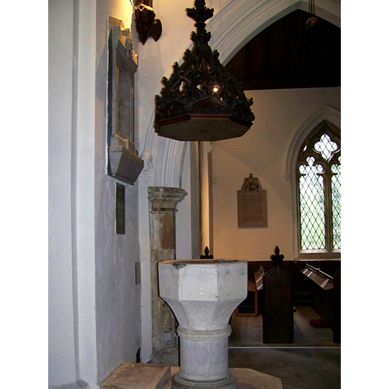
Image copyright © Trish Steel, 2009
CC-BY-SA-3.0
Results: 2 records
view of font and cover
Scene Description: the modern font
Copyright Statement: Image copyright © Trish Steel, 2009
Image Source: digital photograph taken 28 May 2009 by Trish Steel [www.geograph.org.uk/photo/1343490] [accessed 9 August 2011]
Copyright Instructions: CC-BY-SA-3.0
view of church exterior - south view
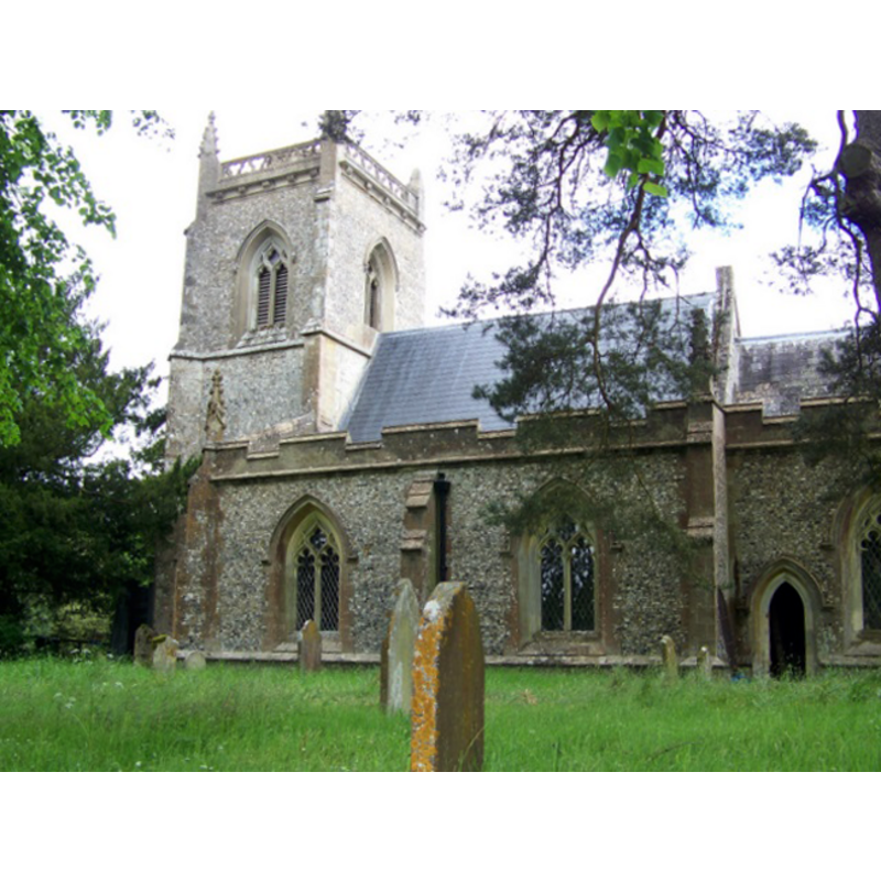
Copyright Statement: Image copyright © Trish Steel, 2009
Image Source: digital photograph taken 28 May 2009 by Trish Steel [www.geograph.org.uk/photo/1342156] [accessed 9 August 2011]
Copyright Instructions: CC-BY-SA-3.0
INFORMATION
Font ID: 17564TIS
Object Type: Baptismal Font1
Font Date: ca. 1234?
Font Century and Period/Style: 13th century (early?), Early English
Church / Chapel Name: Parish Church of St. James
Font Location in Church: [cf. FontNotes]
Church Patron Saint(s): St. James
Church Address: Station Road (corner with A32), East Tisted , Hampshire, GU34 3QP, United Kingdom GU34 3QP, United Kingdom -- Tel.: +44 1420 588398
Site Location: Hampshire, South East, England, United Kingdom
Directions to Site: Located on the A32, SW of Newton Valence, 8 km SSW of Alton
Ecclesiastic Region: Diocese of Winchester
Historical Region: Hundred of Selborn
Additional Comments: disappeared font? (the medieval one)
Font Notes:
Click to view
No entry for East Tisted found in the Domesday survey. The Victoria County History (Hampshire, vol. 3, 1908) reports documentary evidence of the church "about 1234, when the advowson of East Tisted was granted in reversion to Robert Walerond [...] The church [...] was entirely rebuilt in 1846, with the exception of the lower part of the tower"; there is no mention of a font in the VCH entry. The entry for this church in Historic England [Listing 1351138] reports: "the fittings are Victorian, with an octagonal font and octagonal nave columns" in it. The present font, an octagonal basin with plain sides and a tall underbowl chamfer, raised on a cylindrical pedestal base and lower base, is modern. On the font is a pyramidal wooden cover raised by means of a counterweight pulley. Both font and cover appear to be about the same period, the 19th century, perhaps ca. 1846, the time of the re-building of St. James'. [NB: we have no information on the font of the medieval church]
COORDINATES
UTM: 30U 640087 5661197
Latitude & Longitude (Decimal): 51.0856, -1.0001
Latitude & Longitude (DMS): 51° 5' 8" N, 1° 0' 0" W
REFERENCES
- Victoria County History [online], University of London, 1993-. URL: https://www.british-history.ac.uk.