Lymington / Leminton / Lentune / Lymington / Lyminton
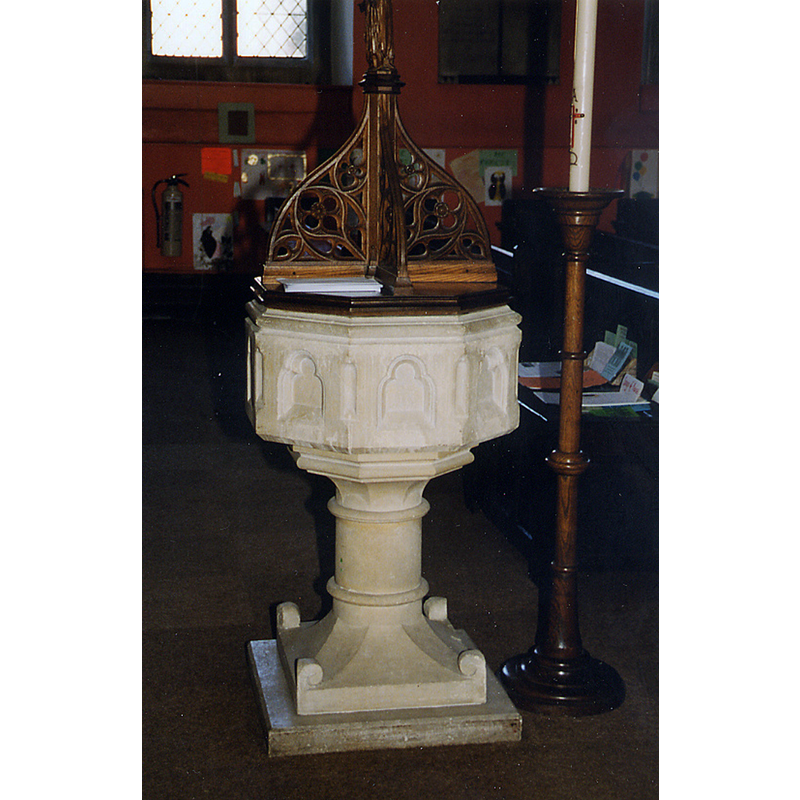
Image copyright © John Salmon, 2013
CC-BY-SA-2.0
Results: 2 records
view of font and cover
Scene Description: the modern font
Copyright Statement: Image copyright © John Salmon, 2013
Image Source: digital image of a photograph taken 4 August 1998 by John Salmon [www.geograph.org.uk/photo/3314115] [accessed 21 September 2018]
Copyright Instructions: CC-BY-SA-2.0
view of church exterior - east view
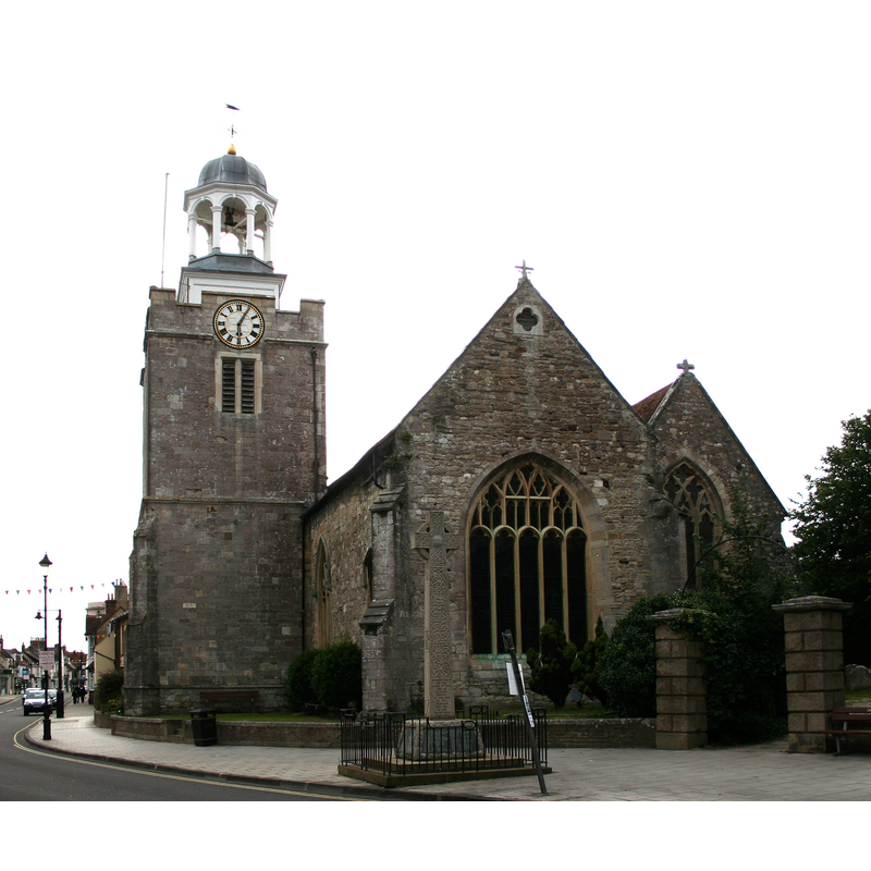
Copyright Statement: Image copyright © [in the public domain]
Image Source: digital photograph taken 10 July 2007 by Dave Pape [https://commons.wikimedia.org/wiki/File:Lymington_Parish_Church.jpg] [accessed 21 September 2017]
Copyright Instructions: PD-user
INFORMATION
Font ID: 17558LYM
Object Type: Baptismal Font1?
Font Century and Period/Style: Medieval
Church / Chapel Name: Parish Church of St. Thomas the Apostle
Church Patron Saint(s): St. Thomas the Apostle
Church Notes: documented as a chapel of Christchurch Priory in mid-12thC; re-built 17th and 18thC
Church Address: 47-48 St Thomas St, Lymington SO41 9ND, UK
Site Location: Hampshire, South East, England, United Kingdom
Directions to Site: Located off (E) the A337, 2 km SW of Portmore, across the Solent from Yarmout
Ecclesiastic Region: Diocese of Winchester
Historical Region: Borough of Lymington
Additional Comments: disappeared font? (the one from the mid-12thC chapel here? did it have baptismal rights? [cf. FontNotes])
Font Notes:
Click to view
There is an entry for Lymington [variant spelling] in the Domesday survey [http://opendomesday.org/place/SZ3295/lymington/] [accessed 21 September 2018] but it mentions neither cleric nor church in it. The entry for this parish in the Victoria County History (Hampshire, vol. 4, 1911) notes: "The earliest known record of a chapel at Lymington is in a charter of 1141–55 by which Baldwin de Redvers granted to Christchurch Twyneham the church of Boldre, with its chapels of Brockenhurst and Lymington. [...] the font is comparatively modern." There are nodetails of the old chapel function in the VCH entry; was it a full chapel-of-ease with baptismal, marriage, burial rights? [NB: we have no information on the font form the medieval church here]
COORDINATES
UTM: 30U 602614 5623874
Latitude & Longitude (Decimal): 50.757556, -1.545167
Latitude & Longitude (DMS): 50° 45′ 27.2″ N, 1° 32′ 42.6″ W
REFERENCES
- Victoria County History [online], University of London, 1993-. URL: https://www.british-history.ac.uk.