Harbridge / Haberigge / Hardbridge / Hardebrygg / Harebrigg / Herdebrige
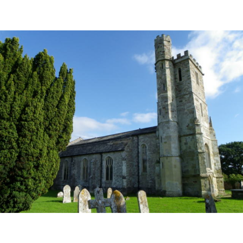
Image copyright © Trish Steel, 2010
CC-BY-SA-3.0
Results: 1 records
view of church exterior - northwest view
Copyright Statement: Image copyright © Trish Steel, 2010
Image Source: digital photograph 26 September 2010 by Trish Steel [www.geograph.org.uk/photo/2084073] [accessed 5 August 2011]
Copyright Instructions: CC-BY-SA-3.0
INFORMATION
Font ID: 17555HAR
Object Type: Baptismal Font1
Font Century and Period/Style: 15th century, Late Medieval
Church / Chapel Name: Parish Church of All Saints
Church Patron Saint(s): All Saints
Church Address: Harbridge, Ringwood BH24 3PS, UK -- Tel.: 01425 653163
Site Location: Hampshire, South East, England, United Kingdom
Directions to Site: Located off the A338, 3 km NE of Somerley, 4 km N of Ringwood, 4 km S of Fordingbridge
Ecclesiastic Region: Diocese of Winchester
Historical Region: Hundred of Ringwood
Additional Comments: disappeared font?
Font Notes:
Click to view
There is an entry for Harbridge [variant spelling] in the Domesday survey [http://opendomesday.org/place/SU1410/harbridge/] [accessed 18 September 2018] but it mentions neither cleric nor church in it. The entry for this parish in the Victoria County History (Hampshire, vol. 4, 1911) notes: "The church of All Saints is an ashlar-faced building consistingof chancel, nave and west tower, rebuilt in 1838 in 15th-century style, but part of the tower masonry appears to be older"; the VCH further notes that the register of baptisms here starts in 1679. [NB: unconfirmed source dates the tower masonry to the 15th century; we have no information on the font of the earlier church]
COORDINATES
UTM: 30U 584731 5638352
Latitude & Longitude (Decimal): 50.89061, -1.7953
Latitude & Longitude (DMS): 50° 53′ 26.2″ N, 1° 47′ 43.08″ W
REFERENCES
- Victoria County History [online], University of London, 1993-. URL: https://www.british-history.ac.uk.