Whitsbury / Whichbury / Whistlebury / Whitchbury / Whitsbury / Whyttesbury / Wiccheburi / Wicheberia / Wicheburia / Witchebury / Witeberge / Wychbury
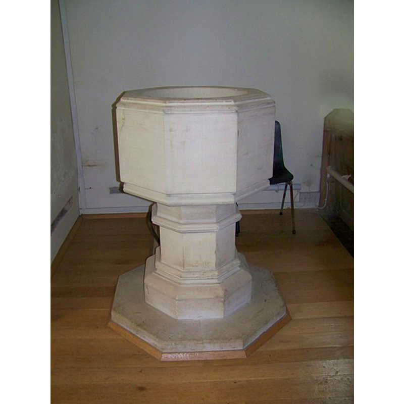
Image copyright © Trish Steel, 2008
CC-BY-SA-2.0
Results: 4 records
view of font
Scene Description: the modern font
Copyright Statement: Image copyright © Trish Steel, 2008
Image Source: digital photograph taken 13 September 2008 by Trish Steel [www.geograph.org.uk/photo/961708] [accessed 5 August 2011]
Copyright Instructions: CC-BY-SA-2.0
view of church exterior - southwest view
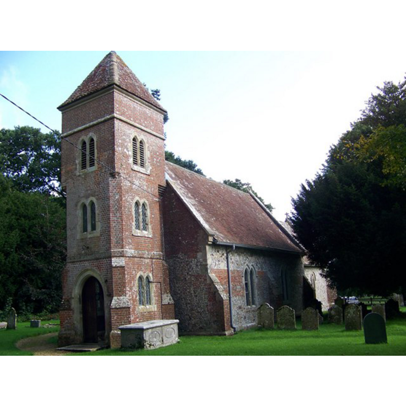
Copyright Statement: Image copyright © Trish Steel, 2008
Image Source: digital photograph taken 13 September 2008 by Trish Steel [www.geograph.org.uk/photo/961676] [accessed 5 August 2011]
Copyright Instructions: CC-BY-SA-2.0
view of church interior - nave - looking east
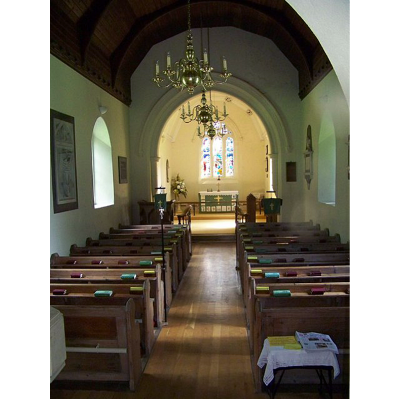
Scene Description: the modern font partially visible in the foreground, left (north) side
Copyright Statement: Image copyright © Trish Steel, 2008
Image Source: digital photograph taken 13 September 2008 by Trish Steel [www.geograph.org.uk/photo/961678] [accessed 5 August 2011]
Copyright Instructions: CC-BY-SA-2.0
view of stoup

Scene Description: disused now, according to the CRSBI (2018) entry
Copyright Statement: Image copyright © CRSBI, 2018
Image Source: digital image of a photograph by Ron Baxter in the CRSBI [www.crsbi.ac.uk/site/4587/] [accessed 18 September 2018]
Copyright Instructions: PERMISSION NOT AVAILABLE -- IMAGE NOT FOR PUBLIC USE
INFORMATION
Font ID: 17554WHI
Object Type: Stoup?
Font Century and Period/Style: 12th century [composite font?], Medieval / composite
Church / Chapel Name: Parish Church St. Leonard
Font Location in Church: Outside, in the porch
Church Patron Saint(s): St. Leonard
Church Address: Whitsbury, Fordingbridge SP6 3QD, UK
Site Location: Hampshire, South East, England, United Kingdom
Directions to Site: Located 5 km NE of Fordingbridge, 11 km S of Salisbury, near the border with Wiltshire
Ecclesiastic Region: Diocese of Salisbury [in Winchester until 1984]
Historical Region: Hundred of Fordingbridge
Additional Comments: altered or composite stoup? (in the porch) -- disappeared font (the one from the 12thC church here)?
Font Notes:
Click to view
No entry found for Whitsbury in the Domesday survey. The entry for this parish in the Victoria County History (Hampshire, vol. 4, 1911) notes: "The church of Whitsbury is mentioned in confirmation charters of Henry I [1100-1135], Henry II [1154-1189], Richard I [1189-1199] and John [1199-1216] to the abbey of Reading [...] The church of Whitsbury has always been in the diocese of Winchester and in the hundred of Fordingbridge in Hampshire, though all the parishioners lived in Wiltshire. [...] The church of St. Leonard is a modern building". There is no mention of a font in the VCH entry. The present font in the church is modern, dated 1877. The entry for this church in Historic England [Listing NGR: SP1529519175] notes a "small plain cylinder font of old church" in it [cf. infra]. The entry for this church in the CRSBI (2018) reports a holy-water stoup here as Romanesque: "In the porch under the W tower is a stoup consisting of a narrow cylindrical bowl with a hole in its bottom resting on a roll/ hollow base with an integral square plinth. [...] There is a current of opinion,repeated in the EH list description and the Hampshire Historic Buildings Record, but apparently disputed by the Salisbury Museum, that the object described above was the font of the old church. This is extremely unlikely because it is much too small. It appears to consist of a 12thc base, perhaps from a doorway, to which a small cylindrical bowl has been later added. It seems unlikely that it ever served as a font, since it could not hold water as it stands, and this also rules out its use as a stoup. It is currently used as a stand for floral displays."
[NB: we have no information on the font of the medieval church here]
[NB: we have no information on the font of the medieval church here]
COORDINATES
UTM: 30U 582913 5647117
MEDIUM AND MEASUREMENTS
Material: stone
Font Shape: cylindrical, mounted
Basin Interior Shape: round
Basin Exterior Shape: round
Drainage System: centre hole in basin
Drainage Notes: no lining
Rim Thickness: 4.5 cm [calculated]
Diameter (inside rim): 27 cm*
Diameter (includes rim): 36 cm*
Basin Total Height: 32 cm*
Notes on Measurements: * CRSBI (2018)
REFERENCES
- Victoria County History [online], University of London, 1993-. URL: https://www.british-history.ac.uk.
- Corpus of Romanesque Sculpture in Britain and Ireland, The Corpus of Romanesque Sculpture in Britain and Ireland, The Corpus of Romanesque Sculpture in Britain and Ireland. URL: http://www.crsbi.ac.uk.