Martin nr. Ringwood / Meretun / Mertone / Mertoun
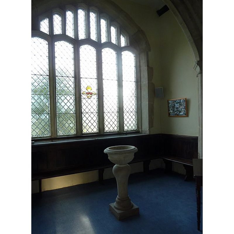
Image copyright © Basher Eyre, 2011
CC-BY-SA-2.0
Results: 4 records
view of font in context
Scene Description: the modern font in use in this church
Copyright Statement: Image copyright © Basher Eyre, 2011
Image Source: digital photograph taken 6 December 2011 by Basher Eyre [www.geograph.org.uk/photo/2741079] [accessed 18 September 2018]
Copyright Instructions: CC-BY-SA-2.0
view of basin
![the much damaged and now disused stone basin of an old font [cf. FontNotes]](/static-50478a99ec6f36a15d6234548c59f63da52304e5/compressed/1180918021_compressed.png)
Scene Description: the much damaged and now disused stone basin of an old font [cf. FontNotes]
Copyright Statement: Image copyright © Basher Eyre, 2011
Image Source: edited detail of a digital photograph taken 6 December 2011 by Basher Eyre [www.geograph.org.uk/photo/2741078] [accessed 18 September 2018]
Copyright Instructions: CC-BY-SA-2.0
view of church exterior - southwest view
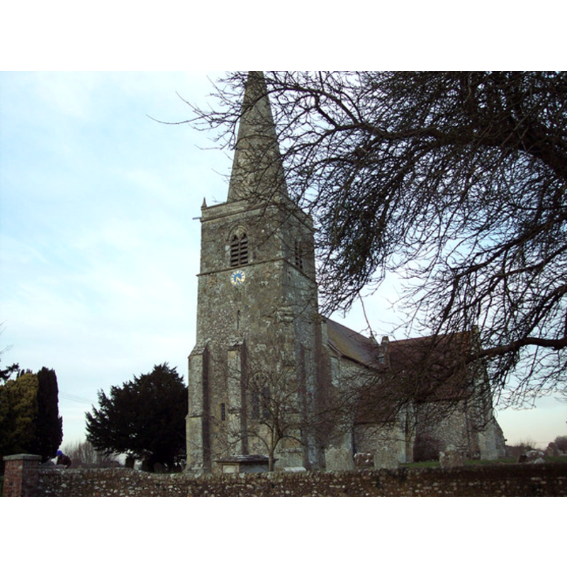
Copyright Statement: Image copyright © Trish Steel, 2007
Image Source: digital photograph taken 7 February 2007 by Trish Steel [www.geograph.org.uk/photo/332427.jpg] [accessed 5 August 2011]
Copyright Instructions: CC-BY-SA-2.0
view of church interior - detail
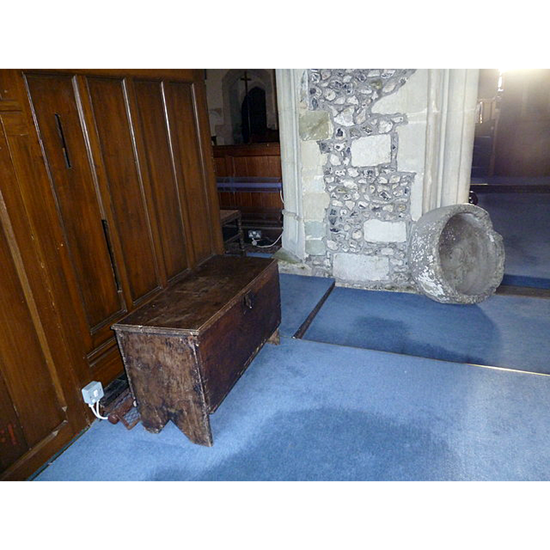
Scene Description: Source caption: "All Saints, Martin: ancient artefacts". -- Is this the basin of an earlier font?
Copyright Statement: Image copyright © Basher Eyre, 2011
Image Source: digital photograph taken 6 December 2011 by Basher Eyre [www.geograph.org.uk/photo/2741078] [accessed 18 September 2018]
Copyright Instructions: CC-BY-SA-2.0
INFORMATION
Font ID: 17553MAR
Object Type: Baptismal Font1, fragment?
Font Century and Period/Style: 12th century, Late Norman
Church / Chapel Name: Parish Church of All Saints
Font Location in Church: [cf. FontNotes]
Church Patron Saint(s): All Saints
Church Address: Martin, Hampshire SP6 3LE , UK
Site Location: Hampshire, South East, England, United Kingdom
Directions to Site: Located off the A31, just NW of Tidpit, near Ringwood
Ecclesiastic Region: Diocese of Winchester
Historical Region: Hundred of Fordingbridge -- formerly in Wiltshire
Additional Comments: disappeared font? (the one from the 12thC church here, or is the old basin here the original font? [cf. FontNotes])
Font Notes:
Click to view
No entry found for this Martin in the Domesday survey. The entry for this parish in the Victoria County History (Hampshire, vol. 4, 1911) notes: "The earliest church of which there are traces belonged to the first half of the 12th century [...] The font is of late 18th-century date." Ditto in the entry for this church in Historic England [Listing NGR: SP1291418787]. [NB: we have no information on the font of the medieval church, but there is an interesting stone object inside the church: it is definitely the basin of an old font; it is roughly cylindrical, it has a centre drain, and shows damage evidence to its upper rim that would indicate the former presence of cover hardware [cf. ImagesArea]].
COORDINATES
UTM: 30U 577156 5647653
Latitude & Longitude (Decimal): 50.9753, -1.901
Latitude & Longitude (DMS): 50° 58′ 31.08″ N, 1° 54′ 3.6″ W
MEDIUM AND MEASUREMENTS
Material: stone
Font Shape: cylindrical
Basin Interior Shape: round
Basin Exterior Shape: round
Drainage System: centre hole in basin
Drainage Notes: no lining
REFERENCES
- Victoria County History [online], University of London, 1993-. URL: https://www.british-history.ac.uk.