Rockbourne / Rocheborne / Rechesburna / Rochesburna / Rogborne / Rokeburn
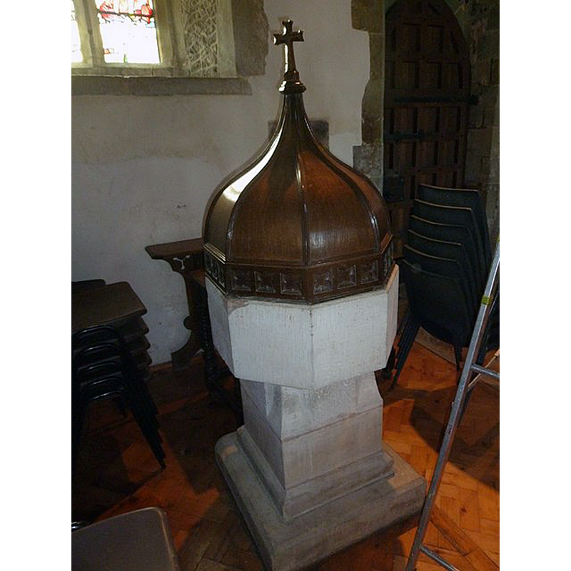
Image copyright © Basher Eyre, 2011
CC-BY-SA-2.0
Results: 4 records
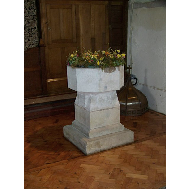
view of font and cover
Scene Description: the 15th-century basin raised on a modern pedestal
Copyright Statement: Image copyright © Basher Eyre, 2011
Image Source: digital photograph taken 6 December 2011 by Basher Eyre [www.geograph.org.uk/photo/2739689] [accessed 18 September 2018]
Copyright Instructions: CC-BY-SA-2.0
view of font and cover
Scene Description: the font cover, an octagonal peaked dome, is visible on the floor, behind the font, in the right corner
Copyright Statement: Image copyright © Trish Steel, 2008
Image Source: digital photograph taken 26 March 2008 by Trish Steel [ww.geograph.org.uk/photo/740465] [accessed 5 August 2011]
Copyright Instructions: CC-BY-SA-2.0
view of church exterior
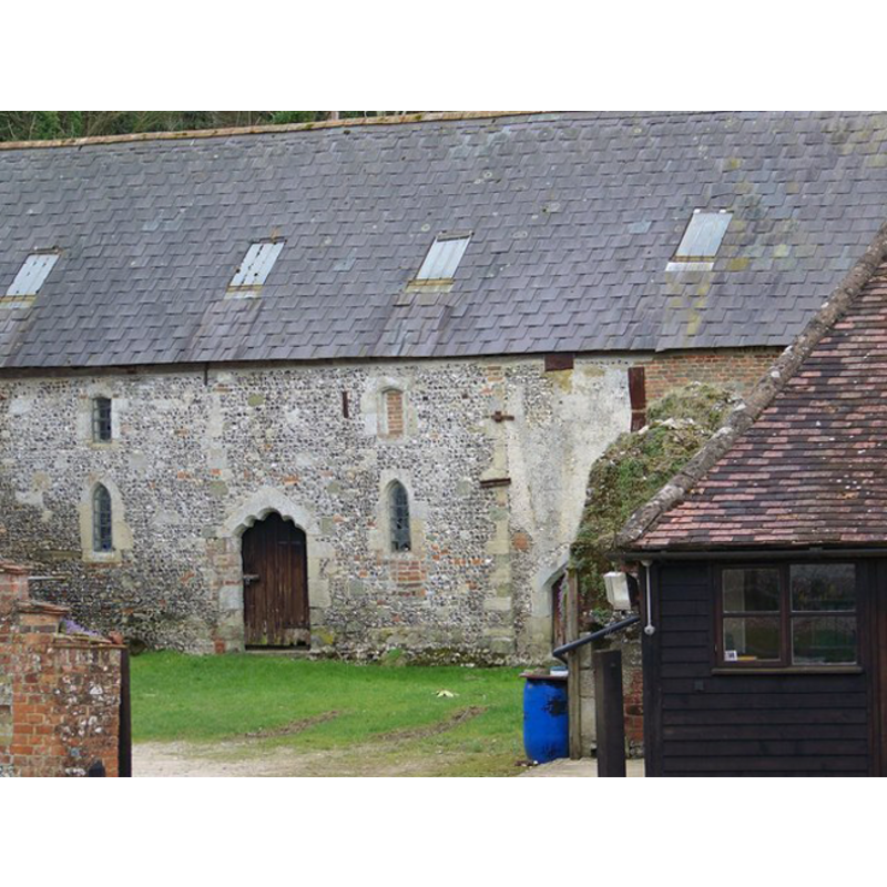
Scene Description: former 13th-century chapel; now used as barn
Copyright Statement: Image copyright © Trish Steel, 2008
Image Source: digital photograph taken 26 March 2008 by Trish Steel [ww.geograph.org.uk/photo/739460] [accessed 5 August 2011]
Copyright Instructions: CC-BY-SA-2.0
view of church exterior
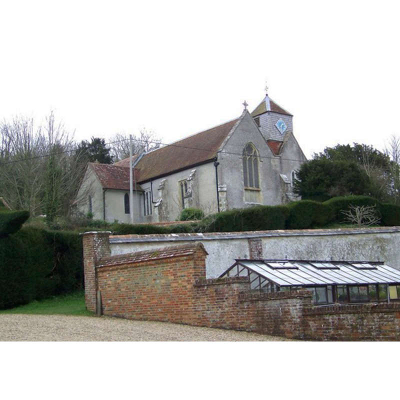
Scene Description: the present parish church
Copyright Statement: Image copyright © Trish Steel, 2008
Image Source: digital photograph taken 26 March 2008 by Trish Steel [ww.geograph.org.uk/photo/739226] [accessed 5 August 2011]
Copyright Instructions: CC-BY-SA-2.0
INFORMATION
Font ID: 17551ROC
Object Type: Baptismal Font1
Font Century and Period/Style: 15th century [basin only] [composite font], Late Medieval
Church / Chapel Name: Parish Church of St. Andrew
Font Location in Church: Inside the church, at the W end of the nave
Church Patron Saint(s): St. Andrew
Church Notes: 11th/12thC church; modified 13th, 16th and 17thC;
Church Address: Rockbourne Rd, Rockbourne, Fordingbridge SP6 3NW, UK
Site Location: Hampshire, South East, England, United Kingdom
Directions to Site: Located just W of Whitsbury and Brookheath, 5-6 km NW of Fordingbridge and the A338, 10 km S of Salisbury
Ecclesiastic Region: Diocese of Winchester
Historical Region: Hundred of Fordingbridge
Additional Comments: altered font (15thC (?) basin on a 19thC base) -- disappeared font? (from the 12thC church here)
Font Notes:
Click to view
There are three entries for Rockbourne [variant spelling] in the Domesday survey [http://opendomesday.org/place/SU1118/rockbourne/] [accessed 18 September 2018] none of which mentions cleric or church in it. The entry for this parish in the Victoria County History (Hampshire, vol. 4, 1911) notes: "Henry de Blois, Bishop of Winchester (1129–71), [...] confirmed the appropriation of the church to Breamore, and assigned a pension of 2s. to Crispin the priest. [...] The earliest building for which architectural evidence exists consisted of an aisleless cruciform 12th-century church [...] The font is octagonal, probably dating from the 15 th century, and has a modern base. [...] the font is now set at the west end of the nave in the space formerly occupied by the steps leading up from the old west door. The entry for this church in Historic England [Listing NGR: SU1163218400] notes: "At west of nave C15 octagonal font C19 base". [NB: we have no information on the font from the 12th-century church]
COORDINATES
UTM: 30U 581669 5646491
Latitude & Longitude (Decimal): 50.96423, -1.837
Latitude & Longitude (DMS): 50° 57′ 51.23″ N, 1° 50′ 13.2″ W
MEDIUM AND MEASUREMENTS
Material: stone
Font Shape: octagonal, mounted
Basin Interior Shape: round
Basin Exterior Shape: octagonal
LID INFORMATION
Material: wood?
Apparatus: no
Notes: octagonal peaked dome with cross finial
REFERENCES
- Victoria County History [online], University of London, 1993-. URL: https://www.british-history.ac.uk.