Ellingham nr. Ringwood / Adelingeham / Adelingham / Aylingham / Elyngham
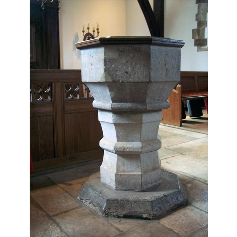
Image copyright © Trish Steel, 2007
CC-BY-SA-3.0
Results: 4 records
view of font and cover
Copyright Statement: Image copyright © Trish Steel, 2007
Image Source: digital photograph taken 19 June 2007 by Trish Steel [www.geograph.org.uk/photo/474368] [accessed 4 August 2011]
Copyright Instructions: CC-BY-SA-3.0
design element - motifs - roll moulding
Scene Description: it is part of the basin block
Copyright Statement: Image copyright © Trish Steel, 2007
Image Source: digital photograph taken 19 June 2007 by Trish Steel [www.geograph.org.uk/photo/474368] [accessed 4 August 2011]
Copyright Instructions: CC-BY-SA-3.0
view of church exterior - south view
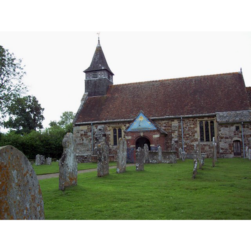
Copyright Statement: Image copyright © Trish Steel, 2007
Image Source: digital photograph taken 19 June 2007 by Trish Steel [www.geograph.org.uk/photo/474169] [accessed 4 August 2011]
Copyright Instructions: CC-BY-SA-3.0
design element - motifs - roll moulding
Copyright Statement: Image copyright © Trish Steel, 2007
Image Source: digital photograph taken 19 June 2007 by Trish Steel [www.geograph.org.uk/photo/474368] [accessed 4 August 2011]
Copyright Instructions: CC-BY-SA-3.0
INFORMATION
Font ID: 17549ELL
Object Type: Baptismal Font1
Font Century and Period/Style: 15th century [basin and stem] -- 13th century [lower base] [composite font], Late Medieval
Church / Chapel Name: Parish Church of St. Mary and All Saints [formerly Benedictine Priory Church of All Saints]
Font Location in Church: Inside the church
Church Patron Saint(s): St. Mary the Virgin & All Saints [formerly All Saints]
Church Notes: Benedictine priory founded ca. 1160; dissolved 1414, church becoming parocial
Church Address: Ellingham Drrive, Ellingham, Hampshire BH24 3PJ, UK
Site Location: Hampshire, South East, England, United Kingdom
Directions to Site: Located off (W) the A338, N of Ringwood
Ecclesiastic Region: Diocese of Winchester
Historical Region: Hundred of Fordingbridge
Additional Comments: composite font? [cf. FontNotes] / disappeared font?
Font Notes:
Click to view
There is an entry for Ellingham [variant spelling] in the Domesday survey [http://opendomesday.org/place/SU1408/ellingham/] [accessed 17 September 2018] but it mentions neither cleric nor church in it. The Victoria County History (Hampshire, vol. 4, 1911) notes: "The church of Ellingham, in one charter described as the church of St. Mary, [...] and in another as the church of All Saints with the chapel of St. Mary, [...] formed part of the grant of William de Solers to Ellingham Priory [W. de Solers was born ca. 1184] [...] The whole building appears to have been built in the late 13th century [...] The font is octagonal, probably of the 15th century, but the base on which it stands is of Purbeck marble, and may have formed part of an earlier font." [NB: the lower base may be part of the 13th-century font; we have no information on the rest of it].
COORDINATES
UTM: 30U 584683 5636541
Latitude & Longitude (Decimal): 50.87434, -1.7964
Latitude & Longitude (DMS): 50° 52′ 27.62″ N, 1° 47′ 47.04″ W
MEDIUM AND MEASUREMENTS
Material: stone, [cf. FontNotes]
Font Shape: octagonal, mounted
Basin Interior Shape: round
Basin Exterior Shape: octagonal
REFERENCES
- Victoria County History [online], University of London, 1993-. URL: https://www.british-history.ac.uk.