Plaitford / Playdeford / Playteford / Playtfourth / Pleiteford / Pleyford
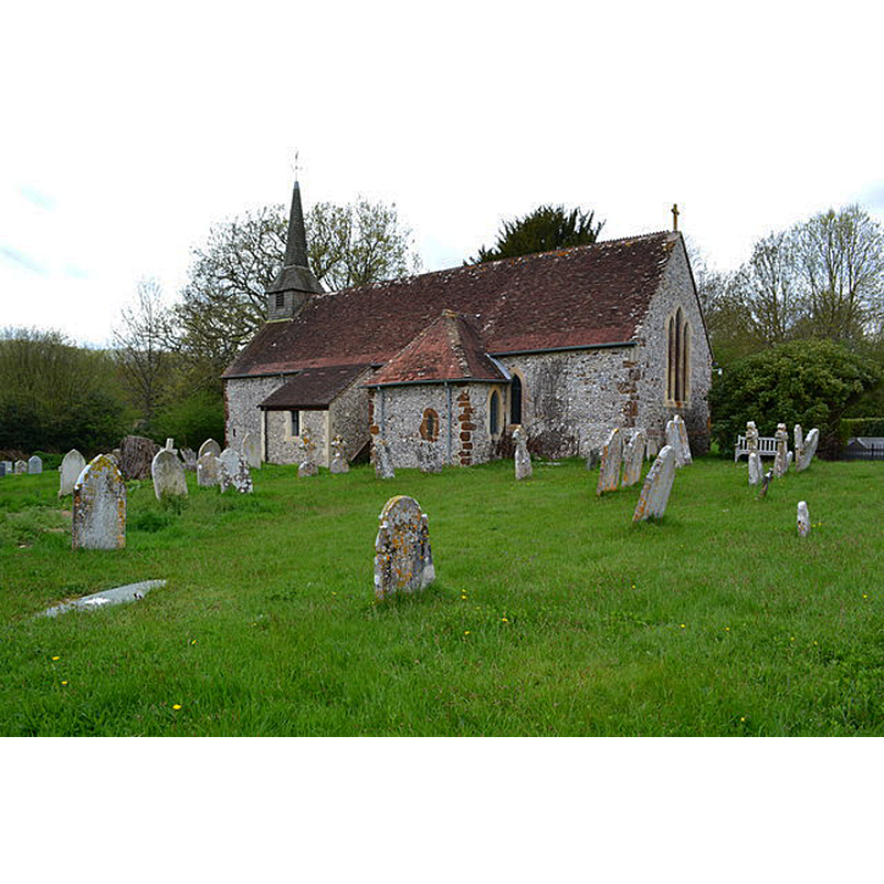
Image copyright © David Martin, 2007
CC-BY-SA-2.0
Results: 2 records
view of church exterior - southeast view
Copyright Statement: Image copyright © David Martin, 2007
Image Source: digital photograph taken 30 April 2018 by David Martin [www.geograph.org.uk/photo/5757116] [accessed 13 September 2018]
Copyright Instructions: CC-BY-SA-2.0
view of church exterior - southwest view
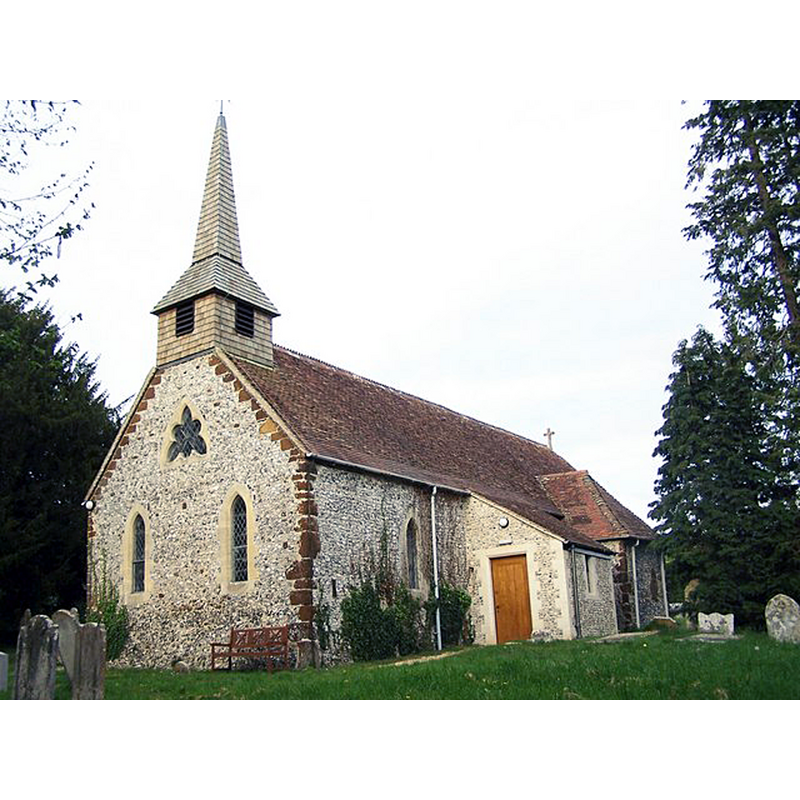
Copyright Statement: Image copyright © David Martin, 2007
Image Source: digital photograph taken 25 April 2007 by David Martin [www.geograph.org.uk/photo/412868] [accessed 13 September 2018]
Copyright Instructions: CC-BY-SA-2.0
INFORMATION
Font ID: 17546PLA
Object Type: Baptismal Font1
Font Century and Period/Style: 13th century [restored], Early English [altered]
Church / Chapel Name: Parish Church of St. Peter
Church Patron Saint(s): St. Peter
Church Address: Church Lane, Plaitford SO516EF, UK
Site Location: Hampshire, South East, England, United Kingdom
Directions to Site: Located off (N) the A36, 8 km W of Romsey; the church is very close to the border with Wiltshire
Ecclesiastic Region: Diocese of Winchester
Historical Region: Hundred of Thorngate -- Hundred of Frustfield [in Domesday]
Additional Comments: restored font [cf. FontNotes]
Font Notes:
Click to view
There is an entry for Plaitford [variant spelling] in the Domesday survey [http://opendomesday.org/place/SU2719/plaitford/] [accessed 13 September 2018] but it mentions neither cleric nor church in it. The entry for this parish in the Victoria County History (Hampshire, vol. 4, 1911) notes: "The walls of the church are probably of early 13th century date [...] The font is a modern restoration from part of a 13th-century font with four spurs on the angles."
COORDINATES
UTM: 30U 597881 5648702
Latitude & Longitude (Decimal): 50.98158, -1.6056
Latitude & Longitude (DMS): 50° 58′ 53.69″ N, 1° 36′ 20.16″ W
MEDIUM AND MEASUREMENTS
Material: stone
REFERENCES
- Victoria County History [online], University of London, 1993-. URL: https://www.british-history.ac.uk.