Nether Wallop / Wallop / Wallope / Wappol / Welhop / Wellop / Netherwellup
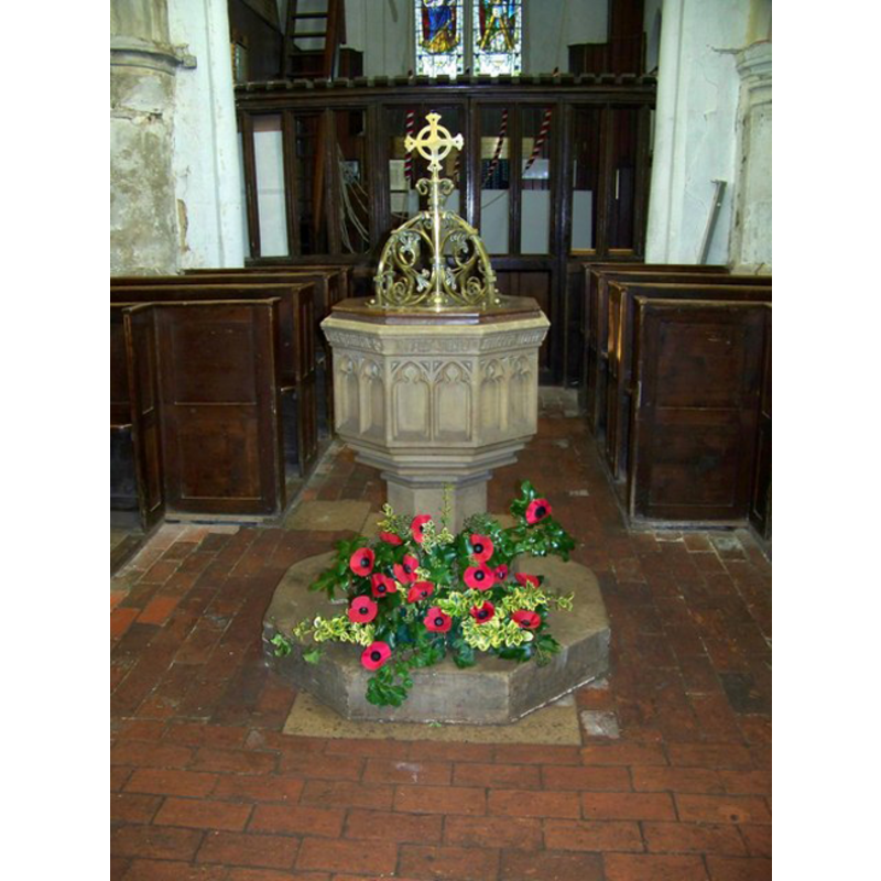
Image copyright © Trish Steel, 2008
CC-BY-SA-2.0
Results: 2 records
view of font and cover in context
Scene Description: the modern font
Copyright Statement: Image copyright © Trish Steel, 2008
Image Source: digital photograph taken 11 November 2008 by Trish Steel [www.geograph.org.uk/photo/1044219] [accessed 4 August 2011]
Copyright Instructions: CC-BY-SA-2.0
view of church exterior - south view
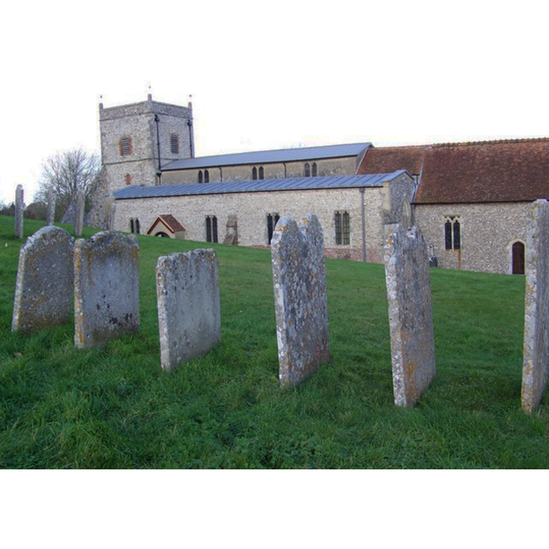
Copyright Statement: Image copyright © Trish Steel, 2008
Image Source: digital photograph taken 11 November 2008 by Trish Steel [www.geograph.org.uk/photo/1041898] [accessed 4 August 2011]
Copyright Instructions: CC-BY-SA-2.0
INFORMATION
Font ID: 17543WAL
Object Type: Baptismal Font1?
Font Century and Period/Style: 11th century, Pre-Conquest? / Norman
Church / Chapel Name: Parish Church of St. Andrew
Church Patron Saint(s): St. Andrew
Church Notes: Anglo-Saxon wall paintings? [www.thewallops.net/NWallop/Church/paintings.htm] [accessed 4 August 2011]
Church Address: Church Hill, Nether Wallop, Hampshire SO20 8ET
Site Location: Hampshire, South East, England, United Kingdom
Directions to Site: Located 6 km NW of Stockbridge, 11 km SW of Andover
Ecclesiastic Region: Diocese of Winchester
Historical Region: Hundred of Thorngate
Additional Comments: disappeared font? (the one from the Domesday-time church here)
Font Notes:
Click to view
There are two entries for [Nether] Wallop [variant spelling] in the Domesday survey [http://opendomesday.org/place/SU3036/nether-wallop/] [accessed 8 September 2015], one of which mentions two churches and one hide in church lands in it. The Victoria County History (Hampshire, vol. 4, 1911) notes: "The history of the building appears to be that an aisleless nave and chancel [...] stood here early in the 12th century, having in its north wall the doorway which is now in the north aisle. Towards the end of the 12th century a south aisle was added to the nave, and in the first quarter of the 13th a considerable scheme of enlargement was begun. [...] The present west tower was built in 1704, but its east wall seems part of an older tower on the same site. [...] The octagonal font is modern, of 15th-century style." The modern -19thC- font is located at the west end of the nave. The Parish web site [www.thewallops.net/NWallop/Church/Church.htm] [accessed 4 August 2011] describes the church as Anglo-Saxon and mentions "the only Anglo-Saxon wall painting to survive in situ [...] the precious legacy of artists of the Winchester School who worked here around the year 1020."
COORDINATES
UTM: 30U 600310 5664772
Latitude & Longitude (Decimal): 51.125628, -1.566552
Latitude & Longitude (DMS): 51° 7′ 32.26″ N, 1° 33′ 59.59″ W
REFERENCES
- Victoria County History [online], University of London, 1993-. URL: https://www.british-history.ac.uk.