West Tytherley No. 1 / Chuderleg / Tederlec / Tederleg / Tiderlei /Tuderlegh / Tuderleigh / Tyderle / West Huderleg / West Uderle / West Tytherley / Westaderle / Westerdeley / West Ryderley / Westhuderleg / Westiderleg / Westytherley
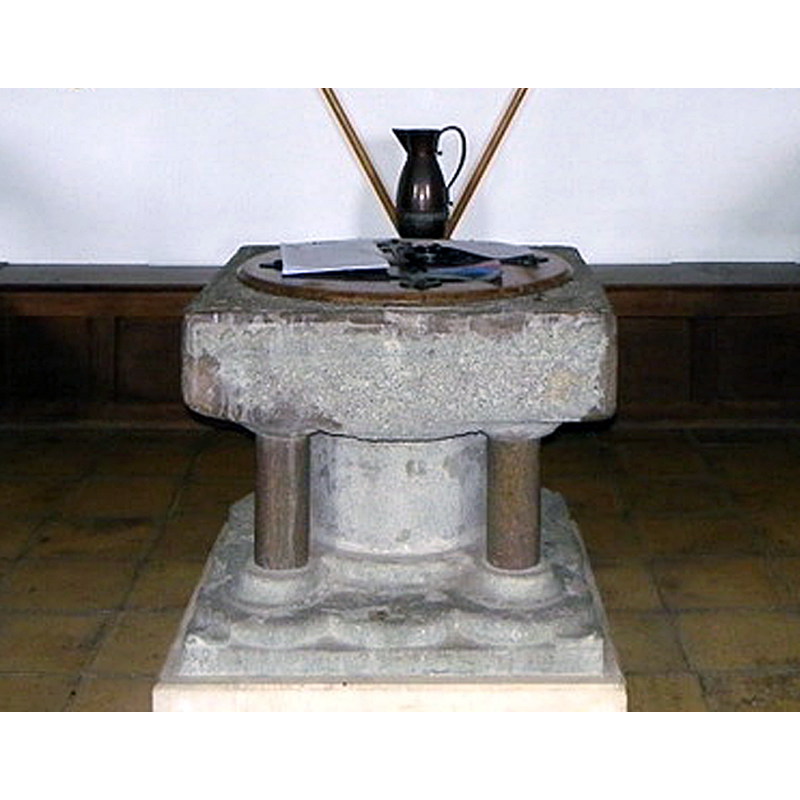
Image copyright © Maigheach-gheal, 2011
CC-BY-SA-2.0
Results: 7 records
view of font and cover - south side
Copyright Statement: Image copyright © Maigheach-gheal, 2011
Image Source: edited detail of a digital photograph taken 27 February 2011 by Maigheach-gheal [www.geograph.org.uk/photo/2318366] [accessed 13 September 2018]
Copyright Instructions: CC-BY-SA-2.0
design element - motifs - foliage
Scene Description: on the sides, almost invisible now
Copyright Statement: Image copyright © Maigheach-gheal, 2011
Image Source: edited detail of a digital photograph taken 27 February 2011 by Maigheach-gheal [www.geograph.org.uk/photo/2318366] [accessed 13 September 2018]
Copyright Instructions: CC-BY-SA-2.0
view of church exterior - south view
![EXT S digital photograph taken 11 January 2009 by Chris Talbot [www.geograph.org.uk/photo/1130307] [accessed 13 September 2018]
INT E digital photograph taken 20 April 2013 by Basher Eyre [www.geograph.org.uk/photo/3489192] [accessed 13 September 2018]
INT W digital photograph taken 27 February 2011 by Maigheach-gheal [www.geograph.org.uk/photo/2318416] [accessed 13 September 2018]
FONT IN CNTXT digital photograph taken 27 February 2011 by Maigheach-gheal [www.geograph.org.uk/photo/2318366] [accessed 13 September 2018]](/static-50478a99ec6f36a15d6234548c59f63da52304e5/compressed/1180917001_compressed.png)
Scene Description: EXT S digital photograph taken 11 January 2009 by Chris Talbot [www.geograph.org.uk/photo/1130307] [accessed 13 September 2018]
INT E digital photograph taken 20 April 2013 by Basher Eyre [www.geograph.org.uk/photo/3489192] [accessed 13 September 2018]
INT W digital photograph taken 27 February 2011 by Maigheach-gheal [www.geograph.org.uk/photo/2318416] [accessed 13 September 2018]
FONT IN CNTXT digital photograph taken 27 February 2011 by Maigheach-gheal [www.geograph.org.uk/photo/2318366] [accessed 13 September 2018]
Copyright Statement: Image copyright © Chris Talbot, 2009
Image Source: digital photograph taken 11 January 2009 by Chris Talbot [www.geograph.org.uk/photo/1130307] [accessed 13 September 2018]
Copyright Instructions: CC-BY-SA-2.0
view of font and cover in context - south side
Copyright Statement: Image copyright © Maigheach-gheal, 2011
Image Source: digital photograph taken 27 February 2011 by Maigheach-gheal [www.geograph.org.uk/photo/2318366] [accessed 13 September 2018]
Copyright Instructions: CC-BY-SA-2.0
view of church interior - nave - looking west
![the font, hidden in this image, is on the rifght [north] side, below the flags](/static-50478a99ec6f36a15d6234548c59f63da52304e5/compressed/1180917003_compressed.png)
Scene Description: the font, hidden in this image, is on the rifght [north] side, below the flags
Copyright Statement: Image copyright © Maigheach-gheal, 2011
Image Source: digital photograph taken 27 February 2011 by Maigheach-gheal [www.geograph.org.uk/photo/2318416] [accessed 13 September 2018]
Copyright Instructions: CC-BY-SA-2.0
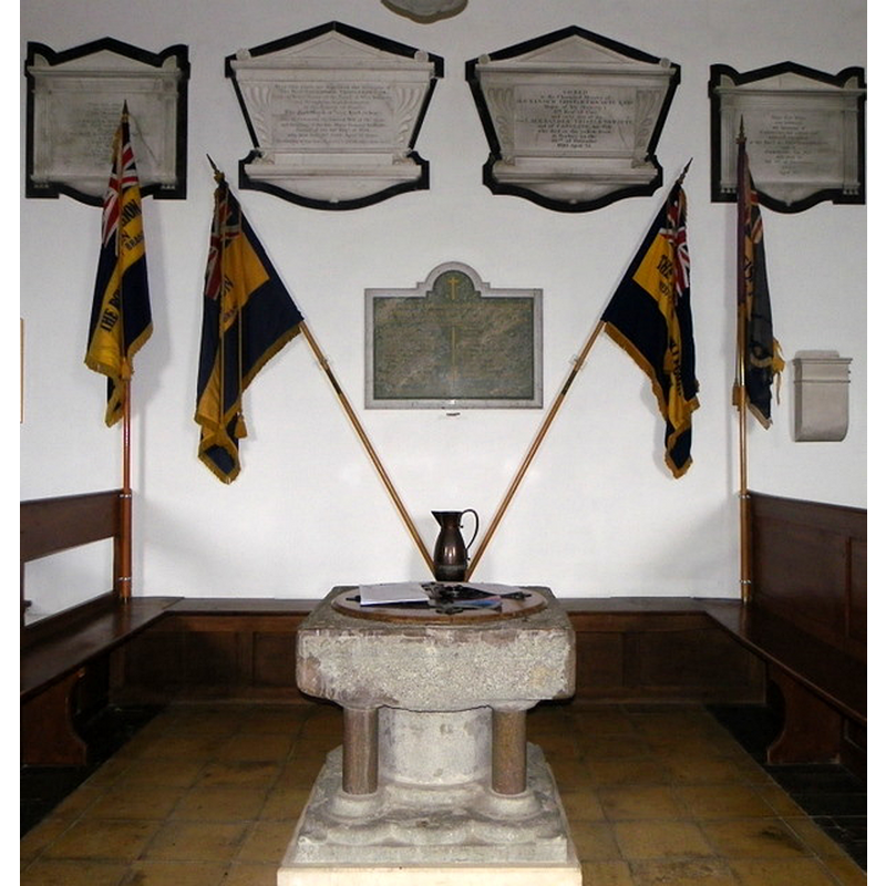
view of church interior - nave - looking east
![the font, hidden in this image, is on the left [north] side, below the flags](/static-50478a99ec6f36a15d6234548c59f63da52304e5/compressed/1180917002_compressed.png)
Scene Description: the font, hidden in this image, is on the left [north] side, below the flags
Copyright Statement: Image copyright © Basher Eyre, 2013
Image Source: digital photograph taken 20 April 2013 by Basher Eyre [www.geograph.org.uk/photo/3489192] [accessed 13 September 2018]
Copyright Instructions: CC-BY-SA-2.0
design element - motifs - moulding
Scene Description: the outer colonnettes of the base are modern replacements, but the lower base itself appears original; the plain square plinth below is modern
Copyright Statement: Image copyright © Maigheach-gheal, 2011
Image Source: edited detail of a digital photograph taken 27 February 2011 by Maigheach-gheal [www.geograph.org.uk/photo/2318366] [accessed 13 September 2018]
Copyright Instructions: CC-BY-SA-2.0
INFORMATION
Font ID: 17541TYT
Object Type: Baptismal Font1
Font Date: ca. 1200?
Font Century and Period/Style: 12th - 13th century, Transitional / Early English
Church / Chapel Name: Parish Church of St. Peter
Font Location in Church: Inside the church
Church Patron Saint(s): St. Peter
Church Notes: the VCH has dedication unknown -- the Church of England web site [www.achurchnearyou.com/westtytherley/] [accessed 4 August 2011] has it dedicated to St. Peter
Church Address: Church Lane, West Tytherley, Salisbury SP5 1JY, UK -- Tel.: : +44 1794 340635
Site Location: Hampshire, South East, England, United Kingdom
Directions to Site: Located 1-2 km NW of East Tytherley, 10 km SW of Stockbridge
Ecclesiastic Region: Diocese of Winchester
Historical Region: Hundred of Thorngate -- Hundred of Broughton
Font Notes:
Click to view
There are three entries for [West] Tytherley [variant spelling] in the Domesday survey [http://opendomesday.org/place/SU2729/west-tytherley/] [accessed 13 September 2018], one of which reports seven churches in it [NB: West Tytherley was one of the seven, a chapelry dependent on the mother church at Motisfont]. The entry for this parish in the Victoria County History (Hampshire, vol. 4, 1911) notes: "At the time of the Domesday Survey West Tytherley was a chapelry annexed to the church of Mottisfont [...] There is an early 13th-century font of black marble. The bowl is square with traces of foliage on the sides, the stem circular, with four modern shafts." [cf. Index entry for West Tytherley No. 2 for the remains of a 15th-century font in this church] [NB: we have no information on the font from the earlier period of this church]
COORDINATES
UTM: 30U 597394 5658128
Latitude & Longitude (Decimal): 51.0664, -1.61
Latitude & Longitude (DMS): 51° 3′ 59.04″ N, 1° 36′ 36″ W
MEDIUM AND MEASUREMENTS
Material: stone, limestone (Purbeck marble
Font Shape: square, mounted
Basin Interior Shape: round
Basin Exterior Shape: square
REFERENCES
- Victoria County History [online], University of London, 1993-. URL: https://www.british-history.ac.uk.